Category:Maps of Holyoke, Massachusetts
Jump to navigation
Jump to search
Wikimedia category | |||||
| Upload media | |||||
| Instance of | |||||
|---|---|---|---|---|---|
| Category combines topics | |||||
| Holyoke | |||||
city in Hampden County, Massachusetts, United States .jpg)    | |||||
| Instance of | |||||
| Part of | |||||
| Location | Hampden County, Massachusetts | ||||
| Located in or next to body of water | |||||
| Head of government |
| ||||
| Founded by |
| ||||
| Inception |
| ||||
| Highest point |
| ||||
| Population |
| ||||
| Area |
| ||||
| Elevation above sea level |
| ||||
| official website | |||||
 | |||||
Subcategories
This category has the following 5 subcategories, out of 5 total.
A
Media in category "Maps of Holyoke, Massachusetts"
The following 49 files are in this category, out of 49 total.
-

-

-
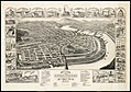
 At The Heart of Industrial New England (Holyoke, Mass.).jpg 1,386 × 1,993; 1.2 MB
-
 Atlas of Massachusetts LOC 2013591316-17.jpg 4,974 × 5,977; 4.41 MB
-
 Atlas-Mass-Hampden-Co 1894 018.jpg 7,831 × 5,507; 10.9 MB
-
 Atlas-Mass-Hampden-Co 1894 020.jpg 7,831 × 5,507; 11.08 MB
-
 Atlas-Mass-Hampden-Co 1894 022.jpg 7,817 × 5,507; 11.79 MB
-
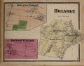
 Atlas-Mass-Holyoke 1884 006.jpg 8,343 × 5,350; 1.83 MB
-

-
-
 Birds eye view of Holyoke, Mass. (2675942508).jpg 9,760 × 7,295; 17.73 MB
-

-
 Combined map of Holyoke and Chicopee (3886418475).jpg 1,733 × 2,000; 3.06 MB
-
 Ewingville, Holyoke, Massachusetts (Beers 1870).png 481 × 328; 282 KB
-
 Geological map of South Hadley.jpg 2,651 × 3,084; 2.13 MB
-

-
 Holyoke Canal System for National Register of Historic Places.png 3,800 × 2,325; 9.84 MB
-
 Holyoke Center, Holyoke, Atlas of Hampden County (Beers 1870).png 2,471 × 3,535; 15.95 MB
-
 Holyoke Hadley Falls Plan 1853.png 4,576 × 3,531; 17.04 MB
-
 Holyoke ma highlight.png 788 × 466; 54 KB
-
 Holyoke, Atlas of Hampden County (Beers 1870).png 2,690 × 2,101; 7.85 MB
-

-

-
 Holyoke.jpg 744 × 520; 560 KB
-
 Holyoke1876 MBradley.png 2,424 × 1,605; 5.23 MB
-
 HolyokeMA neighborhoods.svg 501 × 828; 25 KB
-
 HolyokeWaterPowerMap circa 1950.jpg 5,844 × 4,400; 20.69 MB
-
-
 Ireland, the 3rd Parish of West Springfield, Holyoke (1827).png 3,904 × 2,597; 13.35 MB
-
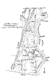
 Joseph Muller Bridge and South Hadley Falls Interchange Project (1958-1959).png 1,412 × 642; 1.34 MB
-
 MansirMap Holyoke, Massachusetts 1920.jpg 2,129 × 1,937; 1.37 MB
-
 Map of Churches in Holyoke (1957).jpg 1,315 × 1,635; 694 KB
-
 Map of Holyoke Canal System (Holyoke, Massachusetts).jpg 769 × 1,184; 510 KB
-
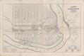
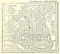
 Map of the City of Holyoke, published by Loomis and Kirtland (1874).png 4,482 × 4,000; 28.54 MB
-
 NewCityWeeklyTimes Extra 1849.jpg 4,398 × 6,919; 7.61 MB
-
 No40 PerceeDeHolyoke.png 1,039 × 1,943; 3.86 MB
-
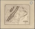
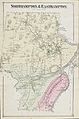 Northampton Easthampton SmithsFerry Map.jpg 4,560 × 6,889; 10.58 MB
-
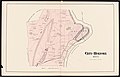
 Plan of the New Town of Holyoke (1850).jpg 3,324 × 3,167; 2.8 MB
-

-

-
 South Holyoke, Holyoke, Atlas of Hampden County (Beers 1870).png 2,296 × 3,366; 13.08 MB
-
 Springfield-Chicopee-Holyoke Central Business Districts (1977 Census of Trade).jpg 1,330 × 1,676; 1.15 MB
-

-
 Tighe HolyokeMassachusetts 1903.jpg 16,473 × 11,510; 34.7 MB
-
 USA Holyoke location map municipal fiber network.svg 176 × 266; 384 KB
-
 USGS Holyoke, MA 30 minute Quadrangle SE (1938).png 3,404 × 4,339; 8.92 MB
-
 USGS Holyoke, MA 30 minute Quadrangle SW (1938).png 3,409 × 4,348; 9.11 MB
-
 Walker and Tighe, Holyoke, Massachusetts (1904).jpg 8,942 × 6,276; 11.93 MB
-
 WSpringfield1795Map.png 2,085 × 3,136; 2.04 MB
_-_Hampden_County_-_Holyoke_-_ED_19-1_to_116_-_NARA_-_12549072_(page_1).jpg)
_-_Hampden_County_-_Holyoke_-_ED_19-1_to_116_-_NARA_-_12549072_(page_2).jpg)
.jpg)


.jpg)
.jpg)
_by_Nirenstein%27s_National_Preferred_Real_Estate_Locations_of_Business_Properties,_New_England_States_Edition.jpg)
.jpg)
.png)


.png)


.png)
.jpg)
.jpg)


.jpg)
.png)
.png)

.jpg)
.jpg)
.png)


.jpg)


.png)
.jpg)
.jpg)


.png)
.png)
.jpg)
