Category:Maps of Hildesheim
Jump to navigation
Jump to search
Wikimedia category | |||||
| Upload media | |||||
| Instance of | |||||
|---|---|---|---|---|---|
| Category combines topics | |||||
| Hildesheim | |||||
city in Lower Saxony, Germany     | |||||
| Instance of |
| ||||
| Location | Hildesheim, Lower Saxony, Germany | ||||
| Head of government |
| ||||
| Inventory number |
| ||||
| Population |
| ||||
| Area |
| ||||
| Elevation above sea level |
| ||||
| Different from | |||||
| Said to be the same as | Hildesheim | ||||
| official website | |||||
 | |||||
Subcategories
This category has the following 3 subcategories, out of 3 total.
O
P
Media in category "Maps of Hildesheim"
The following 21 files are in this category, out of 21 total.
-
 Achtum-Uppen in Hildesheim.svg 670 × 590; 221 KB
-
 Bavenstedt in Hildesheim.svg 670 × 590; 221 KB
-
 DomhofHildesheimKarte.jpg 1,772 × 722; 322 KB
-
 Drispenstedt in Hildesheim.svg 670 × 590; 221 KB
-
 Einum in Hildesheim.svg 670 × 590; 221 KB
-
 Hildes 1653.jpg 800 × 611; 196 KB
-
 Hildesheim in HI.svg 1,394 × 1,394; 507 KB
-
 Hildesheim-Position.png 140 × 175; 14 KB
-
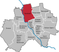
 Himmelsthür in Hildesheim.svg 670 × 590; 221 KB
-
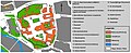
 HINordstadtPlan.png 1,342 × 1,566; 1.43 MB
-
 Itzum-Marienburg in Hildesheim.svg 670 × 590; 221 KB
-
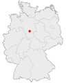
 Karte Deutschland Hildesheim.png 328 × 352; 15 KB
-
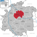
 Marienburger Höhe-Galgenberg in Hildesheim.svg 670 × 590; 221 KB
-
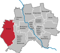
 Moritzberg-Bockfeld in Hildesheim.svg 670 × 590; 221 KB
-
 Neuhof-Hildesheimer Wald-Marienrode in Hildesheim.svg 670 × 590; 221 KB
-
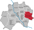
 Nordstadt in Hildesheim.svg 670 × 590; 221 KB
-
 Ochtersum in Hildesheim.svg 670 × 590; 221 KB
-
 Ochtersum.jpg 630 × 610; 56 KB
-
 Oststadt-Stadtfeld in Hildesheim.svg 671 × 590; 221 KB
-
 Sorsum in Hildesheim.svg 670 × 590; 221 KB
-
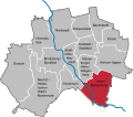
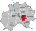
 Stadtmitte-Neustadt in Hildesheim.svg 670 × 590; 221 KB


