<nowiki>Category:Maps of Hattingen; categoría de Wikimedia; kategori Wikimedia; Wikimedia category; د ويکيمېډيا وېشنيزه; Vikimedya kategorisi; ویکیمیڈیا زمرہ; kategória projektov Wikimedia; категорія проєкту Вікімедіа; 维基媒体分类; Wikimedia-Kategorie; kategorie na projektech Wikimedia; kategorija na Wikimediji; विकिपीडिया:श्रेणी; page de catégorie de Wikimedia; kategorija na Wikimediji; विकिपीडिया वर्ग; категорија на Викимедији; Wikimedia-Kategorie; Wikimedia-kategori; kategori Wikimédia; تصنيف ويكيميديا; pajenn rummata eus Wikimedia; Wikimedia:ကဏ္ဍခွဲခြင်း; 維基媒體分類; Wikimedia категориясы; categoría de Wikimedia; categoria de Wikimedia; Wikimedia-Kategorie; tudalen categori Wikimedia; kategori e Wikimedias; ردهٔ ویکیپدیا; 维基媒体分类; Wikimedia-kategori; ვიკიპედია:კატეგორიზაცია; ウィキメディアのカテゴリ; categoria Wikimedia; تصنيف بتاع ويكيميديا; විකිමීඩියා ප්රභේද පිටුව; categoria Vicimediorum; Vikipidiya:Shopni; Wikimedia-luokka; Wikimedia category; guruhi Vikimedia; катэгорыя ў праекце Вікімэдыя; Викимедиа проектындагы төркем; catigurìa di nu pruggettu Wikimedia; หน้าหมวดหมู่วิกิมีเดีย; Wikimedia:Kategorija; Wikimedia-Kategorie; Wikimedia:Klassys; категория на Уикимедия; categorie a unui proiect Wikimedia; 維基媒體分類; Wikimedia-kategori; kawan Wikimèdia; 維基媒體分類; 위키미디어 분류; Wikimedia-bólkur; kategorio en Vikimedio; kategori Wikimedia; categoría de Wikimedia; উইকিমিডিয়া বিষয়শ্রেণী; kategori Wikimedia; 维基媒体分类; וויקימעדיע קאַטעגאָריע; kategorija w projektach Wikimedije; thể loại Wikimedia; Wikimedia projekta kategorija; kategoria ti Wikimedia; categoria de um projeto da Wikimedia; Wikimedia category; категорияд Ангилал; Wikimedia-kategori; kategori Wikimedia; پۆلی ویکیمیدیا; Wikimedia category; Vikimédia ñemohenda; Wikimédia-kategória; વિકિપીડિયા શ્રેણી; Wikimediako kategoria; категория в проекте Викимедиа; Wikimedia-Kategorie; катэгорыя ў праекце Вікімедыя; Wikimedia-kategorie; Wîkîmediya:Kategorî; विकिमिडिया श्रेणी; Wikimedia-Kategorie; קטגוריה במיזמי ויקימדיה; Викимедиа проектындагы төркем; kategoria w projekcie Wikimedia; विकिमिडिया श्रेणी; 维基媒体分类; Wikimedia-kategoriija; гурӯҳи Викимедиа; 維基媒體分類; Wikimedia:Ronnaghys; Wikimedia-kategory; categoria di un progetto Wikimedia; Wikimedia-categorie; Wikimedia-Kategorie; categurìa 'e nu pruggette Wikimedia; 維基媒體分類; Վիքիմեդիայի նախագծի կատեգորիա; Wikimedia-categorie; Wikimedia proyektındağı törkem; гурӯҳи Викимедиа; ẹ̀ka Wikimedia; Викимедиина категорија; categoria de um projeto da Wikimedia; Wikimedia-Kategorie; விக்கிமீடியப் பகுப்பு; tumbung Wikimedia; Wikimedia-kategorie; kategorija Wikimedie; kategorya ng Wikimedia; Viciméid catagóir; 维基媒体分类; kategori Wikimedia; jamii ya Wikimedia; വിക്കിമീഡിയ വർഗ്ഗം; Wikimedia-categorie; kategori Wikimedia; Викимедиа категорияһы; زمرو:وڪيپيڊيا زمرا بندي; Wikimedia kategooria; categoría de Wikimedia; विकिमीडिया श्रेणी; κατηγορία εγχειρημάτων Wikimedia; Kategoriya ning Wikimedia</nowiki>
Subcategories
This category has only the following subcategory.

 Breckerfeld · Ennepetal · Gevelsberg · Hattingen · Herdecke · Schwelm · Sprockhövel · Wetter · Witten


 1775 Amt Blankenstein, Elfringhausen.jpg 1,162 × 809; 423 KB
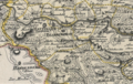 1790 Bauerschaft Stüter-Elfringhausen.png 1,056 × 673; 1.73 MB
 1791 Grafschaft Mark, Elfringhausen.jpg 1,149 × 756; 395 KB
 1791 Hattingen, Elfringhausen.jpg 1,158 × 736; 386 KB
 DB 2292 railway map.png 1,446 × 1,030; 954 KB
 Hattingen - Schulstraße 01 ies.jpg 3,888 × 2,592; 1.31 MB
 Hattingen in EN.svg 310 × 328; 270 KB
 Lage der Stadt Hattingen in Deutschland.png 188 × 235; 5 KB
 Messtischblatt 4509 Bochum 1899.jpg 1,654 × 1,774; 1,004 KB
 Messtischblatt 4509 Bochum 193x.jpg 10,336 × 7,960; 15.75 MB
 Messtischblatt 4609 Hattingen 193x.jpg 10,328 × 7,948; 16 MB
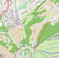 RauendahlPBahn.JPG 569 × 558; 121 KB


