Category:Maps of Harz
Jump to navigation
Jump to search
Wikimedia category | |||||
| Upload media | |||||
| Instance of | |||||
|---|---|---|---|---|---|
| Category combines topics | |||||
| Harz | |||||
mountain range in northern Germany  | |||||
| Instance of | |||||
| Made from material | |||||
| Location | |||||
| Located in or next to body of water | |||||
| Has part(s) | |||||
| Width |
| ||||
| Length |
| ||||
| Highest point | |||||
| Area |
| ||||
| Elevation above sea level |
| ||||
| Different from | |||||
 | |||||
Subcategories
This category has the following 9 subcategories, out of 9 total.
G
- Geological maps of Harz (10 F)
H
- Hiking maps of Harz (3 F)
M
- Maps of Brocken (12 F)
- Maps of Sankt Andreasberg (11 F)
O
- Old maps of Harz (11 F)
T
- Topographic maps of Harz (5 F)
- Transport maps of Harz (9 F)
Media in category "Maps of Harz"
The following 44 files are in this category, out of 44 total.
-
 1732 illustration of Blocksberg.jpg 14,017 × 12,060; 25.49 MB
-

-
 Alternativvorschlag der 21. Armeegruppe vom 10. Juli 1945.jpg 1,911 × 1,596; 1.4 MB
-
 B.Haushalter MA Harzgebiet5.JPG 3,312 × 2,907; 5.29 MB
-
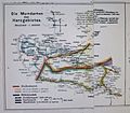
 B.Haushalter Sprachgrenze Karte3.JPG 3,665 × 2,056; 3.1 MB
-
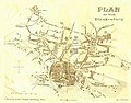 Blankenburger Stadtplan 1891.jpg 5,536 × 4,353; 3.11 MB
-
 Brocken L. S. Bestehorn cropped.jpg 797 × 416; 446 KB
-
 Brocken L. S. Bestehorn.jpg 1,770 × 1,517; 2.88 MB
-
 Brocken, perspektivische Ansicht.jpg 800 × 600; 175 KB
-

-
 Der Harz.png 2,261 × 1,719; 7.65 MB
-
 Einzugs- und Flussgebietskarte Selke.png 672 × 588; 503 KB
-
 Elbingerode – Schirke – Tanne - (1).png 1,272 × 704; 1.7 MB
-
 Gebietstausch vom 23 Juli 1945.jpg 1,367 × 725; 609 KB
-
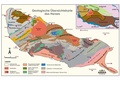 Geologische Karte des Harzes (K Stedingk).pdf 1,754 × 1,239; 232 KB
-
 Grund Riss der Wendefurther Forst.jpg 1,693 × 1,239; 493 KB
-
 Halberstadtwerke Netzgebietskarte 01 Gas.jpg 3,080 × 1,904; 2.08 MB
-
 Halberstadtwerke Netzgebietskarte 02 Strom.jpg 3,080 × 1,904; 1.34 MB
-
 Harz 1945.jpg 770 × 696; 60 KB
-
 Harz map blank.png 2,529 × 1,523; 2.42 MB
-
 Harz map topography.png 2,491 × 1,500; 1.83 MB
-
 Harz map-es.png 2,577 × 1,526; 3.21 MB
-
 Harz map-es.svg 10,084 × 5,973; 3.64 MB
-
 Harz map.svg 512 × 303; 2.97 MB
-
 Harz SW.png 939 × 682; 585 KB
-
 Karstwanderweg.png 2,514 × 1,514; 2.91 MB
-
 Karte Harz mit Verwaltungsgrenzen.png 1,283 × 846; 985 KB
-
 Karte Harzer Schmalspurbahnen.png 1,204 × 990; 1.1 MB
-
 Karte Naturpark Harz.png 750 × 1,000; 202 KB
-
 Karte Südharz-Eisenbahn-Gesellschaft.jpg 1,234 × 1,687; 682 KB
-
 Loipenübersicht der Stadt Oberharz am Brocken.jpg 4,032 × 3,024; 6.15 MB
-
 Meyer‘s Zeitungsatlas 041 – Herzogthum Braunschweig.jpg 7,344 × 6,251; 18.2 MB
-
 Naturraumkarte Harz.png 1,410 × 1,033; 1.87 MB
-
 Naturraumkarte Noerdliches Harzvorland.png 2,169 × 1,688; 3.17 MB
-
 Prediger-Nordwestlicher-Harz-1861.pdf 700 × 1,208, 3 pages; 5.37 MB
-
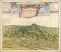
 Prospecte des Hartzwalds (View of the Harz Forest).jpg 7,881 × 6,848; 23.02 MB
-
 Reilly 376.jpg 1,665 × 1,259; 499 KB
-
 Reilly 377.jpg 1,579 × 1,302; 501 KB
-
 Schierke Karte 1912.JPG 587 × 691; 92 KB
-
 Schuchardt Atlas Nds (6b).jpg 2,336 × 1,944; 2.34 MB
-
 Stauseen im Harz.png 2,731 × 1,890; 1.85 MB
-
 Straßen im Harz.png 1,366 × 839; 1.48 MB
-
 Treseburg Karte 1912.jpg 437 × 458; 69 KB
-
 Vorschlag 229 (P) MilGovDet Hannover vom 15 Juni 1945.jpg 1,911 × 1,596; 1.46 MB

.jpg)


.png)


.jpg)


.jpg)


_MilGovDet_Hannover_vom_15_Juni_1945.jpg)