Category:Maps of Hämeenlinna
Jump to navigation
Jump to search
Suomi: Hämeenlinnan kaupungin karttoja
Svenska: Kartor över Tavastehus
Wikimedia category | |||||
| Upload media | |||||
| Instance of | |||||
|---|---|---|---|---|---|
| Category combines topics | |||||
| Hämeenlinna | |||||
city in the region of Tavastia Proper in Finland     | |||||
| Instance of | |||||
| Location | Kanta-Häme, Southern Finland Regional State Administrative Agency, Finland | ||||
| Legislative body |
| ||||
| Official language | |||||
| Head of government |
| ||||
| Inception |
| ||||
| Population |
| ||||
| Area |
| ||||
| Follows | |||||
| Different from | |||||
| official website | |||||
 | |||||
Subcategories
This category has the following 3 subcategories, out of 3 total.
Media in category "Maps of Hämeenlinna"
The following 34 files are in this category, out of 34 total.
-
 Hameenlinna kartta2009.svg 261 × 193; 42 KB
-
 Hauho.sijainti.suomi.2007.svg 1,850 × 3,220; 269 KB
-
 Hauho.sijainti.suomi.2008.svg 1,750 × 2,950; 1.01 MB
-
 Hauhon location.GIF 136 × 265; 3 KB
-
 Hämeenlinna kaupunginosat numeroitu.svg 550 × 400; 167 KB
-
 Hämeenlinna kaupunginosat.svg 1,698 × 1,299; 135 KB
-
 Hämeenlinna kieldâlahtemeh ive 1948 rääjist smn.svg 1,698 × 1,299; 99 KB
-
 Hämeenlinna liitokset fi.svg 1,698 × 1,299; 99 KB
-
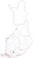
 Hämeenlinna location.png 230 × 400; 10 KB
-
 Hämeenlinna pitäjät.svg 1,698 × 1,299; 139 KB
-
 Hämeenlinna puuttuvat 1.png 1,036 × 694; 579 KB
-
 Hämeenlinna puuttuvat 2.png 1,313 × 821; 1.74 MB
-
 Hämeenlinna puuttuvat 3.png 1,396 × 929; 1.45 MB
-
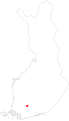
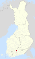
 Hämeenlinna.sijainti.suomi.2007.svg 1,850 × 3,220; 270 KB
-
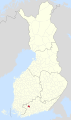
 Hämeenlinna.sijainti.suomi.2008.svg 1,850 × 3,220; 269 KB
-
 Hämeenlinna.sijainti.suomi.2009.svg 1,850 × 3,220; 233 KB
-
 Hämeenlinna.sijainti.suomi.2010.svg 1,850 × 3,220; 235 KB
-
 Hämeenlinnan mlk jako.svg 660 × 550; 30 KB
-
 Kalvola.sijainti.suomi.2007.svg 1,850 × 3,220; 269 KB
-
 Kalvola.sijainti.suomi.2008.svg 1,750 × 2,950; 1.01 MB
-
 Lammi.sijainti.suomi.2007.svg 1,850 × 3,220; 269 KB
-
 Lammi.sijainti.suomi.2008.svg 1,750 × 2,950; 1.01 MB
-
 Location of Hauho in Finland.png 230 × 400; 6 KB
-
 Location of Kalvola in Finland.png 230 × 400; 8 KB
-
 Location of Lammi in Finland.png 230 × 400; 6 KB
-
 Location of Renko in Finland.png 230 × 400; 7 KB
-
 Location of Tuulos in Finland.png 230 × 400; 6 KB
-
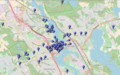
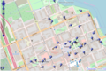
 OpenStreetMap Hämeenlinna.jpg 1,920 × 858; 392 KB
-
 Renko.sijainti.suomi.2007.svg 1,850 × 3,220; 269 KB
-
 Renko.sijainti.suomi.2008.svg 1,750 × 2,950; 1.01 MB
-
 Tavastland Häme.png 826 × 1,168; 2.24 MB
-
 Tuulos.sijainti.suomi.2007.svg 1,850 × 3,220; 270 KB
-
 Tuulos.sijainti.suomi.2008.svg 1,750 × 2,950; 1.01 MB
-
 Vanaja jako.svg 720 × 370; 31 KB


