Category:Maps of Gulf of Khambhat
Jump to navigation
Jump to search
Media in category "Maps of Gulf of Khambhat"
The following 34 files are in this category, out of 34 total.
-
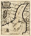
 A bit more to the north and west* From William Blaeu's famous map, 1638.jpg 1,120 × 840; 190 KB
-

-
 Admiralty Chart No 1321 Plans on the Kathiawar Coast, Published 1927, New Edition 1956.jpg 16,221 × 11,082; 34.92 MB
-
 Admiralty Chart No 826 Karachi to Vengurla, Published 1877.jpg 10,907 × 15,966; 56.67 MB
-
 Coastal India topographical.jpg 622 × 345; 49 KB
-
 Coastal South West India.jpg 512 × 324; 19 KB
-
 Du Val's more detailed route map of the Deccan, 1690, from Surat westward.jpg 1,600 × 1,236; 564 KB
-

-
 Gujarat Gulfs.jpg 538 × 352; 25 KB
-
 Gulf of Cambay (North part) 1896.jpg 2,048 × 1,286; 851 KB
-
 Gulf of Cambay (South part) 1896.jpg 2,048 × 1,286; 873 KB
-
 Gulf of Cambay A closer look from a map by Bellin, 1752.jpg 900 × 720; 141 KB
-
 Gulf of Cambay A map engraved for the 'Annual Register', London, 1763.jpg 1,066 × 1,029; 234 KB
-

-

-
 Gulf of Cambay From a map by Gilles Robert de Vaugondy, 1793.jpg 800 × 600; 166 KB
-

-

-
-

-
 Gulf of Cambay, From William Blaeu's famous map, 1638.jpg 1,120 × 840; 183 KB
-

-

-
 Gulf of Khambhat From Pieter Vander Aa's Nouvel Atlas.jpg 900 × 720; 207 KB
-
-
 Kachch.png 1,058 × 749; 143 KB
-
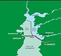
 Kalpsar1.jpg 632 × 470; 96 KB
-
 Kalpsar3.jpg 943 × 866; 86 KB
-

-
 Map of Gulf of Cambay by Gerard Mercator.jpg 900 × 720; 204 KB
-
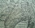
 Map of Gulf of Cambay, A map by Petrus Bertius, Amsterdam, 1606.jpg 770 × 563; 59 KB
-
 Periplus 181 Gulf of Cambay.png 1,436 × 1,676; 2.75 MB
-
 Surrat City by William Hack.jpg 1,166 × 873; 176 KB
-
 Wakal River basin in Rajasthan and Gujarat states of India.jpg 2,937 × 4,057; 2.13 MB


_1896.jpg)
_1896.jpg)


,_published_1783.jpg)
.jpg)


_by_Pieter_van_der_Aa,_from_%27La_Galerie_Agreable_du_Monde_(...).Tome_premier_des_Indes_Orientales.%27,_published_in_Leyden,_c._1725.jpg)


