Category:Maps of Guatemala City
Jump to navigation
Jump to search
Subcategories
This category has only the following subcategory.
R
- Mapa en Relieve de Guatemala (40 F)
Media in category "Maps of Guatemala City"
The following 21 files are in this category, out of 21 total.
-
 Autopista VAS (Via Alterna del Sur), AMG.png 4,167 × 4,152; 7.72 MB
-
 BRT Líneas GT.png 1,200 × 1,500; 268 KB
-
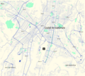
 Guatemala City map.png 600 × 1,115; 67 KB
-
 Guatemala City Map.png 4,167 × 3,769; 9.31 MB
-
 Guatemala City Roads.png 9,000 × 9,914; 88.12 MB
-
 Guatemala city zones.png 839 × 687; 28 KB
-
 IDH por Zonas Ciudad de Guatemala Definitivo.png 867 × 684; 71 KB
-
 IDH por Zonas de Ciudad de Guatemala 2018 FINAL.png 920 × 736; 74 KB
-
 Mapa Autopista VAS - Via Alterna del Sur Guatemala.png 6,000 × 4,885; 33.67 MB
-
 Mapa de la Ciudad de Guatemala.png 2,338 × 2,298; 5.81 MB
-
 Mapa del Area Metropolitana de Guatemala AMG.png 9,000 × 9,251; 68.03 MB
-
 Mapa del área central de la Ciudad de Guatemala.png 1,998 × 2,000; 977 KB
-
 Mapa IDH Ciudad de Guatemala.jpg 854 × 700; 107 KB
-
 Mapa1868.jpg 960 × 720; 354 KB
-
 Municipality of Guatemala City and its neighbors.svg 544 × 489; 83 KB
-
 Población del Área Metropolitana de Guatemala.png 3,507 × 2,480; 429 KB
-
 Rutas Transmetro.png 538 × 821; 194 KB
-
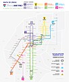 Transmetro Guatemala Public Map March 2020.jpg 3,490 × 4,096; 785 KB
-
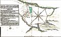 Valleermitamapa1770.jpg 955 × 577; 230 KB
-
 ZonasMarkedNew.png 854 × 700; 27 KB
-
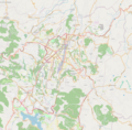
 Área Metropolitana de Guatemala, Guatemala.png 3,530 × 3,653; 8.59 MB
,_AMG.png)


