Category:Maps of Groß-Umstadt
Jump to navigation
Jump to search
Wikimedia category | |||||
| Upload media | |||||
| Instance of | |||||
|---|---|---|---|---|---|
| Category combines topics | |||||
| Groß-Umstadt | |||||
municipality in Landkreis Darmstadt-Dieburg in Hesse, Germany    | |||||
| Instance of |
| ||||
| Named after |
| ||||
| Location | Darmstadt-Dieburg, Darmstadt Government Region, Hesse, Germany | ||||
| Population |
| ||||
| Area |
| ||||
| Elevation above sea level |
| ||||
| official website | |||||
 | |||||
Media in category "Maps of Groß-Umstadt"
The following 20 files are in this category, out of 20 total.
-
 Da-schloss-umstadt 1787-1940-2011.png 782 × 835; 219 KB
-
 Darmstadt-Schloss-Grundriss.png 897 × 683; 40 KB
-
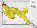
 Dorndiel.png 1,009 × 796; 31 KB
-
 Geopfad Klein-Umstadt.png 792 × 759; 410 KB
-
 Groß-Umstadt in DA.svg 738 × 502; 588 KB
-
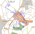
 Groß-Umstadt-osm.png 1,137 × 709; 859 KB
-
 Heubach.png 1,009 × 796; 31 KB
-
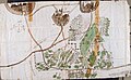 Karte der Gemarkung Klein-Umstadt.jpg 2,946 × 1,821; 2.63 MB
-
 Karte der Oberwaldungen des Oberamts Umstadt.jpg 5,140 × 3,704; 22.77 MB
-
 Karte des Amorbacher, Schaafheimer, Umstädter und Richener Waldes.jpg 4,982 × 3,771; 20.26 MB
-
 Karte Gemarkungsgrenzen Klein-Umstadt.jpg 1,412 × 1,061; 664 KB
-
 Karte von Babenhausen und Umgebung.jpg 7,534 × 8,937; 88.54 MB
-
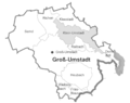
 Kleestadt.png 1,009 × 796; 31 KB
-
 Klein-umstadt.png 1,009 × 796; 31 KB
-
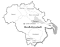 Raibach.png 1,009 × 796; 31 KB
-
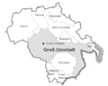
 Richen.png 1,009 × 796; 31 KB
-
 Rod-schloss Heddersdorf lage-in-Umstadt 2011.png 1,200 × 841; 586 KB
-
 Semd.png 1,009 × 796; 31 KB
-
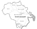
 Umstadt.png 1,009 × 796; 31 KB
-
 Wiebelsbach.png 1,009 × 796; 31 KB


