Category:Maps of Gauteng municipalities with 2006 borders
Jump to navigation
Jump to search
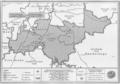
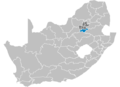
This category contains maps of municipalities in the Gauteng province of South Africa that show the the municipal borders as they were after the municipal election of 1 March 2006. The borders of many municipalities changed in 2009 and again in 2011.
Media in category "Maps of Gauteng municipalities with 2006 borders"
The following 32 files are in this category, out of 32 total.
-
 DC42 locator.svg 922 × 1,000; 145 KB
-
 DC46 locator.svg 922 × 1,000; 145 KB
-
 DC48 locator.svg 922 × 1,000; 145 KB
-
 EKU locator.svg 922 × 1,000; 145 KB
-
 Gauteng municipalities map svg zh.png 553 × 600; 132 KB
-
 Gauteng municipalities map.svg 922 × 1,000; 133 KB
-
 GT02b1 locator.svg 922 × 1,000; 145 KB
-
 GT02b2 locator.svg 922 × 1,000; 145 KB
-
 GT421 locator.svg 922 × 1,000; 145 KB
-
 GT422 locator.svg 922 × 1,000; 145 KB
-
 GT423 locator.svg 922 × 1,000; 145 KB
-
 GT481 locator.svg 922 × 1,000; 145 KB
-
 GT482 locator.svg 922 × 1,000; 145 KB
-
 GT483 locator.svg 922 × 1,000; 145 KB
-
 GTDMA48 locator.svg 922 × 1,000; 145 KB
-
 JHB locator.svg 922 × 1,000; 145 KB
-
 Map No. 17 of Schedule 2 to Notice 1998 of 2005.png 2,800 × 1,950; 3.92 MB
-
 Map No. 18 of Schedule 2 to Notice 1998 of 2005.png 2,800 × 1,950; 3.78 MB
-
 Map No. 19 of Schedule 2 to Notice 1998 of 2005.png 2,800 × 1,950; 3.8 MB
-
 Map No. 20 of Schedule 2 to Notice 1998 of 2005.png 2,800 × 1,950; 3.86 MB
-
 Map No. 21 of Schedule 2 to Notice 1998 of 2005.png 2,800 × 1,950; 4.09 MB
-
 Map No. 4 of Schedule 1 to Notice 1998 of 2005.png 2,850 × 2,000; 3.77 MB
-
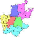
 Map of Gauteng with municipalities blank (2006).svg 1,000 × 1,000; 686 KB
-
 Map of Gauteng with municipalities labelled (2006).svg 1,000 × 1,000; 698 KB
-
 Pretoriamunsipaliteit.jpg 193 × 169; 7 KB
-
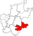
 South Africa District showing Sedibeng.png 1,141 × 828; 31 KB
-
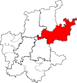
 South Africa Districts showing Ekurhuleni.png 1,141 × 828; 31 KB
-
 South Africa Districts showing Johannesburg.png 1,141 × 828; 31 KB
-
 South Africa Districts showing Metsweding.png 1,141 × 828; 31 KB
-
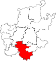
 South Africa Districts showing Tshwane.png 1,141 × 828; 31 KB
-
 South Africa Districts showing West Rand.png 1,141 × 828; 31 KB
-
 TSH locator.svg 922 × 1,000; 145 KB


.svg)


.svg)