Category:Maps of Galicia (Central Europe)
Jump to navigation
Jump to search
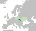
English: Maps of Galicia in central Europe, today divided between Poland and Ukraine.
Wikimedia category | |||||
| Upload media | |||||
| Instance of | |||||
|---|---|---|---|---|---|
| Category combines topics | |||||
| Galicia | |||||
historical and geographic region in western Ukraine and southern Poland  Krakov, centrum Západní Haliče   | |||||
| Instance of | |||||
| Location | |||||
| Different from | |||||
 | |||||
- For the Galicia on the Iberian peninsula, see Category:Maps of Galicia (Spain)
Subcategories
This category has the following 5 subcategories, out of 5 total.
M
- Maps of Halych-Volhynia (14 F)
- Maps of Ruthenian Voivodeship (26 F)
O
- Old maps of Mariampil (Galicia) (16 F)
Media in category "Maps of Galicia (Central Europe)"
The following 18 files are in this category, out of 18 total.
-
 East Galicia and Volhynia 1939.png 600 × 450; 74 KB
-
 Galicia english.svg 275 × 264; 28 KB
-
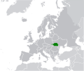
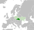 Galicia in modern Europe map.svg 512 × 444; 323 KB
-
 Galicia in modern Europe.svg 512 × 356; 268 KB
-
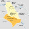
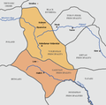 Galicia-Volhynia map.PNG 661 × 655; 41 KB
-
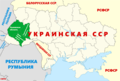 Galician referendum in Ukrainian SSR in 1991.png 1,547 × 1,041; 305 KB
-
 Galician referendum, 1991.png 2,000 × 1,346; 315 KB
-
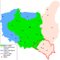 Galicja Wschodnia w II RP i III RP.PNG 889 × 892; 39 KB
-
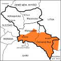
 General Government of Galicia and Bukovina.png 924 × 549; 51 KB
-
 GminyProtestanckiePołudniowaDiecezjaKrakowska ok1600r.png 1,780 × 1,198; 143 KB
-
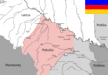
 Location Carpatian Galicia in Europe.svg 512 × 430; 288 KB
-
 MapaDelPrincipadoDeGalitzia-Volynia-pt.svg 661 × 655; 38 KB
-
 MapaDelPrincipadoDeGalitzia-Volynia.svg 661 × 655; 1.3 MB
-
 Pocutia.png 1,197 × 879; 287 KB
-
 Polen Galizien Wolhynien.png 700 × 610; 152 KB
-
 Polsko 1400, Halič.svg 300 × 300; 27 KB
-
 Region of Galicia in modern Europe map.png 2,526 × 2,168; 520 KB
-
 Ukraine-Halychyna.png 999 × 685; 772 KB


