Category:Maps of Franklin Park (Boston)
Jump to navigation
Jump to search
Media in category "Maps of Franklin Park (Boston)"
The following 6 files are in this category, out of 6 total.
-
 1876 plan for West Roxbury Park.jpg 8,376 × 7,840; 5.97 MB
-
 1884 topographical map of West Roxbury Park.jpg 10,224 × 7,214; 7.85 MB
-
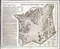 1885 plan for Franklin Park.jpg 8,888 × 7,295; 17.37 MB
-
 1893 OaklandGarden Boston map bySampson Murdock BPL 12466 detail.png 1,064 × 746; 1.34 MB
-
 An arboreal guide of the wilderness (1979) (19742035612).jpg 2,345 × 2,562; 1.31 MB
-


_(19742035612).jpg)
_(20213938529).jpg)