Category:Maps of Falleron
Jump to navigation
Jump to search
Wikimedia category | |||||
| Upload media | |||||
| Instance of | |||||
|---|---|---|---|---|---|
| Category combines topics | |||||
| Falleron | |||||
commune in Vendée, France .jpg) .svg)  | |||||
| Instance of | |||||
| Location |
| ||||
| Street address |
| ||||
| Population |
| ||||
| Area |
| ||||
| official website | |||||
 | |||||
Media in category "Maps of Falleron"
The following 2 files are in this category, out of 2 total.
-
 85086-Falleron-Sols.png 3,270 × 2,598; 2.02 MB
-
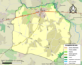
 Map commune FR insee code 85086.png 756 × 605; 59 KB
