Category:Maps of Eibergen
Jump to navigation
Jump to search
Wikimedia category | |||||
| Upload media | |||||
| Instance of | |||||
|---|---|---|---|---|---|
| Category combines topics |
| ||||
| Eibergen | |||||
former Dutch municipality    | |||||
| Instance of |
| ||||
| Location |
| ||||
| Dissolved, abolished or demolished date |
| ||||
| Population |
| ||||
| Replaced by | |||||
 | |||||
Media in category "Maps of Eibergen"
The following 3 files are in this category, out of 3 total.
-
 Beltrum, Gemeenteatlas van Nederland.jpg 2,200 × 1,675; 4.25 MB
-
 Eibergen, Gemeenteatlas van Nederland.jpg 2,053 × 1,620; 4.3 MB
-
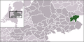 Locator map of Eibergen.png 280 × 140; 9 KB


