Category:Maps of Dutchess County, New York
Jump to navigation
Jump to search
Counties of New York (state): Albany · Allegany · Bronx · Broome · Cattaraugus · Cayuga · Chautauqua · Chemung · Chenango · Clinton · Columbia · Cortland · Delaware · Dutchess · Erie · Essex · Franklin · Fulton · Genesee · Greene · Hamilton · Herkimer · Jefferson · Kings · Lewis · Livingston · Madison · Monroe · Montgomery · Nassau · New York · Niagara · Oneida · Onondaga · Ontario · Orange · Orleans · Oswego · Otsego · Putnam · Queens · Rensselaer · Richmond · Rockland · Saratoga · Schenectady · Schoharie · Schuyler · Seneca · St. Lawrence · Steuben · Suffolk · Sullivan · Tioga · Tompkins · Ulster · Warren · Washington · Wayne · Westchester · Wyoming · Yates
Wikimedia category | |||||
| Upload media | |||||
| Instance of | |||||
|---|---|---|---|---|---|
| Category combines topics | |||||
| Dutchess County | |||||
county in New York, United States    | |||||
| Instance of | |||||
| Named after | |||||
| Location | New York | ||||
| Capital | |||||
| Inception |
| ||||
| Highest point | |||||
| Population |
| ||||
| Area |
| ||||
| official website | |||||
 | |||||
Subcategories
This category has the following 3 subcategories, out of 3 total.
Media in category "Maps of Dutchess County, New York"
The following 70 files are in this category, out of 70 total.
-
 Map of towns in Dutchess County, New York.svg 1,430 × 1,895; 13 KB
-
 1798 map of lower Saw Kill, Rhinebeck, NY.jpg 600 × 903; 497 KB
-
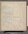
 1867 Map of Red Hook.png 673 × 564; 604 KB
-

-
-
 Dover (Township); Mabbettsville (Village); Hopewell Junction (Village).jpg 2,068 × 2,560; 1,013 KB
-
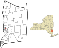
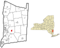
 Dutchess County New York incorporated areas Amenia CDP highlighted.svg 954 × 766; 148 KB
-
 Dutchess County New York incorporated areas Amenia highlighted.svg 954 × 766; 148 KB
-
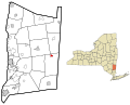
 Dutchess County New York incorporated areas Arlington highlighted.svg 954 × 766; 148 KB
-
 Dutchess County New York incorporated areas Beekman highlighted.svg 954 × 766; 148 KB
-
 Dutchess County New York incorporated areas Brinckerhoff highlighted.svg 954 × 766; 148 KB
-

-

-
 Dutchess County New York incorporated areas Clinton highlighted.svg 954 × 766; 148 KB
-

-
 Dutchess County New York incorporated areas Dover highlighted.svg 954 × 766; 148 KB
-
 Dutchess County New York incorporated areas Dover Plains highlighted.svg 954 × 766; 148 KB
-

-
 Dutchess County New York incorporated areas Fairview highlighted.svg 954 × 766; 148 KB
-
 Dutchess County New York incorporated areas Fishkill highlighted.svg 954 × 766; 148 KB
-
-
 Dutchess County New York incorporated areas Haviland highlighted.svg 954 × 766; 148 KB
-

-

-

-
 Dutchess County New York incorporated areas Hyde Park highlighted.svg 954 × 766; 148 KB
-
 Dutchess County New York incorporated areas La Grange highlighted.svg 954 × 766; 148 KB
-
 Dutchess County New York incorporated areas Merritt Park highlighted.svg 954 × 766; 148 KB
-
 Dutchess County New York incorporated areas Milan highlighted.svg 954 × 766; 148 KB
-
 Dutchess County New York incorporated areas Millbrook highlighted.svg 954 × 766; 148 KB
-
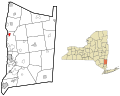
 Dutchess County New York incorporated areas Millerton highlighted.svg 954 × 766; 148 KB
-
 Dutchess County New York incorporated areas Myers Corner highlighted.svg 954 × 766; 148 KB
-
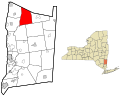
 Dutchess County New York incorporated areas North East highlighted.svg 954 × 766; 148 KB
-
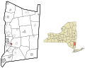
 Dutchess County New York incorporated areas Pawling highlighted.svg 954 × 766; 148 KB
-

-
 Dutchess County New York incorporated areas Pine Plains highlighted.svg 954 × 766; 148 KB
-

-

-
 Dutchess County New York incorporated areas Red Hook highlighted.svg 954 × 766; 148 KB
-

-
 Dutchess County New York incorporated areas Rhinebeck highlighted.svg 954 × 766; 148 KB
-
 Dutchess County New York incorporated areas Rhinecliff highlighted.svg 954 × 766; 148 KB
-
 Dutchess County New York incorporated areas Salt Point highlighted.svg 954 × 766; 148 KB
-
 Dutchess County New York incorporated areas Spackenkill highlighted.svg 954 × 766; 148 KB
-
 Dutchess County New York incorporated areas Staatsburg highlighted.svg 954 × 766; 148 KB
-
 Dutchess County New York incorporated areas Stanford highlighted.svg 954 × 766; 148 KB
-
 Dutchess County New York incorporated areas Titusville highlighted.svg 954 × 766; 148 KB
-
 Dutchess County New York incorporated areas Tivoli highlighted.svg 954 × 766; 148 KB
-

-
 Dutchess County New York incorporated areas Union Vale highlighted.svg 954 × 766; 148 KB
-

-

-

-

-
 Dutchess County New York incorporated areas Wappinger highlighted.svg 954 × 766; 148 KB
-

-
 Dutchess County New York incorporated areas Washington highlighted.svg 954 × 766; 148 KB
-
 Dutchess County New York incorporated areas.svg 954 × 766; 148 KB
-
 Dutchess County.jpg 564 × 741; 265 KB
-
 Great Nine Partners Patent.jpg 9,053 × 6,182; 44.11 MB
-
 Irondale (Village); Millerton (Village); North East (Township) NYPL1584632.tiff 5,428 × 6,720; 104.36 MB
-
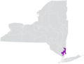
 Map of New York highlighting Dutchess County.svg 6,599 × 5,030; 112 KB
-

-
 Maritje Kill 1829.jpg 1,748 × 2,717; 2.02 MB
-
 New York State Senate District 40 (2012).png 3,259 × 2,492; 400 KB
-
 New York State Senate District 41 (2012).png 3,259 × 2,492; 400 KB
-
 Spackenkill.gif 575 × 425; 67 KB
-
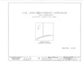
 T-2265A.jpg 7,441 × 10,791; 2.38 MB
-
-
 Wyndclyffe, Mill Road, Rhinebeck, Dutchess County, NY HABS NY,14-RHINB.V,2- (sheet 1 of 3).tif 14,440 × 9,632; 1.51 MB


.png)
;_Mabbettsville_(Village);_Hopewell_Junction_(Village).jpg)


.png)
.png)

