Category:Maps of Curzon
Jump to navigation
Jump to search
Wikimedia category | |||||
| Upload media | |||||
| Instance of | |||||
|---|---|---|---|---|---|
| Category combines topics | |||||
| Curzon | |||||
commune in Vendée, France .jpg)   | |||||
| Instance of | |||||
| Location |
| ||||
| Located in or next to body of water | |||||
| Street address |
| ||||
| Population |
| ||||
| Area |
| ||||
| Elevation above sea level |
| ||||
| Different from | |||||
| official website | |||||
 | |||||
Subcategories
This category has only the following subcategory.
U
- Urbanisation maps of Curzon (2 F)
Media in category "Maps of Curzon"
The following 7 files are in this category, out of 7 total.
-
 85077-Curzon-Hydro.jpeg 5,846 × 4,133; 1.63 MB
-
 85077-Curzon-Sols.png 3,270 × 2,598; 1.45 MB
-
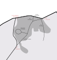
 Hydrographie de Curzon.svg 467 × 618; 148 KB
-
 Map commune FR insee code 85077.png 756 × 605; 35 KB
-
 Morphologie urbaine de la commune de Curzon.svg 467 × 618; 214 KB
-
 Odonymes du Port-la-Claye.svg 366 × 388; 83 KB
-
 Odonymes à Curzon.svg 346 × 494; 287 KB


