Category:Maps of Chatham, Massachusetts
Jump to navigation
Jump to search
Media in category "Maps of Chatham, Massachusetts"
The following 9 files are in this category, out of 9 total.
-
-

-
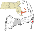
 Chatham ma highlight.png 788 × 466; 54 KB
-
 Chatham, Massachusetts 1894 (14961816432).jpg 2,000 × 1,360; 2.47 MB
-
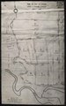
 Oyster Pond River (Chatham, Massachusetts) map.jpg 1,700 × 2,800; 1.83 MB
-

-

-
 Plan of land in Chatham, 1924 April (IA planoflandinchat00unse).pdf 658 × 1,052, 2 pages; 136 KB
-
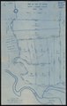 Plan of land in Chatham, 1924 August 13 (IA planoflandinchat00unse 0).pdf 650 × 1,018, 6 pages; 368 KB
_highlighted.svg)


.jpg)
_map.jpg)

