Category:Maps of Bucy-Saint-Liphard
Jump to navigation
Jump to search
Wikimedia category | |||||
| Upload media | |||||
| Instance of | |||||
|---|---|---|---|---|---|
| Category combines topics | |||||
| Bucy-Saint-Liphard | |||||
commune in Loiret, France  .svg)  | |||||
| Instance of | |||||
| Location |
| ||||
| Population |
| ||||
| Area |
| ||||
 | |||||
Subcategories
This category has the following 2 subcategories, out of 2 total.
Media in category "Maps of Bucy-Saint-Liphard"
The following 10 files are in this category, out of 10 total.
-
 45-Bucy-Saint-Liphard-Routes.png 5,457 × 3,543; 1.52 MB
-
 45059-Bucy-Saint-Liphard-argile.png 3,057 × 2,480; 1.6 MB
-
 45059-Bucy-Saint-Liphard-Cours eau.jpg 3,507 × 2,480; 360 KB
-
 45059-Bucy-Saint-Liphard-Hydro.jpeg 5,846 × 4,133; 1.4 MB
-
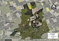 45059-Bucy-Saint-Liphard-Orthophoto.jpeg 10,559 × 7,440; 12.34 MB
-
 45059-Bucy-Saint-Liphard-Sols.png 3,519 × 2,480; 1.19 MB
-
 Bucy-Saint-Liphard OSM 01.png 714 × 669; 268 KB
-
 Bucy-Saint-Liphard OSM 03.png 449 × 436; 69 KB
-
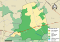
 Bucy-Saint-Liphard-Interco.png 3,507 × 2,480; 965 KB
-
 Map commune FR insee code 45059.png 756 × 605; 34 KB


