Category:Maps of Bresse
Jump to navigation
Jump to search
Wikimedia category | |||||
| Upload media | |||||
| Instance of | |||||
|---|---|---|---|---|---|
| Category combines topics | |||||
| Bresse | |||||
plain considered part of Burgundy   | |||||
| Instance of |
| ||||
| Location |
| ||||
| Has part(s) | |||||
| Area |
| ||||
| Different from | |||||
 | |||||
Media in category "Maps of Bresse"
The following 22 files are in this category, out of 22 total.
-
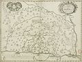
 "Bressia, vulgo Bresse" (21634105453).jpg 4,078 × 3,120; 2.65 MB
-
 "La Bresse Chalonnoise" (21632405554).jpg 3,922 × 3,114; 2.57 MB
-
 16xx Lion Caloire Guillotiere Vaize Rilliau.png 677 × 543; 676 KB
-
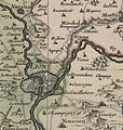 Bresse Bugey Valromay Dombes Viennois 169x (cropped - Zoom on Lyon).jpg 1,318 × 1,391; 651 KB
-
 Bresse Bugey Valromay Dombes Viennois 169x.jpg 7,371 × 10,260; 25.92 MB
-
 Bresse localization.jpg 2,172 × 2,074; 1.11 MB
-
 Bressia vulgo Bresse (8343183440).jpg 6,682 × 5,555; 35.98 MB
-
-
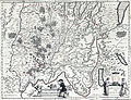
 Cartes de Dauphiné 1613.jpg 8,448 × 5,549; 20.17 MB
-
 Description du pays de Bresse 1619.jpg 6,373 × 5,376; 23.02 MB
-
 Gebiet des AOC-Schutzes Crème et Beurre de Bresse.png 1,133 × 1,607; 1.13 MB
-

-
 Jura-geologie.jpg 1,000 × 1,341; 659 KB
-
 Map Niévroz 16xx Bresse.jpg 599 × 352; 61 KB
-
 Map of Miribel region (XVIe century).jpg 510 × 377; 131 KB
-
 Netz der Biefs in der Bresse.png 624 × 845; 932 KB
-
 Plan Bresse 16xx.jpg 7,723 × 5,905; 35.49 MB
-
 Plan pays de Bresse 1619.jpg 4,904 × 4,096; 8.07 MB
-
 Profil fossé Bresse St Cyr Menthon.svg 815 × 450; 150 KB
-
 Territoire AOC Crème Beurre Bresse.svg 575 × 600; 863 KB
-
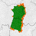 Territoire AOC Poule Bresse.svg 810 × 810; 2.05 MB
-
 Territoire Prairie Val Saône.svg 460 × 735; 1.39 MB
.jpg)
.jpg)

.jpg)

.jpg)


.jpg)


