Category:Maps of Bommes (Gironde)
Jump to navigation
Jump to search
Subcategories
This category has only the following subcategory.
T
Media in category "Maps of Bommes (Gironde)"
The following 9 files are in this category, out of 9 total.
-
 33060-Bommes-Routes-Hydro.png 3,507 × 2,480; 2.36 MB
-
 33060-Bommes-Sols.png 3,270 × 2,598; 1.86 MB
-
 33060-Bommes-ZNIEFF2.png 5,866 × 4,133; 5.68 MB
-
 Bommes (Gironde) dans son Arrondissement.png 2,000 × 2,467; 646 KB
-
 Bommes Limite communale.jpg 964 × 577; 153 KB
-
 Bommes OSM 01.png 514 × 526; 238 KB
-
 Bommes OSM 03.png 395 × 519; 169 KB
-
 Cassini 105-Bommes.png 1,368 × 768; 1.95 MB
-
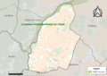
 Map commune FR insee code 33060.png 756 × 605; 39 KB


_dans_son_Arrondissement.png)


