Category:Maps of Beira
Jump to navigation
Jump to search
Media in category "Maps of Beira"
The following 9 files are in this category, out of 9 total.
-

-
 Admiralty Chart No 2933 Ponta Chinguno to Rio Mauendeni, Published 1961.jpg 16,218 × 11,074; 32.98 MB
-
 Admiralty Chart No 642 Plans in Portugese East Africa, Published 1962.jpg 16,403 × 11,261; 41.23 MB
-
 Cefala - (Thevet) - btv1b8595677z.jpg 3,132 × 2,532; 1.65 MB
-
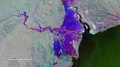
 Cyclone Idai floods near Beira 2019-3-19 by ESA Copernicus Sentinel-1.jpg 3,761 × 2,116; 2.56 MB
-
 Floods imaged by Copernicus Sentinel-1 ESA418453.tiff 7,521 × 4,231; 91.06 MB
-

-
 Receding waters ESA19317085.jpeg 7,521 × 4,231; 12.04 MB
-
 Receding waters ESA418751.tiff 7,521 × 4,231; 91.06 MB
%27_(11222854493).jpg)


_-_btv1b8595677z.jpg)


