Category:Maps of Aylesbury Vale District
Jump to navigation
Jump to search
English: Maps of the former Aylesbury Vale district, now in Buckinghamshire district, in the ceremonial county of Buckinghamshire, England.
Media in category "Maps of Aylesbury Vale District"
The following 9 files are in this category, out of 9 total.
-
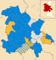 Aylesbury Vale UK local election 2003 map.svg 1,187 × 1,266; 890 KB
-
 Aylesbury Vale UK local election 2007 map.svg 1,187 × 1,266; 889 KB
-
 Aylesbury Vale UK local election 2011 map.svg 1,187 × 1,266; 890 KB
-
 Aylesbury Vale UK local election 2015 map.svg 1,187 × 1,266; 926 KB
-
 Aylesbury Vale UK locator map.svg 1,070 × 1,266; 921 KB
-
 Aylesbury Vale UK ward map 2010 (blank).svg 1,187 × 1,266; 889 KB
-
 Aylesbury Vale UK ward map 2015 (blank).svg 1,187 × 1,266; 923 KB
-
 Buckinghamshire-AylesburyVale.png 335 × 520; 49 KB
-
 BuckinghamshireAylesburyVale.png 200 × 282; 15 KB


.svg)
.svg)