Category:Maps of Asia-Pacific
Jump to navigation
Jump to search
Media in category "Maps of Asia-Pacific"
The following 19 files are in this category, out of 19 total.
-
 Asia and the Pacific.png 3,129 × 2,978; 1.23 MB
-
 Asia-Pacific map.png 1,425 × 625; 99 KB
-
 Asia-Pacific map1.png 1,427 × 628; 19 KB
-
 Bangladesh map.png 1,976 × 1,390; 145 KB
-

-
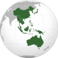 East Asia, Southeast Asia and the Pacific.png 2,044 × 2,048; 576 KB
-
 East-Asia-and-Pacific DNI Solar-resource-map GlobalSolarAtlas World-Bank-Esmap-Solargis.png 2,598 × 2,125; 2.38 MB
-
 East-Asia-and-Pacific GHI Solar-resource-map GlobalSolarAtlas World-Bank-Esmap-Solargis.png 2,598 × 2,125; 2.39 MB
-

-
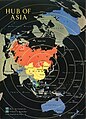 Hub of Asia, 1955.jpg 1,060 × 1,470; 316 KB
-
 Iberoasia e Iberooceanía.svg 1,100 × 1,100; 1.15 MB
-
 Kolonialmächte im Pazifikraum, 1939.svg 1,039 × 814; 1.76 MB
-
 LLWS Asia-Pacific Part Asia.svg 1,100 × 837; 608 KB
-
 The Orient, 1958.jpg 5,545 × 4,181; 3.63 MB
-

-

-
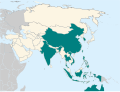
 Wikimedia ESEAP.svg 3,840 × 1,567; 226 KB
-
 Wikimedia regions - East, Southeast Asia, & Pacific.svg 800 × 800; 372 KB
-
 World outline map - Asia-Pacific.jpg 2,097 × 3,920; 1,012 KB


._1-75._LOC_76695618.jpg)

