Category:Maps of Armstrong County, Pennsylvania
Jump to navigation
Jump to search
Counties of Pennsylvania : Adams · Allegheny · Armstrong · Beaver · Bedford · Berks · Blair · Bradford · Bucks · Butler · Cambria · Cameron · Carbon · Centre · Chester · Clarion · Clearfield · Clinton · Columbia · Crawford · Cumberland · Dauphin · Delaware · Elk · Erie · Fayette · Forest · Franklin · Fulton · Greene · Huntingdon · Indiana · Jefferson · Juniata · Lackawanna · Lancaster · Lawrence · Lebanon · Lehigh · Luzerne · Lycoming · McKean · Mercer · Mifflin · Monroe · Montgomery · Montour · Northampton · Northumberland · Perry · Philadelphia · Pike · Potter · Schuylkill · Snyder · Somerset · Sullivan · Susquehanna · Tioga · Union · Venango · Warren · Washington · Wayne · Westmoreland · Wyoming · York
Wikimedia category | |||||
| Upload media | |||||
| Instance of | |||||
|---|---|---|---|---|---|
| Category combines topics | |||||
| Armstrong County | |||||
county in Pennsylvania, United States   | |||||
| Instance of | |||||
| Named after | |||||
| Location | Pennsylvania | ||||
| Capital | |||||
| Inception |
| ||||
| Population |
| ||||
| Area |
| ||||
| Different from | |||||
| official website | |||||
 | |||||
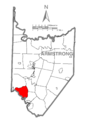
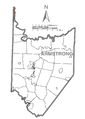
Armstrong County is located in northwest Pennsylvania in the United States. Its county seat is Kittanning.
Subcategories
This category has only the following subcategory.
.
Media in category "Maps of Armstrong County, Pennsylvania"
The following 72 files are in this category, out of 72 total.
-

-

-

-
-
-

-
-

-
-
-

-

-

-

-

-

-
 Crooked Creek Lake LOC 98689635.jpg 7,828 × 4,287; 3.79 MB
-
 Crooked Creek Reservoir, Pennsylvania LOC 99447695.jpg 12,154 × 4,279; 8.56 MB
-
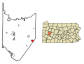
 Map of Apollo, Armstrong County, Pennsylvania Highlighted.png 1,502 × 2,106; 61 KB
-
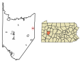
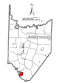
 Map of Applewold, Armstrong County, Pennsylvania Highlighted.png 1,502 × 2,106; 61 KB
-
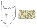
 Map of Armstrong County Pennsylvania School Districts.png 283 × 449; 12 KB
-

-
 Map of Armstrong County, Pennsylvania No Text.png 1,502 × 2,106; 67 KB
-
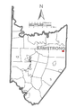
 Map of Armstrong County, Pennsylvania.png 1,502 × 2,106; 180 KB
-
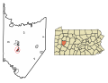
 Map of Atwood, Armstrong County, Pennsylvania Highlighted.png 1,502 × 2,106; 61 KB
-
 Map of Bethel Township, Armstrong County, Pennsylvania Highlighted.png 1,502 × 2,106; 61 KB
-
 Map of Boggs Township, Armstrong County, Pennsylvania Highlighted.png 1,502 × 2,106; 61 KB
-
 Map of Bradys Bend Township, Armstrong County, Pennsylvania Highlighted.png 1,502 × 2,106; 61 KB
-
 Map of Burrell Township, Armstrong County, Pennsylvania Highlighted.png 1,502 × 2,106; 61 KB
-
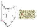
 Map of Cadogan, Armstrong County, Pennsylvania Highlighted.png 1,502 × 2,106; 61 KB
-
 Map of Cowanshannock Township, Armstrong County, Pennsylvania Highlighted.png 1,502 × 2,106; 61 KB
-
 Map of Dayton, Armstrong County, Pennsylvania Highlighted.png 1,502 × 2,106; 61 KB
-
 Map of East Franklin Township, Armstrong County, Pennsylvania Highlighted.png 1,502 × 2,106; 61 KB
-
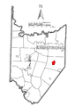
 Map of Elderton, Armstrong County, Pennsylvania Highlighted.png 1,502 × 2,106; 61 KB
-
 Map of Ford City, Armstrong County, Pennsylvania Highlighted.png 1,502 × 2,106; 61 KB
-
 Map of Ford Cliff, Armstrong County, Pennsylvania Highlighted.png 1,502 × 2,106; 61 KB
-
 Map of Freeport, Armstrong County, Pennsylvania Highlighted.png 1,502 × 2,106; 61 KB
-
 Map of Gilpin Township, Armstrong County, Pennsylvania Highlighted.png 1,502 × 2,106; 61 KB
-
 Map of Hovey Township, Armstrong County, Pennsylvania Highlighted.png 1,502 × 2,106; 61 KB
-
 Map of Kiskiminetas Township, Armstrong County, Pennsylvania Highlighted.png 1,502 × 2,106; 61 KB
-
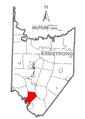
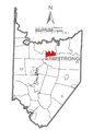
 Map of Kittaning, Armstrong County, Pennsylvania Highlighted.png 1,502 × 2,106; 61 KB
-
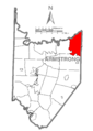
 Map of Kittanning Township, Armstrong County, Pennsylvania Highlighted.png 1,502 × 2,106; 62 KB
-
 Map of Leechburg, Armstrong County, Pennsylvania Highlighted.png 1,502 × 2,106; 61 KB
-
 Map of Lenape Heights, Armstrong County, Pennsylvania Highlighted.png 1,502 × 2,106; 61 KB
-
 Map of Madison Township, Armstrong County, Pennsylvania Highlighted.png 1,502 × 2,106; 61 KB
-
 Map of Mahoning Township, Armstrong County, Pennsylvania Highlighted.png 1,502 × 2,106; 61 KB
-
 Map of Manor Township, Armstrong County, Pennsylvania Highlighted.png 1,502 × 2,106; 61 KB
-
 Map of Manorville, Armstrong County, Pennsylvania Highlighted.png 1,502 × 2,106; 61 KB
-
 Map of North Apollo, Armstrong County, Pennsylvania Highlighted.png 1,502 × 2,106; 61 KB
-
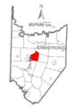
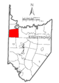
 Map of North Buffalo Township, Armstrong County, Pennsylvania Highlighted.png 1,502 × 2,106; 61 KB
-

-
 Map of Orchard Hills, Armstrong County, Pennsylvania Highlighted.png 1,502 × 2,106; 61 KB
-
 Map of Parker, Armstrong County, Pennsylvania Highlighted.png 1,502 × 2,106; 61 KB
-
 Map of Parks Township, Armstrong County, Pennsylvania Highlighted.png 1,502 × 2,106; 61 KB
-
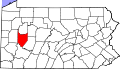 Map of Pennsylvania highlighting Armstrong County.svg 4,950 × 2,846; 106 KB
-
 Map of Perry Township, Armstrong County, Pennsylvania Highlighted.png 1,502 × 2,106; 61 KB
-
 Map of Pine Township, Armstrong County, Pennsylvania Highlighted.png 1,502 × 2,106; 61 KB
-
 Map of Plumcreek Township, Armstrong County, Pennsylvania Highlighted.png 1,502 × 2,106; 61 KB
-
 Map of Rayburn Township, Armstrong County, Pennsylvania Highlighted.png 1,502 × 2,106; 61 KB
-
 Map of Redbank Township, Armstrong County, Pennsylvania Highlighted.png 1,502 × 2,106; 61 KB
-
 Map of Rural Valley, Armstrong County, Pennsylvania Highlighted.png 1,502 × 2,106; 61 KB
-
 Map of South Bend Township, Armstrong County, Pennsylvania Highlighted.png 1,502 × 2,106; 61 KB
-
 Map of South Bethlehem, Armstrong County, Pennsylvania Highlighted.png 1,502 × 2,106; 61 KB
-
 Map of South Buffalo Township, Armstrong County, Pennsylvania Highlighted.png 1,502 × 2,106; 61 KB
-
 Map of Sugarcreek Township, Armstrong County, Pennsylvania Highlighted.png 1,502 × 2,106; 61 KB
-
 Map of Valley Township, Armstrong County, Pennsylvania Highlighted.png 1,502 × 2,106; 61 KB
-
 Map of Washington Township, Armstrong County, Pennsylvania Highlighted.png 1,502 × 2,106; 61 KB
-
 Map of Wayne Township, Armstrong County, Pennsylvania Highlighted.png 1,502 × 2,106; 61 KB
-
 Map of West Franklin Township, Armstrong County, Pennsylvania Highlighted.png 1,502 × 2,106; 61 KB
-
 Map of West Hills, Armstrong County, Pennsylvania Highlighted.png 1,502 × 2,106; 61 KB
-
 Map of West Kittanning, Armstrong County, Pennsylvania Highlighted.png 1,502 × 2,106; 61 KB
-
 Map of Worthington, Armstrong County, Pennsylvania Highlighted.png 1,502 × 2,106; 61 KB


