Category:Maps of Anglo-Egyptian Sudan
Jump to navigation
Jump to search
Wikimedia category | |||||
| Upload media | |||||
| Instance of | |||||
|---|---|---|---|---|---|
| Category combines topics | |||||
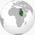
| Anglo-Egyptian occupation of Sudan | |||||
Joint British and Egyptian rule between 1899-1956     | |||||
| Pronunciation audio | |||||
| Instance of |
| ||||
| Location |
| ||||
| Capital | |||||
| Basic form of government | |||||
| Official language | |||||
| Anthem | |||||
| Currency | |||||
| Inception |
| ||||
| Dissolved, abolished or demolished date |
| ||||
| Religion or worldview | |||||
| Replaces |
| ||||
 | |||||
Media in category "Maps of Anglo-Egyptian Sudan"
The following 56 files are in this category, out of 56 total.
-

-
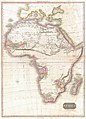 1818 Pinkerton Map of Africa - Geographicus - Africa-pinkerton-1818.jpg 4,320 × 6,000; 6.24 MB
-
 1911Nile.png 652 × 1,310; 607 KB
-
 Force Publique trek 1941.jpg 524 × 374; 59 KB
-
 Anglo-Egyptian Sudan - DPLA - 2b4e80f8c513c56063a76465eb459917.jpg 8,460 × 12,647; 10.93 MB
-
 Anglo-Egyptian Sudan - DPLA - 2e951a5b52da8eb8f9e3ae282e00a7fa.jpg 3,072 × 4,182; 1.51 MB
-
 Anglo-Egyptian Sudan - DPLA - 314db67fb67bacae0bb96035bd3d7373.jpg 8,392 × 12,590; 9.23 MB
-
 Anglo-Egyptian Sudan - DPLA - 79974e18e37f4cf087ea69b01ed1a89a.jpg 3,095 × 4,142; 1.37 MB
-
 Anglo-Egyptian Sudan - DPLA - 87511e57f7c4e4dbb9ccbed870b0f996.jpg 8,480 × 12,682; 11.47 MB
-
 Anglo-Egyptian Sudan 1911.png 635 × 721; 251 KB
-
 Anglo-Egyptian Sudan Provinces.png 1,654 × 1,956; 424 KB
-
 Anglo-Egyptian Sudan.png 2,000 × 2,000; 594 KB
-
 Century Mag the Nile and NE Africa.png 1,062 × 1,079; 241 KB
-
-
 Egypt and the basin of the Nile (2674836051).jpg 1,692 × 2,000; 2.94 MB
-
 Egypt Kingdom map.png 800 × 400; 101 KB
-
 Egypt sudan under british control.jpg 964 × 1,583; 489 KB
-
 Egypt under Muhammad Ali Dynasty map (HY).png 773 × 872; 254 KB
-
 Egypt under Muhammad Ali Dynasty map ar.png 1,998 × 2,253; 969 KB
-
 Egypt under Muhammad Ali Dynasty map de 2.png 1,998 × 2,253; 1.1 MB
-
 Egypt under Muhammad Ali Dynasty map de.svg 779 × 878; 882 KB
-
 Egypt under Muhammad Ali Dynasty map en.png 1,998 × 2,253; 1,022 KB
-
 Egypt under Muhammad Ali Dynasty map en.svg 779 × 878; 855 KB
-
 Egypt under Muhammad Ali Dynasty map es.svg 779 × 878; 873 KB
-
 Ethiopia1911.png 2,004 × 2,066; 3.06 MB
-
 Index of Sheets. 1-250,000 W & SW (WOMAT-AFR-BEA-311-2).jpg 6,412 × 8,331; 22.82 MB
-
 Karte der Nilländer.png 2,468 × 3,647; 8.25 MB
-
 Kingdom of Egypt.png 2,000 × 2,000; 594 KB
-
 Mahdi 1885.png 333 × 600; 418 KB
-
 Map Illustrating Dodinga Operations (WOMAT-AFR-BEA-230).jpg 6,522 × 8,345; 30.71 MB
-
 Map of British Egypt.jpg 2,938 × 3,516; 2.23 MB
-
 Map of the Soudan.png 3,003 × 3,773; 9.53 MB
-
-
 Meyers b1 s0209a (cropped).jpg 389 × 284; 69 KB
-
 Meyers b1 s0209a.jpg 1,657 × 2,048; 810 KB
-
 Mideast1920.jpg 3,992 × 3,012; 2.48 MB
-
 Prismatic Compass Sketch of New Road between Nimule and Gondokoro (WOMAT-AFR-BEA-146).jpg 6,507 × 8,033; 22.8 MB
-
 Prismatic Compass Sketch of New Road between Nimule and Gondokoro (WOMAT-AFR-BEA-189-3).jpg 5,140 × 8,718; 35.12 MB
-

-
 Reference. (WOMAT-AFR-BEA-311-3).jpg 8,453 × 6,513; 22.17 MB
-
 Soudan anglo-égyptien.PNG 1,219 × 975; 117 KB
-
 Soudan égyptien 1900.JPG 3,456 × 4,608; 4.86 MB
-
 Sudan FrenchWestAfrica Border 1922.png 815 × 1,134; 153 KB
-
 Sudan politisch 1956.png 539 × 652; 219 KB
-

-
 The Anglo-Egyptian Sudan.jpg 2,282 × 2,960; 1.54 MB
-
 The Anglo-Egyptian Sudan.png 6,894 × 8,558; 88.89 MB
-

-

-

-

-

-

-

-
 Yuzhakov Big Encyclopedia Map of Egypt.jpg 3,828 × 4,620; 3.7 MB
-
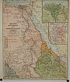
 Ägypten Dar Fur und Abessinien.jpg 2,832 × 3,488; 4.11 MB
.jpg)


_(14797736313).jpg)
.jpg)

.png)


.jpg)


.jpg)


.jpg)


.jpg)
.jpg)
.jpg)
.jpg)


.jpg)
.jpg)
.jpg)
.jpg)
.jpg)
.jpg)
.jpg)

