Category:Maps of Amundsen Expedition
Jump to navigation
Jump to search
Amundsen · Terra Nova ·
Media in category "Maps of Amundsen Expedition"
The following 23 files are in this category, out of 23 total.
-
 Aan de Zuidpool - p1913-108.gif 760 × 1,058; 144 KB
-
 Amundsen 271.jpg 1,500 × 964; 224 KB
-
 Amundsen Map 2 ru.svg 697 × 732; 583 KB
-
 Antarctic expedition map (Amundsen - Scott)-ar.svg 1,898 × 1,865; 353 KB
-
 Antarctic expedition map (Amundsen - Scott)-bg.svg 1,898 × 1,865; 434 KB
-
 Antarctic expedition map (Amundsen - Scott)-ca.svg 1,898 × 1,865; 306 KB
-
 Antarctic expedition map (Amundsen - Scott)-cs-colorswap.svg 1,898 × 1,865; 304 KB
-
 Antarctic expedition map (Amundsen - Scott)-cs.svg 1,898 × 1,865; 304 KB
-
 Antarctic expedition map (Amundsen - Scott)-de.svg 1,898 × 1,865; 306 KB
-
 Antarctic expedition map (Amundsen - Scott)-el.svg 1,898 × 1,865; 306 KB
-
 Antarctic expedition map (Amundsen - Scott)-en-crop.png 1,446 × 1,361; 361 KB
-
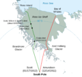
 Antarctic expedition map (Amundsen - Scott)-en.svg 1,898 × 1,865; 304 KB
-
 Antarctic expedition map (Amundsen - Scott)-es.svg 1,898 × 1,865; 306 KB
-
 Antarctic expedition map (Amundsen - Scott)-fr.svg 1,898 × 1,865; 306 KB
-
 Antarctic expedition map (Amundsen - Scott)-he.svg 1,898 × 1,865; 306 KB
-
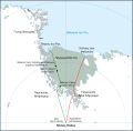
 Antarctic expedition map (Amundsen - Scott)-hu.svg 1,898 × 1,865; 307 KB
-
 Antarctic expedition map (Amundsen - Scott)-ka.svg 1,898 × 1,865; 629 KB
-
 Antarctic expedition map (Amundsen - Scott)-no.svg 1,898 × 1,865; 306 KB
-
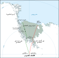
 Antarctic expedition map (Amundsen - Scott)-ru.svg 1,898 × 1,865; 295 KB
-
 Antarctic expedition map (Amundsen - Scott)-zh-hans.svg 1,898 × 1,865; 306 KB
-
 Antarctic expedition map (Amundsen - Scott)-zh-hant.svg 1,898 × 1,865; 306 KB
-
 Ca. 1930 Italian image illustrating the race for the South Pole and a map of Antarctica.jpg 10,627 × 12,750; 44.04 MB
-
 Carmen Land on Amundsens map 1912.jpg 966 × 593; 280 KB


-ar.svg)
-bg.svg)
-ca.svg)
-cs-colorswap.svg)
-cs.svg)
-de.svg)
-el.svg)
-en-crop.png)
-en.svg)
-es.svg)
-fr.svg)
-he.svg)
-hu.svg)
-ka.svg)
-no.svg)
-ru.svg)
-zh-hans.svg)
-zh-hant.svg)

