Category:Maps of 6th-century Iberian Peninsula
Jump to navigation
Jump to search
| Preceded by: Maps of 5th-century Iberian Peninsula |
Maps of 6th-century Iberian Peninsula 501 AD-600 AD |
Succeeded by: Maps of 7th-century Iberian Peninsula |
Media in category "Maps of 6th-century Iberian Peninsula"
The following 28 files are in this category, out of 28 total.
-
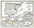 (Spruner-Menke, map 14) The Iberian peninsula 531-711.jpg 3,355 × 2,759; 2.18 MB
-
 Byzantine Spain - 565-586-zh.svg 997 × 555; 111 KB
-
 Byzantine Spain - 565-586.svg 798 × 444; 292 KB
-
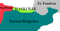 BaskoiakVI mendean.PNG 369 × 192; 25 KB
-
 Britonia6hcentury-ar.jpg 1,670 × 2,928; 375 KB
-
 Britonia6hcentury.png 1,670 × 2,928; 542 KB
-
 Byzantine Spain - 565-586-ru.svg 798 × 444; 363 KB
-
 España bizantina 5-fr.svg 798 × 444; 299 KB
-
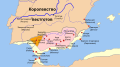
 España bizantina 5-hu.svg 3,731 × 2,000; 527 KB
-
 España bizantina 5.svg 3,731 × 2,000; 917 KB
-
 España bizantina-pt.svg 512 × 274; 142 KB
-
 Hispania 560 AD.PNG 2,500 × 2,500; 250 KB
-
 Hispania 565.png 238 × 238; 74 KB
-
 Hispania 586 AD.PNG 2,500 × 2,500; 228 KB
-
 Hispania sVI.jpg 511 × 357; 42 KB
-
 Hispania3c-es.svg 1,262 × 1,053; 542 KB
-
 Hispania3c-gl.jpg 794 × 600; 107 KB
-
 Hispania3c.JPG 883 × 667; 154 KB
-
 Iberia 560 AR.png 1,200 × 990; 205 KB
-
 Iberia 560-es.svg 924 × 762; 172 KB
-
 Iberia 560-pt.svg 924 × 762; 161 KB
-
 Iberia 560-zh.svg 1,155 × 953; 171 KB
-
 Iberia 560.svg 924 × 762; 315 KB
-
 Iberia 586-es.svg 924 × 762; 166 KB
-
 Iberia 586-pt.svg 924 × 762; 157 KB
-
 Iberia 586-zh.svg 1,155 × 953; 160 KB
-
 Iberia 586.svg 924 × 762; 306 KB
-
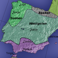
 Suevosevisigodosemportugal.png 870 × 722; 127 KB
_The_Iberian_peninsula_531-711.jpg)


