Category:Maps of 18th-century Arabia
Jump to navigation
Jump to search

English: Category for maps showing the history of the Arabian Peninsula in the 18th century AD (roughly AH 1111-AH 1215).
Old maps belong into: Category:18th-century maps of Arabia or its subcategories.
The modern states of Arabia were founded in the 20th century. Please sort maps accordingly.
Old maps belong into: Category:18th-century maps of Arabia or its subcategories.
The modern states of Arabia were founded in the 20th century. Please sort maps accordingly.
Subcategories
This category has only the following subcategory.
M
- Maps of the First Saudi State (21 F)
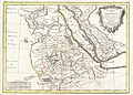
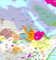
Media in category "Maps of 18th-century Arabia"
The following 10 files are in this category, out of 10 total.
-
 خرائط الدولة السعودية التاريخية 6.jpg 3,000 × 2,272; 220 KB
-
-
 Damascus Eyalet, Ottoman Empire (1795).png 2,434 × 2,037; 591 KB
-
 Af.Est 1700.png 1,720 × 1,830; 638 KB
-
 Asir-1800.PNG 618 × 1,200; 146 KB
-
 Jeddah Eyalet, Ottoman Empire (1795).png 2,434 × 2,037; 592 KB
-
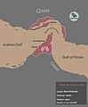 Map of Al Qawasim.jpg 1,080 × 1,308; 39 KB
-
 Omani Empire 2.png 4,645 × 4,399; 2.21 MB
-
 Sheikhdom of Diriyah-ar.png 671 × 593; 116 KB
-
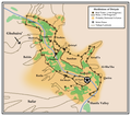 Sheikhdom of Diriyah.png 671 × 593; 116 KB

,_Sudan_and_the_Red_Sea_-_Geographicus_-_Abissine-bonne-1771.jpg)
.png)


.png)


