Category:Maps of 17th-century India
Jump to navigation
Jump to search
Subcategories
This category has only the following subcategory.
M
Media in category "Maps of 17th-century India"
The following 5 files are in this category, out of 5 total.
-
 India in 1605-ar.jpg 1,189 × 1,711; 728 KB
-
 India in 1605-es.svg 1,883 × 2,222; 1.47 MB
-
 India in 1605.jpg 1,248 × 1,832; 325 KB
-
 Indien 1670.jpg 546 × 709; 201 KB
-
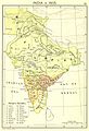
 India in 1605 from "Historical Atlas of India," by Charles Joppen.jpg 600 × 881; 116 KB


