Category:Maps of 15th-century Arabia
Jump to navigation
Jump to search

English: Category for maps showing the history of the Arabian Peninsula in the 15th century AD (roughly AH 800-AH 900).
Old maps belong into: Category:15th-century maps of Arabia or its subcategories.
The modern states of Arabia were founded in the 20th century. Please sort maps accordingly.
Old maps belong into: Category:15th-century maps of Arabia or its subcategories.
The modern states of Arabia were founded in the 20th century. Please sort maps accordingly.
Media in category "Maps of 15th-century Arabia"
The following 5 files are in this category, out of 5 total.
-
 مملكة هرمز.png 1,530 × 1,645; 423 KB
-
 Kingdom of Ormuz.png 1,176 × 818; 508 KB
-
 Jabrids (Banu Jabr).png 2,003 × 1,652; 1.07 MB
-
 Jabrids2 no watermark.png 2,123 × 1,796; 1.39 MB
-
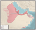
 The Jabrid sultanate under Ajwad bin Zamil.png 858 × 606; 34 KB


.png)

