Category:Maps in the British Museum
Jump to navigation
Jump to search
Subcategories
This category has the following 10 subcategories, out of 10 total.
Media in category "Maps in the British Museum"
The following 200 files are in this category, out of 600 total.
(previous page) (next page)-
 ...Plan of ye Royal Palace and Gardens of Kensington... (BM 1881,0312.99).jpg 2,500 × 2,028; 1.45 MB
-
 ...Versincken ende verbranden vande stadt Ragousa (BM 1873,0809.1515).jpg 2,500 × 1,743; 1.34 MB
-

-
 1720s maps of Germany.jpg 438 × 431; 86 KB
-
 Civitas Londinum Ano Dni circiter MDLX (BM 1880,1113.1117-1118 1).jpg 1,000 × 753; 234 KB
-
 Civitas Londinum Ano Dni circiter MDLX (BM 1880,1113.1117-1118 2).jpg 1,000 × 716; 171 KB
-
 Civitas Londinum Ano Dni circiter MDLX (BM 1880,1113.1117-1118 4).jpg 1,000 × 752; 264 KB
-
 Civitas Londinum Ano Dni circiter MDLX (BM 1880,1113.1117-1118 5).jpg 1,000 × 737; 275 KB
-
 Civitas Londinum Ano Dni circiter MDLX (BM 1880,1113.1117-1118 6).jpg 1,000 × 774; 290 KB
-
 Civitas Londinum Ano Dni circiter MDLX (BM 1880,1113.1117-1118).jpg 1,000 × 747; 233 KB
-
 A chart of the Coast of France from l'Orient to St Gilles (BM 1871,1209.91).jpg 2,500 × 2,029; 1.11 MB
-

-

-

-
 A Description of - Old Jerusalem - according to - Villalpandus (BM 1928,0713.144).jpg 2,500 × 1,533; 1.44 MB
-

-
 A draught of the town and harbour of Mahon (BM Y,4.89).jpg 2,500 × 1,809; 1.23 MB
-

-

-

-
 A Guide for Travellers and the Plaine Mans Map (...) (BM Q,6.134).jpg 2,500 × 2,063; 1.27 MB
-
 A Large and Accurate Map of the City of London (BM 1857,0613.297 1).jpg 1,791 × 2,328; 1.18 MB
-
 A Large and Accurate Map of the City of London (BM 1857,0613.297 2).jpg 1,876 × 2,500; 1.36 MB
-
 A Large and Accurate Map of the City of London (BM 1857,0613.297 3).jpg 2,500 × 1,876; 1.37 MB
-
 A Large and Accurate Map of the City of London (BM 1857,0613.297 4).jpg 1,876 × 2,500; 1.31 MB
-
 A Large and Accurate Map of the City of London (BM 1857,0613.297).jpg 1,876 × 2,500; 1.29 MB
-
 A map exhibiting the retreat of the French Army (BM 1918,0423.62).jpg 1,749 × 2,500; 953 KB
-
 A Map of Both Citties London and Westminster, Before the Fire. (BM 1888,0612.57).jpg 2,500 × 1,313; 1.21 MB
-

-
 A map of England and Wales for the complete history of England (BM 1874,1010.74).jpg 2,028 × 2,500; 942 KB
-
 A map of France from the best Authorities (BM 1871,1209.100).jpg 2,500 × 1,993; 1.2 MB
-

-

-
 A map of Surinam, Barbutius * Cayenne in South America (BM 1871,1209.123).jpg 2,026 × 2,500; 1.09 MB
-
 A Map of the Beacons in Kent (BM 1872,0113.1137).jpg 2,467 × 1,925; 860 KB
-

-

-
 A Map of the East Indies (BM 1871,1209.112).jpg 2,500 × 2,105; 1.2 MB
-
-

-
 A map or groundplott of the citty of London, with the suburbes thereof (BM Q,6.57 1).jpg 2,500 × 1,847; 1.37 MB
-
 A map or groundplott of the citty of London, with the suburbes thereof (BM Q,6.57).jpg 2,500 × 1,743; 1.7 MB
-
 A Mapp of Barkshire with its Hundreds. (BM 1850,0223.274).jpg 2,500 × 1,915; 1.44 MB
-
 A Mapp of Barkshire with its Hundreds. (BM 1864,1114.33).jpg 2,500 × 1,906; 1.46 MB
-
 A Mapp of Staffordshire with its Hundreds (BM 1864,1114.39).jpg 2,500 × 1,750; 1.34 MB
-
 A Mapp of the County of Hartford shire with its Hundreds (BM 1850,0223.273).jpg 2,500 × 1,738; 1.35 MB
-
 A Mapp of the County of Middlesex with its Hundreds (BM 1864,1114.37).jpg 2,500 × 1,737; 1.29 MB
-
 A Mapp of the County of Midlesex (BM 1927,1126.1.17.34).jpg 2,500 × 1,690; 589 KB
-
 A Mapp of the County of Surrey (BM 1864,1114.40).jpg 2,500 × 1,750; 1.45 MB
-
 A Mapp of the County of Surrey with its divisions (BM 1864,1114.41).jpg 2,500 × 1,693; 1.32 MB
-
 A Mapp of ye County of Norfolk with its Hundreds (BM 1864,1114.38).jpg 2,500 × 1,894; 1.53 MB
-

-
 A New & Accurate Map of North America, from the best Authorities (BM 1871,1209.102).jpg 2,500 × 2,020; 1.17 MB
-
 A New and Accurate Map of the Kingdoms of Spain and Portugal (BM 1871,1209.93).jpg 2,500 × 2,124; 1.29 MB
-
 A New and Correct map of Great Britain (BM 1872,1109.65).jpg 1,834 × 2,500; 708 KB
-

-

-

-

-

-

-
-
 A new and exact map of Great Britannie & c (BM Q,6.113).jpg 2,500 × 2,008; 1.34 MB
-
 A new and exact map of Great Britannie & c (BM Q,8.227).jpg 1,756 × 738; 426 KB
-
 A new and most accurate map of the roads of England and Wales... (BM 1921,0818.1).jpg 1,827 × 2,500; 912 KB
-
 A New and Plaine Mapp of the Citty of London... (BM Heal,Topography.186).jpg 2,500 × 1,953; 1.24 MB
-
 A new chart of the Mediterranean Sea from the best Authorities (BM 1871,1209.92).jpg 2,500 × 1,836; 1.04 MB
-
 A New Description of Kent (BM 1853,0611.123 1).jpg 2,380 × 591; 407 KB
-
 A New Description of Kent (BM 1853,0611.123 2).jpg 2,500 × 1,947; 669 KB
-
 A New Description of Kent (BM 1853,0611.123 3).jpg 2,500 × 1,857; 931 KB
-
 A New Description of Kent (BM 1853,0611.123).jpg 2,239 × 889; 591 KB
-
 A New map of England & Wales divided into counties (BM 1871,1209.121).jpg 2,500 × 2,039; 724 KB
-
 A New Map of the Island of Jamaica from an Actual Survey (BM 1868,0822.5015).jpg 2,500 × 1,821; 837 KB
-

-

-

-

-
 A plan of the battle ... near Minden (BM J,7.50).jpg 2,500 × 2,250; 1.48 MB
-
 A Plan of the Battle of Preston Panns (BM 1857,0613.342).jpg 2,005 × 2,500; 824 KB
-

-
 A Plan of the City of Ierusalem (BM 1890,0415.225).jpg 2,500 × 2,196; 1.52 MB
-

-

-
 A Plan of the East end of the Island of Quibo (BM 1918,0423.48).jpg 2,500 × 1,418; 558 KB
-
 A plan of the Great Oke call'd The Green Dale Oke (BM SL,5283.300).jpg 1,282 × 2,076; 314 KB
-
 A Plan of the Harbour of Brest (BM 1871,1209.101).jpg 1,981 × 2,500; 1,011 KB
-

-

-

-
 A plan of the Siege of the Havana. Drawn by an officer on the Spot 1762. (BM 1871,1209.120).jpg 2,500 × 2,016; 1,004 KB
-

-

-
 A poetical description of the map (BM 1872,0113.1216).jpg 2,500 × 1,838; 952 KB
-
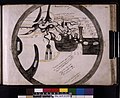
 A sketch of the procession usually observed (BM J,11.108).jpg 1,600 × 1,355; 723 KB
-

-
 A True & Exact Groundplatt or Situation of the Famous Citty of Candia (BM 1888,0612.70).jpg 2,500 × 1,809; 1.35 MB
-
 A True & Exact Groundplatt or Situation of the Famous Citty of Candia (BM 2006,U.84).jpg 2,500 × 1,779; 1.31 MB
-
 Abcontrafeitung der Stat Bommel (BM 1872,0113.617).jpg 2,500 × 1,877; 1.52 MB
-
 Abregé de Canton de Berne fait par le General Brune (BM 1878,1214.215).jpg 1,570 × 2,100; 835 KB
-
 Abris und verzeichnus dess orts Udenheim (BM 1870,1112.179).jpg 2,500 × 1,928; 1.42 MB
-
 Abriss der Gelegenheit der Statt Schlevs (BM 1870,1112.218).jpg 2,500 × 1,552; 879 KB
-

-

-
 Action of Rolica - 17th August 1808 (BM 1982,U.738).jpg 1,607 × 2,500; 482 KB
-
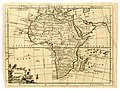
 Africa (BM 1872,0113.1167).jpg 2,500 × 2,100; 1.02 MB
-
 Africa (BM 1956,1018.49).jpg 2,500 × 1,870; 1.08 MB
-

-

-

-
-

-

-

-
-

-
 Alexandria (BM 1947,0319.26.5).jpg 2,500 × 1,967; 1.11 MB
-
 Algiers (BM Nn,4.19).jpg 1,600 × 1,205; 613 KB
-
 Almae Urbis divi Petri veteris novique Templi descriptio (BM 1925,0728.6).jpg 1,300 × 1,600; 484 KB
-
 Amsterdam, met de nieuwe vergrooting (BM Y,2.28).jpg 2,500 × 2,184; 1.48 MB
-
 An accurate map of ... St. Christophers and Nevis (BM 1983,U.243).jpg 2,500 × 2,068; 950 KB
-

-

-

-
 Ancona (BM 1992,U.93).jpg 2,500 × 1,588; 1.34 MB
-

-
 Asia (BM 1872,0113.1161).jpg 2,500 × 2,126; 1.24 MB
-
 Aspecto del Real Palacio de Madrid ... 4 de Marzo de 1704 (BM 1859,0514.341.104).jpg 2,500 × 1,816; 1.11 MB
-
 Aufriss der zweyten und alten Dardanelle (BM 1898,0725.8.1010).jpg 2,500 × 1,538; 988 KB
-
 Bangor (BM 1868,0822.5919).jpg 1,734 × 1,288; 660 KB
-
 Baya de Todos os Sanctos (BM 1885,1114.117).jpg 2,500 × 1,957; 1.21 MB
-
 Benedices coronae anni benignitatis tuae PS LXVIIII (BM 1871,0812.785).jpg 2,500 × 1,747; 1.01 MB
-
 Benedices coronae anni benignitatis tuae PS LXVIIII (BM 1874,0613.610 1).jpg 2,500 × 1,716; 1.07 MB
-
 Benedices coronae anni benignitatis tuae PS LXVIIII (BM 1874,0613.610).jpg 2,500 × 1,832; 1.37 MB
-
 Berkshire (BM 1902,1011.9863).jpg 2,500 × 1,879; 1.27 MB
-

-

-

-
 Bologna (BM 1947,0319.26.8 1).jpg 2,500 × 1,986; 1.24 MB
-
 Book-illustration, map (BM EPH-ME.360).jpg 1,293 × 2,063; 897 KB
-
 Breda novis operibus post Spinolae adventum munita (BM 1848,0205.361).jpg 2,500 × 1,702; 1,005 KB
-
 Brightstowe, vulgo- quondam venta, florentissimum Angliae Emporium (BM Y,5.162).jpg 2,500 × 1,981; 1.57 MB
-
 Bristow (BM 1868,0822.5921).jpg 2,429 × 1,858; 1.09 MB
-
-
 British Map of Herts (BM 1981,U.1003).jpg 2,500 × 1,951; 422 KB
-
 Cambridge (BM 1868,0822.5922).jpg 1,865 × 2,465; 679 KB
-
 Cambridge (BM 1912,1227.395).jpg 2,261 × 2,500; 1.03 MB
-
 Candia (BM 1882,0211.86).jpg 2,500 × 2,054; 1.26 MB
-
 Canea in Candia (BM 1898,0725.8.1115).jpg 1,369 × 873; 412 KB
-
 Canterbvry (BM 1912,1227.393).jpg 2,433 × 2,314; 1.01 MB
-
 Canterbvry (BM 1912,1227.394).jpg 2,308 × 2,500; 822 KB
-

-

-

-

-

-
 Carte du Théâtre de la Guerre (BM 1900,1231.956).jpg 2,500 × 1,932; 725 KB
-
 Carte General de l'Italie (BM 1862,1217.256).jpg 1,759 × 2,500; 731 KB
-
 Carte Mineralogique de France (BM 1914,0520.673).jpg 2,500 × 1,962; 1,016 KB
-
 Carte particuliere de la Syrie (BM 1874,0613.1880).jpg 2,500 × 2,032; 1.02 MB
-

-
 Casal (BM 1898,0725.8.1405).jpg 2,500 × 1,554; 1,005 KB
-
 Cestria (vulgo) Chester (BM Q,7.62).jpg 2,500 × 1,910; 1.44 MB
-
 Cestria (vulgo) Chester, Angliae Civitas (BM Y,5.166).jpg 2,500 × 1,886; 1.54 MB
-
 Chartres (BM 1898,0725.8.904).jpg 1,632 × 1,094; 548 KB
-
 Chester (BM 1868,0822.5924).jpg 2,500 × 1,359; 608 KB
-
 Chester (BM 1874,1212.571).jpg 2,500 × 2,025; 1.33 MB
-
 City of Burgos (BM 1982,U.741).jpg 1,763 × 2,500; 936 KB
-
 Civitas Exoniae (vulgo Excester) Urbs Primaria in Comitatu Devoniae (BM Y,5.167).jpg 2,500 × 2,009; 1.78 MB
-
 Civitas Londinum Ano Dni circiter MDLX (BM 1880,1113.1117-1118 3).jpg 1,000 × 767; 266 KB
-
 Civitas Londinum Ano Dni circiter MDLX (BM Heal,Topography.179).jpg 1,000 × 386; 119 KB
-
 Coni - Piemont (BM 1898,0725.8.1525).jpg 2,214 × 1,772; 1,000 KB
-

-

-
 Cornwall (BM 1893,0803.120).jpg 2,500 × 976; 625 KB
-
 D' 'XVII provincien, met de aengrensende landen en steden, etc. (BM 1870,1008.2900).jpg 2,500 × 1,963; 1.33 MB
-

-
 Darbye (BM Q,7.73).jpg 1,835 × 1,533; 661 KB
-
 Delineation Regionis - Bassora - cum - Pagis... (BM 1898,0725.8.1475).jpg 2,500 × 2,011; 1.36 MB
-
 Demarcacio de Mant-ua (BM 1849,1208.693).jpg 2,500 × 1,871; 1.14 MB
-

-
 Derbyshire (BM 1931,0909.75).jpg 1,122 × 1,735; 351 KB
-
 Derrota de 3000 cavallos Alemanos en 26 de Julio 1702 (BM 1849,1208.696).jpg 2,500 × 1,800; 819 KB
-
 Descriptio Germaniae Inferioris (BM 1872,0113.647).jpg 2,500 × 1,930; 2.07 MB
-
 Die Stadt Prevesa und die Vestung S. Maura (BM 1898,0725.8.1287).jpg 2,500 × 1,818; 1.22 MB
-

-
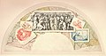 Drawing, fan, medley, map (BM 1871,0429.860.a).jpg 2,500 × 1,309; 451 KB
-
 Drawing, map (BM 1879,0614.772).jpg 1,801 × 2,500; 836 KB
-
 Drawing, map (BM 1880,1113.3790).jpg 1,974 × 1,932; 679 KB
-
 Drawing, map (BM 1882,0812.371).jpg 2,500 × 1,333; 512 KB
-
 Drawing, map (BM 1882,0812.454).jpg 2,500 × 1,603; 690 KB
-
 Drawing, map (BM 1927,1126.1.22.3).jpg 2,500 × 1,784; 483 KB
-
 Drawing, map (BM 1927,1126.1.22.4).jpg 2,500 × 1,615; 184 KB
-
 Drawing, map (BM 1939,0311,0.4.1) (cropped).jpg 843 × 2,275; 172 KB
-
 Drawing, map (BM 1939,0311,0.4.1).jpg 1,063 × 2,500; 197 KB
-
 Drawing, map (BM 1939,0311,0.6.28).jpg 2,500 × 1,731; 745 KB
-
 Drawing, map (BM 1972,U.815 1).jpg 2,500 × 1,877; 595 KB
-
 Drawing, map (BM Ee,4.88).jpg 2,085 × 1,515; 297 KB
-
 Drawing, map, plan (BM 1878,0713.1290).jpg 2,500 × 2,020; 874 KB
-
 Drawing, print study, map (BM 1988,1105.32).jpg 2,500 × 1,508; 633 KB
-
 Drawing, print study, plan, map (BM 1836,0109.143).jpg 2,500 × 1,519; 398 KB
.jpg)
.jpg)
_ou_l%27on_voit_l%27Ordre_de_Bataille_(...)_(Map_of_the_battle_of_Friedberg_which_shows_the_campaign_order)_(BM_1838,1215.365).jpg)

.jpg)
.jpg)
.jpg)
.jpg)
.jpg)
.jpg)
.jpg)
.jpg)
.jpg)
.jpg)
.jpg)
.jpg)
.jpg)
.jpg)
.jpg)
.jpg)
_(BM_Q,6.134).jpg)
.jpg)
.jpg)
.jpg)
.jpg)
.jpg)
.jpg)
.jpg)
.jpg)
.jpg)
.jpg)
.jpg)
.jpg)
.jpg)
.jpg)
.jpg)
.jpg)
.jpg)
.jpg)
.jpg)
.jpg)
.jpg)
.jpg)
.jpg)
.jpg)
.jpg)
.jpg)
.jpg)
.jpg)
.jpg)
.jpg)
.jpg)
.jpg)
.jpg)
.jpg)
.jpg)
.jpg)
.jpg)
.jpg)
.jpg)
.jpg)
.jpg)
.jpg)
.jpg)
.jpg)
.jpg)
.jpg)
.jpg)
.jpg)
.jpg)
.jpg)
.jpg)
.jpg)
.jpg)
.jpg)
.jpg)
.jpg)
.jpg)
.jpg)
.jpg)
.jpg)
.jpg)
.jpg)
.jpg)
.jpg)
.jpg)
.jpg)
.jpg)
.jpg)
.jpg)
.jpg)
.jpg)
.jpg)
.jpg)
.jpg)
.jpg)
.jpg)
.jpg)
_(BM_1870,1112.223).jpg)
.jpg)
.jpg)
.jpg)
.jpg)
.jpg)
.jpg)
.jpg)
.jpg)
.jpg)
.jpg)
.jpg)
.jpg)
.jpg)
.jpg)
.jpg)
.jpg)
.jpg)
.jpg)
.jpg)
.jpg)
.jpg)
.jpg)
.jpg)
.jpg)
.jpg)
.jpg)
.jpg)
.jpg)
.jpg)
.jpg)
.jpg)
.jpg)
.jpg)
.jpg)
.jpg)
.jpg)
.jpg)
.jpg)
.jpg)
.jpg)
.jpg)
.jpg)
.jpg)
.jpg)
.jpg)
.jpg)
.jpg)
.jpg)
.jpg)
.jpg)
.jpg)
.jpg)
.jpg)
.jpg)
.jpg)
.jpg)
.jpg)
.jpg)
.jpg)
_Chester_(BM_Q,7.62).jpg)
_Chester,_Angliae_Civitas_(BM_Y,5.166).jpg)
.jpg)
.jpg)
.jpg)
.jpg)
_Urbs_Primaria_in_Comitatu_Devoniae_(BM_Y,5.167).jpg)
.jpg)
.jpg)
.jpg)
.jpg)
.jpg)
.jpg)
.jpg)
.jpg)
.jpg)
.jpg)
.jpg)
.jpg)
.jpg)
.jpg)
.jpg)
.jpg)
.jpg)
.jpg)
.jpg)
.jpg)
.jpg)
.jpg)
.jpg)
.jpg)
.jpg)
.jpg)
.jpg)
.jpg)
.jpg)
.jpg)
.jpg)
.jpg)
.jpg)
_(BM_2006,0429,0.1).jpg)
_(cropped).jpg)