Category:Maps by William H. Gamble
Jump to navigation
Jump to search
Media in category "Maps by William H. Gamble"
The following 31 files are in this category, out of 31 total.
-
 1862 Mitchell's Map of Vermont and New Hampshire - Geographicus - VTNH-m-63.jpg 2,492 × 3,000; 2.29 MB
-

-
 1864 Mitchell Map of Colorado, Kansas ^ Nebraska - Geographicus - COKANE-mitchell-1864.jpg 4,000 × 3,292; 2.32 MB
-

-
 1864 Mitchell Map of Iowa and Missouri - Geographicus - IAMO-mitchell-1864.jpg 3,261 × 4,000; 2.6 MB
-

-
 1864 Mitchell Map of Maine - Geographicus - ME-mitchell-1864.jpg 3,183 × 4,000; 4.67 MB
-

-
 1864 Mitchell Map of Michigan and Wisconsin - Geographicus - MIWI-mitchell-1864.jpg 4,000 × 3,291; 2.91 MB
-
 1864 Mitchell Map of Minnesota - Geographicus - MN-mitchell-1864.jpg 3,265 × 4,000; 2.55 MB
-
 1864 Mitchell Map of Ohio and Indiana - Geographicus - OHIN-mitchell-1864.jpg 4,000 × 3,213; 3 MB
-
-
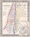
 1864 Mitchell Map of Palestine, Israel or the Holy Land - Jerusalem inset map.jpg 1,136 × 1,589; 381 KB
-

-

-
 1864 Mitchell Map of Washington D.C. - Geographicus - WashingtonDC-mitchell-1864.jpg 4,000 × 3,287; 2.36 MB
-

-
 1866 Mitchell Map of Utah and Nevada - Geographicus - UtahNevada-mitchell-1866.jpg 3,500 × 2,923; 2.84 MB
-

-
 1867 Mitchell Map of New York State - Geographicus - NewYork-mitchell-1867.jpg 5,000 × 3,355; 6.15 MB
-
 1872 Mitchell Map of Utah and Nevada - Geographicus - UTNV-mitchell-1872.jpg 4,000 × 3,231; 3.34 MB
-

-
 1877 Mitchell Map of Arizona and New Mexico - Geographicus - AZNM-mitchell-1877.jpg 4,000 × 3,237; 3.33 MB
-
 Gamble-Mitchell County Map of the State of Texas 1881 UTA.jpg 4,095 × 2,688; 2.44 MB
-
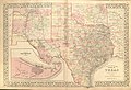 Gamble-Mitchell County Map of Texas 1882 UTA.jpg 5,748 × 3,910; 6.08 MB
-
 Map Kanawha Valley 2nd WVA Cavalry.PNG 737 × 735; 1.34 MB
-

-

-

-
 WVA - VA - MD - PA 1863.png 970 × 620; 1.49 MB
-
 Wytheville Raid 1863.png 452 × 748; 675 KB


_of_the_United_States_of_America_LOC_88693468.jpg)

