Category:Maps by Thomas Kitchin
Jump to navigation
Jump to search
Subcategories
This category has the following 3 subcategories, out of 3 total.
Media in category "Maps by Thomas Kitchin"
The following 97 files are in this category, out of 97 total.
-
 AMH-8182-KB Map of China.jpg 2,400 × 2,104; 1.37 MB
-

-
 Kitchin Africa 1770 UTA.jpg 4,547 × 4,262; 7.2 MB
-

-
 Kitchin Africa Drawn from the Latest Authorities 1780 UTA.jpg 4,562 × 4,336; 7.97 MB
-
 Kitchin Africa 1782 UTA.jpg 4,668 × 4,247; 13.9 MB
-
 1795 D'Anville Wall Map of South America - Geographicus - SouthAmerica-laruiewhittle-1794.jpg 7,000 × 6,110; 10.18 MB
-

-
 Galapagos or Inchanted Islands.jpg 754 × 620; 99 KB
-

-

-

-
 1794 Samuel Dunn Wall Map of the World in Hemispheres - Geographicus - World2-dunn-1794.jpg 6,000 × 5,054; 8.92 MB
-
 1e(-2e) carte d'Allemagne - T. Kitchin, Sculp. - btv1b53085861c (1 of 2).jpg 8,632 × 6,560; 6.29 MB
-
 1e(-2e) carte d'Allemagne - T. Kitchin, Sculp. - btv1b53085861c (2 of 2).jpg 8,640 × 6,592; 6.84 MB
-

-

-
-

-

-
 A map of the Eastern part of the Roman Empire, by Thos Kitchin Senr... - btv1b53058483p.jpg 6,168 × 5,024; 3.86 MB
-
 A map of the Western part of the Roman Empire - by Thos Kitchin Senr... - btv1b53057952j.jpg 6,248 × 5,024; 3.62 MB
-
 A new and accurate map of north America - by Huske ; Tho. Kitchin sculp. - btv1b85958856.jpg 8,205 × 6,744; 9.36 MB
-

-

-

-

-

-

-

-

-

-

-

-

-

-
 A New map of the island of Tobago... - by Tho.s Kitchin... - btv1b53121990k (1 of 2).jpg 7,572 × 5,570; 4.65 MB
-
 A New map of the island of Tobago... - by Tho.s Kitchin... - btv1b53121990k (2 of 2).jpg 7,530 × 5,584; 5.36 MB
-
 A New map of the Province of Quebec in North America.jpg 3,712 × 2,902; 2.17 MB
-
-

-

-
 A Section of the Map of the British Colonies in North America (John Mitchell 1755).jpg 13,554 × 7,974; 8.82 MB
-

-

-

-

-

-

-
-

-

-

-
 An accurate map of the island of Martinico LOC 2010593366.jpg 4,108 × 3,306; 1.95 MB
-
 An accurate map of the island of Martinico LOC 2010593366.tif 4,108 × 3,306; 38.86 MB
-
 BalticCorp.jpg 781 × 565; 129 KB
-
 Bodleian Libraries, Oxfordshire by Thomas Kitchen.jpg 672 × 1,000; 170 KB
-

-

-

-
 Chinglapet - Tho. Kitchin sculpsit - btv1b59628903.jpg 2,224 × 2,832; 1.03 MB
-
 Digital map of the world in hemispheres by thomas kitchin (1777).jpg 904 × 480; 154 KB
-
 Dury Atlas Map 3 Europe.jpg 3,026 × 2,698; 1.97 MB
-
 Dury Atlas Map 6 Africa.jpg 2,980 × 2,550; 1.81 MB
-
 Dury Atlas Map 9 South America.jpg 3,020 × 2,608; 1.63 MB
-
 Dury Atlas Maps 1 and 2 The World.jpg 5,100 × 2,719; 3.13 MB
-
 EB1 Plate LXXXVII Fig. 2 World.png 2,768 × 1,550; 3.34 MB
-
 EB1 Plate LXXXVIII.png 2,836 × 2,172; 3.36 MB
-
 EB1 Plate XC.png 2,836 × 2,064; 2.86 MB
-
 EB1 Plate XCII.png 2,839 × 2,112; 2.38 MB
-
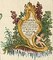 Figurative Cartouche on a 1770s China map by Kitchin.jpg 1,842 × 2,095; 712 KB
-
 Gingee - Tho. Kitchin sculpsit - btv1b5962887m.jpg 5,720 × 4,984; 4.1 MB
-
 GreysRaid.png 3,648 × 2,695; 20.75 MB
-
 Gulf of Cambay From a map by Thomas Kitchin, 1782.jpg 800 × 593; 130 KB
-
 HudsonBay1779.jpg 1,008 × 812; 485 KB
-

-
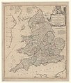
 Map of Middlesex, drawn by Thomas Kitchin, geographer, 1769.jpg 11,813 × 9,471; 20.59 MB
-

-

-
 OneidaCarryKitchen1772.png 781 × 497; 176 KB
-

-
 Plan of the city of New York by Ratzer, 1776.jpg 2,202 × 1,446; 1.08 MB
-

-
 Plan of the city of New York in North America by Ratzer, 1776.jpeg 563 × 760; 104 KB
-
 SaintPierre1772.png 1,105 × 500; 450 KB
-
 T K Empire of Morocco.jpg 720 × 478; 93 KB
-
 The cartouche From a map by Thomas Kitchin, 1782.jpg 723 × 600; 129 KB
-

-

-

-
 Thomas Kitchin. Composite Europe. 1787. (A).jpg 868 × 649; 196 KB
-
 Thomas Kitchin. Composite Europe. 1787. (B).jpg 398 × 670; 98 KB
-
 Thomas Kitchin. Composite Europe. 1787. (C).jpg 471 × 419; 86 KB
-
 Thomas Kitchin. Composite Europe. 1787.jpg 3,817 × 3,125; 3.33 MB
-
 Tritchinapoly - Tho. Kitchin sculpsit - btv1b59628688.jpg 5,720 × 5,056; 3.98 MB
-
 TroisRivieres1759.png 413 × 471; 427 KB
-
 West-Indies---Kitchin.jpg 3,585 × 2,237; 2.23 MB


.jpg)


.jpg)

_-_Geographicus_-_Africa2-boulton-1794.jpg)


_carte_d%27Allemagne_-_T._Kitchin,_Sculp._-_btv1b53085861c_(1_of_2).jpg)
_carte_d%27Allemagne_-_T._Kitchin,_Sculp._-_btv1b53085861c_(2_of_2).jpg)
.jpg)


.jpg)
.jpg)

.jpg)


.jpg)
_An_Accurate..._-_btv1b530571262.jpg)


_observ(atio)ns_-_by_T._Kitchin_-_btv1b10678781n.jpg)
.jpg)
.jpg)


.jpg)


_-_Geographicus_-_Africa2-boulton-1794_(cropped).jpg)
c_-_drawn_from_the_best_surveys_by_Tho(ma)s_Kitchin_Geog(graphe)r_-_btv1b10678806z.jpg)

.jpg)
.jpg)
.jpg)


