Category:Maps by Richard Kiepert
Jump to navigation
Jump to search
Subcategories
This category has the following 3 subcategories, out of 3 total.
Media in category "Maps by Richard Kiepert"
The following 8 files are in this category, out of 8 total.
-
 1893 map of Europe and the Middle East showing German consulates (cropped).tif 3,135 × 2,911; 26.13 MB
-
 Die Deutschen Besitzungen im Stillen Ocean 11657068.jpg 13,359 × 10,744; 45.89 MB
-

-
 Richard Kiepert, Deutsche und Britische Schutzgebiete in Aequatorial-Ost-Afrika, 1890.jpg 3,084 × 2,509; 3.45 MB
-
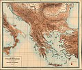 Stumme Physikalische Schul-Wandkarten der Länder Europas - Balkan-Halbinsel.jpg 9,000 × 7,662; 14.12 MB
-
 Stumme Physikalische Schul-Wandkarten der Länder Europas - Deutschland.jpg 7,434 × 9,000; 16.38 MB
-
 Stumme Physikalische Schul-Wandkarten der Länder Europas - Russland.jpg 7,145 × 9,000; 17.13 MB
-


.jpg)