Category:Maps by Joseph Bouchette
Jump to navigation
Jump to search
Media in category "Maps by Joseph Bouchette"
The following 53 files are in this category, out of 53 total.
-
 1841 Carte districts municipaux Bas-Canada.jpg 2,153 × 1,068; 385 KB
-
 A Plan of the new townships on the Grand or Ottawa River.png 2,963 × 943; 4.55 MB
-
 A Plan of the route from Halifax to River du Loup on the St. Lawrence.png 1,269 × 2,653; 6.97 MB
-
 A Sketch of the battle of La Fourche or Chateauguay, Oct. 26th 1813.png 1,920 × 1,133; 2.04 MB
-
 Bouchette 1831 - Boucherville.png 881 × 688; 1.59 MB
-
 Bouchette 1831 - Ile Perrot.png 881 × 688; 1.73 MB
-
 Bouchette 1831 - Lachine.png 881 × 688; 1.71 MB
-
 Carte cadastrale de canton Ham.png 2,126 × 1,887; 3.35 MB
-
 Carte cadastrale du canton Ashburton.PNG 1,661 × 1,568; 2.24 MB
-
 Carte joseph bouchette petite partie bas-canada.jpg 512 × 704; 66 KB
-
 City of Montreal, 1830.png 1,177 × 991; 937 KB
-
 City of Quebec - Joseph Bouchette 1815.png 3,477 × 1,664; 8.18 MB
-
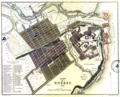 City of Quebec, 1830.png 2,856 × 2,320; 10.66 MB
-
 District of Montreal Bouchette 1831 - A.PNG 1,608 × 4,763; 9.66 MB
-
 District of Montreal Bouchette 1831 - B.PNG 3,203 × 4,825; 20.14 MB
-
 District of Montreal Bouchette 1831 - C.PNG 3,262 × 4,833; 24.2 MB
-
 District of Montreal Bouchette 1831 - D.PNG 3,228 × 4,801; 21.55 MB
-
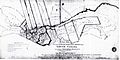
 La premiere carte de By-Town.jpg 1,500 × 1,267; 683 KB
-
 Map of the counties of Terrebonne Two Mountains and Argenteuil.png 1,836 × 1,981; 3.27 MB
-
-

-

-
-
 Montréal 1815. Le "Près de Ville". (6649776083).jpg 3,648 × 2,482; 3.62 MB
-
 Montréal 1815. Secteur Est de la Place dArmes. (6911973951).jpg 3,214 × 2,080; 2.07 MB
-

-
 Plan of the District of Gaspe - Joseph Bouchette 1815.png 2,376 × 2,026; 3.64 MB
-
 Plan of the district of Gaspé (4231299821).jpg 2,000 × 1,631; 2.94 MB
-
 Plan of the Place d Armes, city of Quebec.jpg 6,954 × 9,000; 7.06 MB
-
 Plan of the Place d'Armes, city of Quebec.png 2,898 × 3,751; 14.78 MB
-
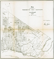
 Plan of the Town of William Henry.png 1,154 × 1,288; 1.17 MB
-
 Plan of Toronto Harbour 1792.jpg 10,351 × 7,819; 4.04 MB
-
 Plan of Toronto Harbour, Joseph Bouchette, 1792.png 1,267 × 955; 1.99 MB
-
 Plan of York Harbour (29652973174).jpg 1,920 × 1,208; 1.16 MB
-

-

-

-

-

-

-
-

-
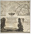
 Topographical map of the province of Lower Canada 01.png 6,614 × 6,982; 41.65 MB
-
 Topographical map of the province of Lower Canada 01a.png 6,533 × 3,445; 18.88 MB
-
 Topographical map of the province of Lower Canada 01b.png 6,590 × 3,578; 22.19 MB
-
 Topographical map of the province of Lower Canada 01b1.png 3,507 × 1,671; 4.88 MB
-
 Topographical map of the province of Lower Canada 01b2.png 3,663 × 1,886; 5.84 MB
-
 Topographical map of the province of Lower Canada 02a.png 4,932 × 3,510; 19.27 MB
-
 Topographical map of the province of Lower Canada 02b.png 4,983 × 3,569; 20.92 MB
-
 Topographical map of the province of Lower Canada 02b1.png 2,496 × 913; 2.33 MB
-
 Topographical map of the province of Lower Canada 02c.png 4,952 × 3,583; 20.91 MB
-
 Topographical map of the province of Lower Canada 02d.png 5,035 × 3,561; 21.6 MB
-
 Town of Montreal with rocks, shoals, soundings in the harbour.png 3,780 × 1,994; 6.27 MB


.jpg)
.jpg)
.jpg)


.jpg)


.jpg)


