Category:Maps by Chapman and André
Jump to navigation
Jump to search
Media in category "Maps by Chapman and André"
The following 10 files are in this category, out of 10 total.
-
 Beauchamp Roding, Chapman and Andre map, 1777.jpg 798 × 566; 520 KB
-
 Berners Roding, Chapman and Andre map, 1777.jpg 797 × 564; 570 KB
-
 Biggin, Essex (1777 map).jpg 1,342 × 712; 326 KB
-
 Coopersale, Chapman and Andre map, 1777.jpg 795 × 566; 682 KB
-
 Knowl Green, Chapman and Andre map, 1777.jpg 793 × 564; 576 KB
-
 Littlebury parish, Chapman and Andre map, 1777, 3-2.jpg 843 × 562; 566 KB
-
 Map Hulmers Great Warley 1777.jpg 1,500 × 776; 301 KB
-
 Morrell Roding, Chapman and Andre map, 1777.jpg 795 × 565; 520 KB
-
 Ugley Green, Chapman and Andre map, 1777.jpg 612 × 567; 408 KB
-
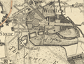 Wanstead Park, Chapman and Andre Map 1777.png 735 × 565; 996 KB


.jpg)


