Category:Maps by Bartholomew
Jump to navigation
Jump to search
Subcategories
This category has only the following subcategory.
Media in category "Maps by Bartholomew"
The following 12 files are in this category, out of 12 total.
-
 1892 Tourist's New Map of Scotland - Geographicus - Scotland-bartholomew-1892.jpg 3,500 × 4,567; 4.73 MB
-
 Bathy-orographical map of the world.jpg 2,428 × 1,606; 1.23 MB
-
 Cromartyshire 1892.jpg 1,243 × 729; 537 KB
-
 Early voyagers, 1492.jpg 1,902 × 1,466; 1.03 MB
-
 Land surface features and ocean currents, 1890.jpg 4,354 × 3,224; 2.02 MB
-
 Mapping of the world, 1922.jpg 5,651 × 4,026; 4.61 MB
-
 Ocean currents and land features, 1887.jpg 3,094 × 2,274; 840 KB
-
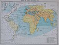
 Routes to India, 1893.jpg 2,222 × 1,725; 963 KB
-
 The Old World - Early explorers.jpg 1,649 × 1,366; 1.3 MB
-
 The World on Sir John Herschel's Projection, 1871.jpg 4,109 × 2,966; 3.26 MB
-
 United Nations Map of the World.jpg 11,103 × 8,188; 23.92 MB
-
 Yorkshire. Maps and plans by Bartholomew (1890) (14781482402).jpg 4,380 × 2,191; 1.91 MB


_(14781482402).jpg)