Category:Maps and diagrams of the Twin Towers (New York City)
Jump to navigation
Jump to search
Subcategories
This category has only the following subcategory.
M
Media in category "Maps and diagrams of the Twin Towers (New York City)"
The following 18 files are in this category, out of 18 total.
-
 Burdż Chalifa.svg 1,233 × 614; 66 KB
-
 BurjDubaiHeight.svg 1,233 × 614; 62 KB
-
 BurjKhalifaHeight-de.svg 1,219 × 541; 28 KB
-
 BurjKhalifaHeight-sr.svg 1,233 × 614; 33 KB
-
 BurjKhalifaHeight.png 1,233 × 614; 164 KB
-
 BurjKhalifaHeight.svg 1,233 × 614; 14 KB
-
 Map of the Mall at the World Trade Center (modifiable).svg 1,000 × 880; 152 KB
-
 Map of the Mall at the World Trade Center.svg 1,000 × 850; 989 KB
-
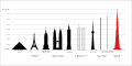
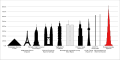
 Tallest buildings 1908 - 1974 (en).svg 530 × 380; 189 KB
-
 Tallest buildings 1908 - 1974.svg 530 × 380; 28 KB
-
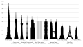
 TallestBuildings ca.svg 1,920 × 1,080; 34 KB
-
 TallestBuildings.svg 1,920 × 1,080; 38 KB
-
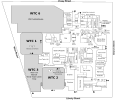
 WTC Building Arrangement and Site Plan comparison.svg 1,423 × 1,756; 344 KB
-
 WTC Building Arrangement and Site Plan ru.svg 1,423 × 1,756; 283 KB
-
 WTC Building Arrangement and Site Plan.jpg 1,935 × 1,923; 930 KB
-
 WTC Building Arrangement and Site Plan.svg 1,423 × 1,756; 273 KB
-
 Бурдж-Халифа.svg 1,233 × 614; 65 KB
-
 برج خليفة مقارنة بالأبراج الأخرى في العالم.jpg 800 × 424; 112 KB


.svg)

.svg)


