Category:Maps about Boko Haram
Jump to navigation
Jump to search
Subcategories
This category has only the following subcategory.
Media in category "Maps about Boko Haram"
The following 15 files are in this category, out of 15 total.
-
 Boko Haram conflict map.png 270 × 221; 22 KB
-
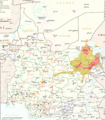 Boko Haram in Lake Chad Region.png 3,075 × 3,500; 5.45 MB
-
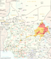
 Boko Haram in Lake Tchad Region.png 3,075 × 3,500; 4.47 MB
-
 Boko Haram Insurgency in Lake Chad Region (Feb. 11, 2015).png 3,075 × 3,500; 4.49 MB
-
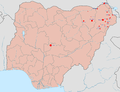 Boko Haram insurgency map.png 1,600 × 1,231; 395 KB
-
 Boko Haram insurgency map.svg 954 × 734; 399 KB
-
 BokoHaram deaths by state.jpg 2,333 × 1,971; 672 KB
-
 BokoHaraminsurgency.png 1,848 × 2,021; 332 KB
-
 Islamist insurgency in Nigeria-es.svg 600 × 600; 921 KB
-
 Islamist insurgency in Nigeria.svg 254 × 254; 412 KB
-
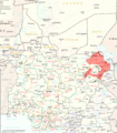
 ISWAP and Boko Haram territory in early 2019.png 1,153 × 1,048; 1.01 MB
-
 The Greatest Extent of Wilāyat al Sūdān al Gharbī.svg 2,048 × 2,048; 845 KB
-
 Wilayat al Sudan al Gharbi maximum territorial control.png 2,000 × 2,000; 455 KB
-
 Wilayat al Sudan al Gharbi.png 2,000 × 2,000; 446 KB
-
 Wilāyat al Sūdān al Gharbī.svg 254 × 254; 814 KB


.png)


