Category:Mancetter
Jump to navigation
Jump to search
village and civil parish in Warwickshire, United Kingdom  | |||||
| Upload media | |||||
| Instance of | |||||
|---|---|---|---|---|---|
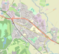
| Location | North Warwickshire, Warwickshire, West Midlands, England | ||||
| Population |
| ||||
| Area |
| ||||
| Said to be the same as | Mancetter (Wikimedia duplicated page, civil parish) | ||||
| official website | |||||
 | |||||
English: Mancetter is a village and civil parish on the outskirts of Atherstone in North Warwickshire, at the crossing of Watling Street over the River Anker.
Nederlands: Mancetter is een dorp en civil parish in het district North Warwickshire van het Engelse graafschap Warwickshire, aan de grens met Leicestershire. Het ligt ongeveer halverwege tussen Birmingham en Leicester. Mancetter heeft 2.449 inwoners (2001).
Subcategories
This category has the following 3 subcategories, out of 3 total.
Media in category "Mancetter"
The following 165 files are in this category, out of 165 total.
-

-
 A5 near Witherley - geograph.org.uk - 3855512.jpg 2,643 × 1,573; 1.72 MB
-
 A5 northbound at The Bull Inn - geograph.org.uk - 4876100.jpg 640 × 480; 49 KB
-
 A5 Watling Street heading towards Hinckley - geograph.org.uk - 3616797.jpg 3,675 × 2,834; 2.91 MB
-
 Allotment plot, Birchley Heath Road - geograph.org.uk - 1865402.jpg 640 × 480; 115 KB
-
 Ash trees and grazing sheep - geograph.org.uk - 4144168.jpg 1,280 × 1,069; 369 KB
-
 Asphalt plant and quarry buildings - geograph.org.uk - 5253914.jpg 1,469 × 1,102; 421 KB
-
 Atherstone & Mancetter map.png 1,077 × 987; 1.31 MB
-
 Atherstone Road - geograph.org.uk - 3845155.jpg 2,000 × 1,333; 708 KB
-
 Atherstone Road Bridge No 32 - geograph.org.uk - 4833778.jpg 800 × 600; 129 KB
-

-
 Bardon Manor Farm - geograph.org.uk - 4849020.jpg 640 × 426; 55 KB
-
 Bardon Manor Farm - geograph.org.uk - 5358577.jpg 640 × 426; 50 KB
-
 Bridge 31 Coventry Canal - geograph.org.uk - 3845176.jpg 2,000 × 1,501; 752 KB
-
 Bridge 32 Coventry Canal - geograph.org.uk - 3845203.jpg 2,000 × 1,333; 868 KB
-

-

-

-
 Caravan Dealer on Watling Street - geograph.org.uk - 3837322.jpg 3,222 × 1,940; 2.23 MB
-

-
 Church End Brewery - geograph.org.uk - 4212901.jpg 1,280 × 851; 201 KB
-

-
 Coventry Canal - geograph.org.uk - 3844652.jpg 2,000 × 1,333; 813 KB
-
 Coventry canal at Mancetter - geograph.org.uk - 1409212.jpg 640 × 360; 47 KB
-
 Coventry canal bridge 33 - geograph.org.uk - 5180486.jpg 5,184 × 3,456; 7.09 MB
-

-
 Coventry Canal south of Mancetter in Warwickshire - geograph.org.uk - 5714242.jpg 1,440 × 848; 1.44 MB
-
 Coventry Canal south of Mancetter, Warwickshire - geograph.org.uk - 5139374.jpg 1,440 × 910; 1.26 MB
-

-

-
 Coventry Canal south-west of Mancetter, Warwickshire - geograph.org.uk - 5714049.jpg 1,280 × 897; 1.36 MB
-
 Coventry Canal, Bridge 36, Mancetter - geograph.org.uk - 104828.jpg 640 × 480; 112 KB
-

-
 Coventry Canal, Bridge Number 34 - geograph.org.uk - 3144473.jpg 640 × 474; 77 KB
-

-

-

-

-
 Coventry Canal, Mancetter - geograph.org.uk - 103991.jpg 640 × 480; 138 KB
-
 Coventry Canal, Mancetter - geograph.org.uk - 104829.jpg 640 × 480; 104 KB
-

-
 Coventry Canal, Reach at Hartshill - geograph.org.uk - 3144907.jpg 640 × 480; 82 KB
-

-
 Coventry Canal, Reach near Rawn Hill - geograph.org.uk - 3144417.jpg 640 × 480; 79 KB
-
 Cows and pasture near Oldbury Farm - geograph.org.uk - 4826359.jpg 800 × 518; 95 KB
-

-
 Crab Tree Farm - geograph.org.uk - 3652408.jpg 640 × 430; 37 KB
-
 Crabtree Farm - geograph.org.uk - 4902508.jpg 640 × 349; 33 KB
-
 Distant view of Ridge Lane masts - geograph.org.uk - 1866814.jpg 640 × 480; 91 KB
-
 Dobbies Garden Centre - geograph.org.uk - 3846185.jpg 2,000 × 1,348; 651 KB
-
 Driveway to Stoneleigh Glebe Farm - geograph.org.uk - 3845146.jpg 2,000 × 1,333; 741 KB
-
 Entrance to Dobbies and Plantasia - geograph.org.uk - 3845492.jpg 2,000 × 1,333; 808 KB
-
 Farm buildings along Purley Chase Lane - geograph.org.uk - 4826367.jpg 800 × 516; 137 KB
-

-
 Farmland by Mancetter Crossing - geograph.org.uk - 2838182.jpg 640 × 430; 38 KB
-
 Farmland by the West Coast Main Line - geograph.org.uk - 3856458.jpg 640 × 430; 40 KB
-
 Farmland in the Anker Valley - geograph.org.uk - 4363177.jpg 640 × 430; 42 KB
-
 Farmland near Dobbies World - geograph.org.uk - 2838243.jpg 640 × 345; 36 KB
-
 Farmland near Mancetter Crossing - geograph.org.uk - 3856446.jpg 640 × 493; 55 KB
-
 Field and cows next to Purley Chase Lane - geograph.org.uk - 4844202.jpg 800 × 562; 139 KB
-
 Field near Mancetter - geograph.org.uk - 4902506.jpg 640 × 426; 73 KB
-
 Footpath near Mancetter Quarry - geograph.org.uk - 4144163.jpg 1,280 × 1,280; 911 KB
-
 Glebe Farm Bridge No 34 - geograph.org.uk - 4834069.jpg 800 × 600; 126 KB
-
 Glebe Farm Bridge south of Mancetter in Warwickshire - geograph.org.uk - 5714238.jpg 1,280 × 805; 1.19 MB
-
 Glebe Farm Bridge south of Mancetter in Warwickshire - geograph.org.uk - 5714240.jpg 1,280 × 960; 1.41 MB
-
 Harpers Lane Mancetter - geograph.org.uk - 5265613.jpg 4,128 × 2,322; 4.59 MB
-
 Hartshill Hayes - geograph.org.uk - 865748.jpg 640 × 443; 72 KB
-

-

-
 Houses at Ridge Lane near Nuneaton - geograph.org.uk - 4826384.jpg 800 × 615; 153 KB
-
 Houses by the B4111 near Mancetter - geograph.org.uk - 2838238.jpg 640 × 430; 47 KB
-
 Industrial units by the WCML - geograph.org.uk - 3652426.jpg 640 × 478; 57 KB
-

-
 Lady Wood Farm, Ridge Lane - geograph.org.uk - 1864263.jpg 640 × 480; 65 KB
-
 Lady Wood Farm, Ridge Lane - geograph.org.uk - 1868336.jpg 640 × 480; 96 KB
-
 Lake at Plantasia ^ Maze World - geograph.org.uk - 3845532.jpg 2,000 × 1,333; 613 KB
-
 Layby along the A5 Watling Street - geograph.org.uk - 3616771.jpg 4,000 × 3,000; 3.41 MB
-

-
 Alms Houses - geograph.org.uk - 682.jpg 640 × 480; 42 KB
-
 Mancetter Almshouses - geograph.org.uk - 6251282.jpg 1,600 × 1,067; 725 KB
-
 Mancetter Bridge No 36 - geograph.org.uk - 4834109.jpg 800 × 582; 175 KB
-

-
 Mancetter Church - geograph.org.uk - 5265603.jpg 4,128 × 2,322; 4.7 MB
-
 Mancetter Crossing Keepers Cottage.JPG 4,238 × 3,309; 3.36 MB
-
 Mancetter Manor Farmhouse.JPG 4,303 × 3,035; 2.36 MB
-
 Mancetter, UK - panoramio (10).jpg 5,472 × 3,648; 4.74 MB
-
 Mancetter, UK - panoramio (11).jpg 5,472 × 3,648; 5.49 MB
-
 Mancetter, UK - panoramio (12).jpg 5,472 × 3,648; 5.17 MB
-
 Mancetter, UK - panoramio (13).jpg 5,472 × 3,648; 7.96 MB
-
 Mancetter, UK - panoramio (2).jpg 5,472 × 3,648; 6.79 MB
-
 Mancetter, UK - panoramio (3).jpg 5,472 × 3,648; 7.97 MB
-
 Mancetter, UK - panoramio (4).jpg 5,472 × 3,648; 10.13 MB
-
 Mancetter, UK - panoramio (5).jpg 5,472 × 3,648; 6.56 MB
-
 Mancetter, UK - panoramio (6).jpg 5,472 × 3,648; 7.89 MB
-
 Mancetter, UK - panoramio (7).jpg 5,472 × 3,648; 9.02 MB
-
 Mancetter, UK - panoramio (8).jpg 5,472 × 3,648; 8.54 MB
-
 Mancetter, UK - panoramio (9).jpg 5,472 × 3,648; 5.58 MB
-
 Mancetter-Dobbies Garden Centre - geograph.org.uk - 4370523.jpg 1,600 × 1,200; 370 KB
-
 Moored narrowboat near Mancetter, Warwickshire - geograph.org.uk - 5139385.jpg 1,280 × 960; 900 KB
-

-
 Moored narrowboats at Garden Farm - geograph.org.uk - 5047757.jpg 640 × 427; 96 KB
-
 Narrowboat on the Coventry Canal - geograph.org.uk - 4144159.jpg 1,280 × 1,042; 461 KB
-

-

-
 Narrowboats south-west of Mancetter in Warwickshire - geograph.org.uk - 5714177.jpg 1,280 × 845; 1.28 MB
-
 Overflow along the Coventry Canal - geograph.org.uk - 4834098.jpg 800 × 577; 161 KB
-
 Path in Bratts Waste - geograph.org.uk - 4144465.jpg 1,280 × 853; 667 KB
-
 Path through woodland at Purley Park - geograph.org.uk - 4826323.jpg 800 × 582; 230 KB
-

-
 Plantasia ^ Maze World - geograph.org.uk - 3845506.jpg 2,000 × 1,333; 696 KB
-
 Plantasia ^ Maze World - geograph.org.uk - 3845521.jpg 2,000 × 1,496; 853 KB
-
 Pool at Mancetter Quarry - geograph.org.uk - 4826342.jpg 800 × 521; 140 KB
-
 Postbox and houses at Ridge Lane - geograph.org.uk - 4844183.jpg 800 × 549; 122 KB
-

-

-
 Purley Chase Lane at Purley Park - geograph.org.uk - 4826320.jpg 800 × 540; 163 KB
-
 Railway at Mancetter - geograph.org.uk - 5265606.jpg 4,128 × 2,322; 5.3 MB
-
 Rawn Hill Bridge No 37 - geograph.org.uk - 4834145.jpg 800 × 560; 145 KB
-
 Rawn Hill Bridge south of Atherstone in Warwickshire - geograph.org.uk - 5713704.jpg 1,280 × 896; 1.48 MB
-
 Rawn Hill Bridge south of Atherstone in Warwickshire - geograph.org.uk - 5713726.jpg 1,280 × 960; 1.48 MB
-
 Rawn Hill next to the Coventry Canal - geograph.org.uk - 4834136.jpg 800 × 559; 108 KB
-

-
 Rose Hill Farm - geograph.org.uk - 5704338.jpg 640 × 425; 51 KB
-
 Sheep grazing - geograph.org.uk - 4761429.jpg 640 × 362; 43 KB
-

-

-
 Stoneleigh Glebe Farm - geograph.org.uk - 3845164.jpg 2,000 × 1,333; 821 KB
-
 Stoneleigh Quarry Farm Bridge No 35 - geograph.org.uk - 4834089.jpg 800 × 536; 175 KB
-
 Stubble field, Mancetter - geograph.org.uk - 4902504.jpg 640 × 426; 56 KB
-

-

-

-
 The A5 in Atherstone - geograph.org.uk - 683371.jpg 640 × 538; 82 KB
-
 The Blue Boar Inn, Mancetter - geograph.org.uk - 683360.jpg 640 × 372; 63 KB
-
 The Bull Inn - geograph.org.uk - 3835443.jpg 2,822 × 1,740; 2.26 MB
-
 The Bull Inn along the A5 Watling Street - geograph.org.uk - 3616822.jpg 3,884 × 2,810; 2.74 MB
-
 The Coventry Canal near Hartshill Green - geograph.org.uk - 4833775.jpg 800 × 496; 106 KB
-

-

-

-

-
 The River Anker - geograph.org.uk - 1416051.jpg 640 × 480; 112 KB
-
 The road north from Hartshill Green - geograph.org.uk - 5281075.jpg 2,322 × 4,128; 1.41 MB
-
 The West Coast Main Line in Atherstone - geograph.org.uk - 4834143.jpg 800 × 608; 207 KB
-
 The White Hart in Ridge Lane - geograph.org.uk - 2882094.jpg 640 × 425; 59 KB
-
 The White Hart, Ridge Lane - geograph.org.uk - 1864252.jpg 640 × 480; 70 KB
-
 Three trees - geograph.org.uk - 4335289.jpg 640 × 430; 46 KB
-
 Three trees - geograph.org.uk - 4849019.jpg 640 × 426; 48 KB
-
 Three trees - geograph.org.uk - 5358580.jpg 640 × 426; 38 KB
-
 Three trees - geograph.org.uk - 5704339.jpg 640 × 426; 51 KB
-

-
 Trees in a field - geograph.org.uk - 3856453.jpg 640 × 430; 52 KB
-
 View from a Rugby-Crewe train - Fields near Mancetter - geograph.org.uk - 5819099.jpg 1,600 × 1,200; 323 KB
-

-
 View from a Rugby-Crewe train - Tractor at work - geograph.org.uk - 5819018.jpg 1,600 × 1,200; 400 KB
-
 View towards Quarry Farm - geograph.org.uk - 1582742.jpg 640 × 480; 89 KB
-
 Warwickshire farmland north of Hartshill - geograph.org.uk - 1138573.jpg 640 × 480; 163 KB
-
 White Hart along Birchley Heath Road - geograph.org.uk - 4844156.jpg 800 × 460; 102 KB
-
 Winter sunrise , mancetter - geograph.org.uk - 651545.jpg 640 × 512; 58 KB
-
 Woodside cottages, Birchley Heath Lane - geograph.org.uk - 1865392.jpg 640 × 480; 119 KB
-

-
 Footbridge across the A5 - geograph.org.uk - 683370.jpg 640 × 473; 130 KB
-
 Oldbury Farm - geograph.org.uk - 8017.jpg 640 × 458; 124 KB
-
 Railway at Mancetter - geograph.org.uk - 104001.jpg 640 × 480; 107 KB
-
 Railway bridge over Mancetter Road - geograph.org.uk - 103980.jpg 640 × 480; 78 KB


.jpg)
.jpg)
.jpg)
.jpg)
.jpg)
.jpg)
.jpg)
.jpg)
.jpg)
.jpg)
.jpg)
.jpg)


