Category:Malborough
Jump to navigation
Jump to search
English: Malborough is a village located in the South Hams region of Devon. The village is located on the A381 between Kingsbridge and Salcombe, and is a popular village for tourists with many holiday homes located around the village.
village and civil parish in Devon, England, UK  | |||||
| Upload media | |||||
| Instance of | |||||
|---|---|---|---|---|---|
| Location | South Hams, Devon, South West England, England | ||||
 | |||||
Subcategories
This category has the following 5 subcategories, out of 5 total.
Media in category "Malborough"
The following 200 files are in this category, out of 561 total.
(previous page) (next page)-
 A field of wheat above Combe - geograph.org.uk - 2519527.jpg 3,872 × 2,592; 6.34 MB
-
 A rough area in The Warren at Soar - geograph.org.uk - 6067145.jpg 1,600 × 1,200; 964 KB
-
 A381 between Salcombe and Malborough - geograph.org.uk - 2270744.jpg 800 × 525; 348 KB
-
 A381 Entering Malborough - geograph.org.uk - 2440596.jpg 3,378 × 2,312; 2.43 MB
-
 A381 near Malborough - geograph.org.uk - 2440576.jpg 3,964 × 2,605; 3.29 MB
-
 A381 north of Malborough - geograph.org.uk - 2270864.jpg 800 × 505; 276 KB
-
 A381, Malborough - geograph.org.uk - 5943689.jpg 1,024 × 681; 118 KB
-
 A381, Salcombe Rd - geograph.org.uk - 5943685.jpg 1,024 × 681; 135 KB
-
 Above Cathole Cliff - geograph.org.uk - 2745420.jpg 1,024 × 768; 248 KB
-
 Above Off Cove - geograph.org.uk - 2180335.jpg 640 × 480; 117 KB
-
 Access to the former RAF airfield at East Soar - geograph.org.uk - 5300013.jpg 1,600 × 1,200; 674 KB
-
 Across Starehole Bottom - geograph.org.uk - 5814215.jpg 4,254 × 2,322; 1.66 MB
-
 Across the Kingsbridge Estuary - geograph.org.uk - 6319852.jpg 3,253 × 1,721; 838 KB
-
 Agricultural Land outside Malborough - geograph.org.uk - 1423273.jpg 640 × 427; 113 KB
-
 Airstrip at East Soar - geograph.org.uk - 5976136.jpg 1,600 × 1,200; 385 KB
-
 All rolled up - geograph.org.uk - 3135220.jpg 1,024 × 768; 205 KB
-
 All Saints Church - geograph.org.uk - 1577536.jpg 640 × 480; 60 KB
-
 All Saints church, Malborough, Devon - geograph.org.uk - 5996358.jpg 2,672 × 4,000; 4.89 MB
-
 All Saints church, Malborough, Devon - geograph.org.uk - 5996360.jpg 4,000 × 2,672; 3.39 MB
-
 Alpacas, Malborough - geograph.org.uk - 2180525.jpg 640 × 498; 124 KB
-
 Approaching Collaton - geograph.org.uk - 3984582.jpg 640 × 425; 86 KB
-
 Approaching road junction at Bolberry - geograph.org.uk - 3793488.jpg 2,560 × 1,920; 2.05 MB
-
 Approaching Southdown Farm - geograph.org.uk - 3984501.jpg 640 × 425; 80 KB
-
 Arable land at Soar - geograph.org.uk - 2278177.jpg 1,024 × 680; 211 KB
-
 Armeria Maritima - geograph.org.uk - 3984354.jpg 640 × 425; 55 KB
-
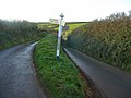
 Attractive and informative Devon roadsign - geograph.org.uk - 226485.jpg 640 × 480; 113 KB
-
 Barn above Starehole Bottom - geograph.org.uk - 2547235.jpg 640 × 480; 96 KB
-
 Barn and farm, Starehole Bottom - geograph.org.uk - 5810770.jpg 3,264 × 1,832; 1.25 MB
-
 Barns at Higher Soar - geograph.org.uk - 2519464.jpg 3,872 × 2,592; 3.96 MB
-
 Barns in Bolberry - geograph.org.uk - 2270769.jpg 800 × 600; 391 KB
-
 Barns near East Soar - geograph.org.uk - 1934810.jpg 512 × 640; 87 KB
-
 Beach at Soar Mill Cove - geograph.org.uk - 4914746.jpg 800 × 600; 76 KB
-
 Bees on Thistle Flower - geograph.org.uk - 1423256.jpg 602 × 640; 120 KB
-
 Bellhouse Rock - geograph.org.uk - 5810380.jpg 4,288 × 2,848; 2.61 MB
-
 Bench above Cathole Cliff - geograph.org.uk - 4914741.jpg 800 × 600; 164 KB
-

-
 Blanksmill Bridge - geograph.org.uk - 2749297.jpg 800 × 600; 338 KB
-
 Blanksmill Bridge - geograph.org.uk - 5285087.jpg 2,840 × 1,605; 861 KB
-
 Blanksmill creek - geograph.org.uk - 1464575.jpg 640 × 313; 49 KB
-
 Blanksmill Creek - geograph.org.uk - 1464592.jpg 480 × 640; 87 KB
-
 Blanksmill creek - geograph.org.uk - 1522899.jpg 640 × 447; 87 KB
-

-
 Bolberry campsite 1 - geograph.org.uk - 1076713.jpg 640 × 480; 99 KB
-
 Bolberry campsite 2 - geograph.org.uk - 1076716.jpg 640 × 480; 72 KB
-
 Bolberry Cross - geograph.org.uk - 2270763.jpg 800 × 600; 388 KB
-
 Bolberry Cross - geograph.org.uk - 2899053.jpg 4,000 × 3,000; 5.26 MB
-
 Bolberry Cross - geograph.org.uk - 3345003.jpg 1,024 × 513; 73 KB
-
 Bolberry Down - geograph.org.uk - 1591195.jpg 640 × 480; 73 KB
-
 Bolberry Down cliff car park - geograph.org.uk - 373019.jpg 640 × 480; 150 KB
-
 Bolt Head - geograph.org.uk - 1934837.jpg 640 × 456; 97 KB
-
 Bolt Head - geograph.org.uk - 5810527.jpg 3,360 × 1,942; 786 KB
-
 Bolt Head Airfield - geograph.org.uk - 5976139.jpg 1,600 × 1,198; 250 KB
-
 Bolt Head Airfield - geograph.org.uk - 6067225.jpg 1,600 × 1,200; 918 KB
-
 Bolt Head Airfield and military buildings - geograph.org.uk - 6400647.jpg 1,600 × 1,200; 925 KB
-
 Bolt Head and the Mew Stone taken from Sharp Tor - geograph.org.uk - 5064285.jpg 1,500 × 1,121; 266 KB
-
 Bolt Head walk - geograph.org.uk - 4874978.jpg 1,800 × 3,200; 2.42 MB
-
 Both lead to Hope Cove - geograph.org.uk - 1076708.jpg 640 × 480; 82 KB
-
 Bridleway from Combe - geograph.org.uk - 3984568.jpg 640 × 425; 109 KB
-
 Bridleway near Malborough - geograph.org.uk - 134429.jpg 427 × 640; 132 KB
-
 Brightham House - geograph.org.uk - 5943470.jpg 1,024 × 681; 153 KB
-
 Bus stop and junction at Yarde Gate - geograph.org.uk - 2270748.jpg 800 × 600; 349 KB
-
 Calf near Middle Soar - geograph.org.uk - 1934517.jpg 454 × 640; 107 KB
-
 Car park at Bolberry Down - geograph.org.uk - 2270777.jpg 800 × 600; 321 KB
-
 Car park at Bolberry Down from the west - geograph.org.uk - 2270780.jpg 800 × 600; 400 KB
-
 Cathole Cliff - geograph.org.uk - 1422588.jpg 484 × 640; 114 KB
-
 Cathole Cliff - geograph.org.uk - 316696.jpg 273 × 413; 19 KB
-
 Cattle above Soar Mill Cove - geograph.org.uk - 2547175.jpg 640 × 425; 76 KB
-
 Cattle grazing near Portlemore Barton - geograph.org.uk - 2737262.jpg 1,024 × 768; 248 KB
-
 Chapel Lane - geograph.org.uk - 5943473.jpg 1,024 × 681; 110 KB
-
 Chapel Lane, Malborough - geograph.org.uk - 1527657.jpg 480 × 640; 56 KB
-
 Church Gate Cottage - geograph.org.uk - 5943464.jpg 1,024 × 681; 121 KB
-
 Church gate, Malborough - geograph.org.uk - 1931086.jpg 640 × 480; 80 KB
-
 Church of All Saints' - font - geograph.org.uk - 5943678.jpg 1,024 × 681; 128 KB
-
 Church of All Saints' - geograph.org.uk - 5943443.jpg 1,024 × 681; 112 KB
-
 Church of All Saints' - geograph.org.uk - 5943445.jpg 1,024 × 681; 124 KB
-
 Church of All Saints' - geograph.org.uk - 5943446.jpg 681 × 1,024; 84 KB
-
 Church of All Saints' - geograph.org.uk - 5943453.jpg 1,024 × 681; 150 KB
-
 Church of All Saints' - geograph.org.uk - 5943454.jpg 681 × 1,024; 100 KB
-
 Church of All Saints' - geograph.org.uk - 5943455.jpg 1,024 × 680; 123 KB
-
 Church of All Saints' - organ - geograph.org.uk - 5943456.jpg 1,024 × 681; 124 KB
-
 Church of All Saints' - pulpit - geograph.org.uk - 5943459.jpg 1,024 × 681; 143 KB
-
 Church of All Saints' - stained glass - geograph.org.uk - 5943460.jpg 1,024 × 681; 168 KB
-
 Cliff at Bolberry Down, Bolberry - geograph.org.uk - 373008.jpg 640 × 480; 144 KB
-
 Cliffs at Ralph's Hole - geograph.org.uk - 1933259.jpg 640 × 464; 100 KB
-
 Cliffs from Bolberry Down.jpg 2,000 × 2,728; 1.45 MB
-
 Cliffs on Bolberry Down - geograph.org.uk - 1562435.jpg 640 × 480; 79 KB
-
 Cliffs west of Slippery Point - geograph.org.uk - 1006702.jpg 640 × 615; 129 KB
-
 CO-OP filling Station - geograph.org.uk - 5943681.jpg 1,024 × 681; 112 KB
-
 Coast above Off Cove, looking towards Bolt Head - geograph.org.uk - 6067162.jpg 1,600 × 1,200; 1.02 MB
-
 Coast at Off Cove - geograph.org.uk - 1934826.jpg 640 × 463; 110 KB
-
 Coast at Saltern Pike - geograph.org.uk - 2742306.jpg 1,024 × 768; 297 KB
-
 Coast at Soar Mill Cove - geograph.org.uk - 1933796.jpg 640 × 480; 84 KB
-
 Coast path - geograph.org.uk - 3984296.jpg 640 × 425; 61 KB
-
 Coast path above Off Cove - geograph.org.uk - 1934819.jpg 551 × 640; 123 KB
-
 Coast path above Off Cove - geograph.org.uk - 2180345.jpg 640 × 405; 98 KB
-
 Coast path above Off Cove - geograph.org.uk - 2279662.jpg 1,024 × 680; 284 KB
-
 Coast path above Off Cove - geograph.org.uk - 2279664.jpg 1,024 × 680; 182 KB
-
 Coast path at Bolt Head - geograph.org.uk - 2180310.jpg 640 × 480; 119 KB
-
 Coast path at West Cliff - geograph.org.uk - 2745417.jpg 1,024 × 768; 310 KB
-
 Coast path at West Cliff - geograph.org.uk - 2745418.jpg 1,024 × 768; 281 KB
-
 Coast path crossing Bolt Head - geograph.org.uk - 3984273.jpg 640 × 425; 93 KB
-
 Coast path, West Cliff - geograph.org.uk - 1933271.jpg 640 × 480; 109 KB
-
 Coastal footpath on Bolberry Down - geograph.org.uk - 2270814.jpg 800 × 600; 416 KB
-
 Coastal footpath on West Cliff - geograph.org.uk - 2270829.jpg 800 × 600; 378 KB
-

-
 Coastal path - geograph.org.uk - 5976089.jpg 1,600 × 1,182; 524 KB
-
 Coastal path heading towards Bolt Head - geograph.org.uk - 2519018.jpg 3,872 × 2,592; 5.21 MB
-

-

-

-

-

-
 Coastal slope above Steeple Cove - geograph.org.uk - 1934287.jpg 640 × 480; 100 KB
-
 Coastal slope above Steeple Cove - geograph.org.uk - 1934388.jpg 640 × 480; 132 KB
-
 Coastguard Station on Bolberry Down - geograph.org.uk - 4914737.jpg 800 × 600; 156 KB
-
 Coastline at Bolberry Down - geograph.org.uk - 1006688.jpg 640 × 611; 103 KB
-
 Colaton Rd - geograph.org.uk - 5943693.jpg 1,024 × 681; 155 KB
-
 Collaton Road, Malborough - geograph.org.uk - 2270652.jpg 800 × 600; 360 KB
-
 Converted Farm Buildings in Bolberry - geograph.org.uk - 1423233.jpg 640 × 427; 122 KB
-
 Cornfields at Middle Soar - geograph.org.uk - 330488.jpg 428 × 640; 112 KB
-
 Cottage at Combe - geograph.org.uk - 1523827.jpg 470 × 640; 84 KB
-
 Cottage at Combe - geograph.org.uk - 3984558.jpg 640 × 425; 94 KB
-
 Cottage, Malborough - geograph.org.uk - 2180619.jpg 640 × 429; 75 KB
-
 Cottage, Malborough - geograph.org.uk - 2180643.jpg 554 × 640; 39 KB
-
 Cottage, Malborough Green - geograph.org.uk - 1931192.jpg 640 × 444; 50 KB
-
 Cottages at Higher Soar - geograph.org.uk - 5300015.jpg 1,600 × 1,200; 629 KB
-
 Cottages, Malborough - geograph.org.uk - 1931029.jpg 496 × 640; 61 KB
-
 Cottages, Malborough - geograph.org.uk - 2180566.jpg 640 × 480; 111 KB
-
 Country south of Malborough - geograph.org.uk - 1523843.jpg 640 × 390; 88 KB
-
 Crag above Steeple Cove - geograph.org.uk - 1934270.jpg 480 × 640; 104 KB
-
 Crops Under Netting - geograph.org.uk - 1423283.jpg 640 × 427; 110 KB
-
 Crossing Bolberry Down - geograph.org.uk - 3935892.jpg 640 × 425; 112 KB
-
 Crossroads on the coastal path - geograph.org.uk - 2519157.jpg 3,872 × 2,592; 5.53 MB
-
 Cycle Path by A381 - geograph.org.uk - 1577583.jpg 640 × 480; 93 KB
-
 Cycle Path by A381 - geograph.org.uk - 1577600.jpg 640 × 480; 90 KB
-
 Devon farmland - geograph.org.uk - 910932.jpg 640 × 427; 105 KB
-
 Down the Cliffs to the Sea - geograph.org.uk - 1421205.jpg 640 × 427; 127 KB
-
 Driftwood - geograph.org.uk - 5943471.jpg 1,024 × 681; 140 KB
-
 Drive to Furzedown Farm - geograph.org.uk - 2180497.jpg 640 × 405; 82 KB
-
 Dry stone wall from coast path - geograph.org.uk - 5975986.jpg 1,600 × 1,200; 598 KB
-
 DyerArms.png 810 × 934; 41 KB
-
 East from Goat Rock - geograph.org.uk - 1934436.jpg 640 × 480; 109 KB
-
 East Soar - Southern National 1218 (JUO983) nearside.JPG 1,366 × 910; 543 KB
-
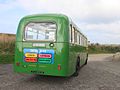 East Soar - Southern National 1218 (JUO983) rear.JPG 1,366 × 1,024; 551 KB
-
 Eastacoombes Way - geograph.org.uk - 5930297.jpg 1,024 × 681; 103 KB
-

-
 Entrance to holiday accommodation at Higher Soar - geograph.org.uk - 5300017.jpg 1,600 × 1,280; 874 KB
-
 Entrance to Soar Farm - geograph.org.uk - 5976114.jpg 1,600 × 1,200; 472 KB
-

-
 Farm buildings at Soar - geograph.org.uk - 2278176.jpg 1,024 × 680; 229 KB
-
 Farm track in The Warren near Middle Soar - geograph.org.uk - 6067148.jpg 1,600 × 1,200; 1.04 MB
-
 Farmland near Malborough - geograph.org.uk - 2281865.jpg 1,024 × 680; 188 KB
-
 Fern near Bolberry Cross - geograph.org.uk - 1523840.jpg 640 × 483; 75 KB
-
 Field above Blanksmill Creek - geograph.org.uk - 5284975.jpg 3,072 × 2,048; 1.08 MB
-
 Field boundary at Middle Soar and Sharp Tor - geograph.org.uk - 6067142.jpg 1,600 × 1,200; 1,010 KB
-
 Field boundary, Furzedown Farm - geograph.org.uk - 2180493.jpg 640 × 480; 99 KB
-
 Field near Portlemore Barton - geograph.org.uk - 2180505.jpg 640 × 475; 116 KB
-
 Fields at Hope Barton, Inner Hope - geograph.org.uk - 3793445.jpg 2,560 × 1,920; 2.29 MB
-
 Fields north of Malborough - geograph.org.uk - 3914299.jpg 1,536 × 1,152; 900 KB
-
 Flat open space on the coastal strip - geograph.org.uk - 2519150.jpg 3,872 × 2,592; 5.95 MB
-
 Footbridge and path in Starehole Bottom - geograph.org.uk - 2749223.jpg 600 × 800; 432 KB
-
 Footbridge, Soar Mill Cove - geograph.org.uk - 3984390.jpg 640 × 425; 127 KB
-
 Footpath above Higher Rew Farm - geograph.org.uk - 2519504.jpg 3,872 × 2,592; 5.57 MB
-
 Footpath and hedge - geograph.org.uk - 5938474.jpg 1,024 × 681; 170 KB
-
 Footpath by edge of field - geograph.org.uk - 1589255.jpg 640 × 480; 85 KB
-
 Footpath down to Ilton Castle Farm - geograph.org.uk - 1577712.jpg 640 × 480; 107 KB
-
 Footpath eastward - geograph.org.uk - 5938460.jpg 1,024 × 681; 129 KB
-
 Footpath from Malborough - geograph.org.uk - 1523781.jpg 640 × 480; 139 KB
-
 Footpath in mist - geograph.org.uk - 5938478.jpg 1,024 × 681; 144 KB
-
 Footpath in the mist - geograph.org.uk - 5943305.jpg 1,024 × 681; 79 KB
-

-
 Footpath junction - geograph.org.uk - 3984258.jpg 640 × 425; 56 KB
-
 Footpath junction above Tor Woods - geograph.org.uk - 2547408.jpg 640 × 439; 102 KB
-
 Footpath near Portlemore Barton (2) - geograph.org.uk - 1523804.jpg 640 × 480; 139 KB
-
 Footpath near Portlemore Barton (3) - geograph.org.uk - 1523809.jpg 427 × 640; 117 KB
-
 Footpath near Portlemore Barton - geograph.org.uk - 1523797.jpg 640 × 480; 143 KB
-
 Footpath on Bolberry Down - geograph.org.uk - 2270812.jpg 640 × 480; 91 KB
-
 Footpath Past Middle Soar - geograph.org.uk - 1421177.jpg 640 × 427; 110 KB
-
 Footpath sign at Rew Cross - geograph.org.uk - 226486.jpg 640 × 480; 104 KB
-

-
 Footpath sign to Goat Rock - geograph.org.uk - 2278368.jpg 1,024 × 680; 224 KB
-
 Footpath through a tunnel of branches at Lower Soar - geograph.org.uk - 6067204.jpg 1,200 × 1,600; 1.03 MB
-
 Footpath through hedge - geograph.org.uk - 5938487.jpg 1,024 × 681; 150 KB
-
 Footpath to Blanksmill - geograph.org.uk - 1523023.jpg 640 × 439; 91 KB
-
 Footpath to Burleigh Farm - geograph.org.uk - 1577505.jpg 640 × 480; 105 KB
-
 Footpath to Combe - geograph.org.uk - 1523813.jpg 495 × 640; 123 KB
-
 Footpath to Higher and Lower Soar - geograph.org.uk - 5976096.jpg 1,600 × 1,200; 505 KB
-
 Footpath to Hope Cove - geograph.org.uk - 5938492.jpg 1,024 × 681; 141 KB
-
 Footpath to Lower Soar - geograph.org.uk - 1422447.jpg 640 × 427; 99 KB
-
 Footpath to Malborough - geograph.org.uk - 2278371.jpg 1,024 × 680; 208 KB
-
 Footpath to North Bolberry - geograph.org.uk - 1591212.jpg 640 × 480; 83 KB
-
 Footpath to Portlemore Barton - geograph.org.uk - 2270675.jpg 800 × 600; 436 KB
-
 Footpath to Rew - geograph.org.uk - 2278172.jpg 1,024 × 680; 255 KB
-
 Footpath to Rew - geograph.org.uk - 2519490.jpg 3,872 × 2,592; 5.78 MB
-
 Footpath to Rew - geograph.org.uk - 3984520.jpg 640 × 425; 80 KB
-
 Footpath to Soar - geograph.org.uk - 2278359.jpg 1,024 × 680; 237 KB
-
 Footpath to Soar and Malborough - geograph.org.uk - 2278373.jpg 1,024 × 680; 187 KB
-
 Footpath to Soar Mill Cove - geograph.org.uk - 1589223.jpg 640 × 480; 89 KB
-
 Footpath to Southdown Farm - geograph.org.uk - 1589525.jpg 640 × 480; 93 KB
-
 Former field boundary on the coastal strip - geograph.org.uk - 2519030.jpg 3,872 × 2,592; 6.27 MB


_nearside.JPG)
_rear.JPG)


_-_geograph.org.uk_-_1523804.jpg)
_-_geograph.org.uk_-_1523809.jpg)


