Category:Majdal Shams
Jump to navigation
Jump to search

Druze village in the Golan Heights  Majdal Shams en 2009 | |||||
| Upload media | |||||
| Instance of | |||||
|---|---|---|---|---|---|
| Location | Golan Subdistrict, Northern District, Israel | ||||
| Population |
| ||||
| Area |
| ||||
| Elevation above sea level |
| ||||
| official website | |||||
 | |||||
Subcategories
This category has only the following subcategory.
I
Media in category "Majdal Shams"
The following 101 files are in this category, out of 101 total.
-
 105661 views of majdal shams at the foot of hermon PikiWiki Israel.jpg 4,032 × 3,024; 1.68 MB
-
 105662 views of majdal shams at the foot of hermon PikiWiki Israel.jpg 4,032 × 3,024; 1.83 MB
-
 105663 views of majdal shams at the foot of hermon PikiWiki Israel.jpg 4,032 × 3,024; 1.93 MB
-
 105664 views of majdal shams at the foot of hermon PikiWiki Israel.jpg 4,032 × 3,024; 2.48 MB
-
 105665 views of majdal shams at the foot of hermon PikiWiki Israel.jpg 4,032 × 3,024; 2.34 MB
-
 Christians and Druze in Majdal Shams.jpg 843 × 1,825; 218 KB
-
 Dan Hadani collection (990044378960205171).jpg 2,072 × 3,343; 970 KB
-
 Dan Hadani collection (990044378970205171).jpg 2,072 × 3,328; 932 KB
-
 Dan Hadani collection (990044378980205171).jpg 2,072 × 3,312; 822 KB
-
 Dan Hadani collection (990044378990205171).jpg 3,319 × 2,072; 1.1 MB
-
 Dan Hadani collection (990044379000205171).jpg 2,072 × 3,104; 1.06 MB
-
 Dan Hadani collection (990044379010205171).jpg 1,959 × 3,312; 997 KB
-
 Dan Hadani collection (990044379020205171).jpg 3,312 × 1,959; 837 KB
-
 Dan Hadani collection (990044379030205171).jpg 1,959 × 3,328; 740 KB
-
 Dan Hadani collection (990044379040205171).jpg 3,311 × 1,959; 876 KB
-
 Dan Hadani collection (990044379050205171).jpg 3,295 × 1,959; 1.16 MB
-
 Dan Hadani collection (990044379060205171).jpg 3,200 × 1,943; 791 KB
-
 Dan Hadani collection (990044379070205171).jpg 3,311 × 1,943; 830 KB
-
 Dan Hadani collection (990044379080205171).jpg 3,312 × 1,943; 1.16 MB
-
 Dan Hadani collection (990044379090205171).jpg 3,311 × 1,943; 821 KB
-
 Dan Hadani collection (990044379100205171).jpg 3,319 × 1,943; 832 KB
-
 Dan Hadani collection (990044379110205171).jpg 3,312 × 1,943; 879 KB
-
 Dan Hadani collection (990044379120205171).jpg 1,999 × 3,319; 1.07 MB
-
 Dan Hadani collection (990044379130205171).jpg 3,320 × 1,999; 1,014 KB
-
 Dan Hadani collection (990044379140205171).jpg 1,999 × 3,319; 946 KB
-
 Dan Hadani collection (990044379150205171).jpg 3,343 × 2,064; 1.16 MB
-
 Dan Hadani collection (990044379160205171).jpg 3,319 × 2,064; 1.28 MB
-
 Dan Hadani collection (990044379170205171).jpg 3,319 × 2,064; 1.36 MB
-
 Dan Hadani collection (990044379180205171).jpg 2,064 × 3,328; 1.11 MB
-
 Dan Hadani collection (990044379190205171).jpg 3,327 × 2,064; 1.38 MB
-
 Dan Hadani collection (990044379200205171).jpg 3,319 × 2,008; 1.06 MB
-
 Dan Hadani collection (990044379210205171).jpg 2,008 × 3,327; 827 KB
-
 Dan Hadani collection (990044379220205171).jpg 2,008 × 3,319; 708 KB
-
 Dan Hadani collection (990044379230205171).jpg 2,008 × 3,319; 841 KB
-
 Dan Hadani collection (990044379250205171).jpg 3,327 × 2,008; 967 KB
-
 Druze cuisine in Majdal Shams.jpg 3,536 × 2,268; 3.42 MB
-
 Fotografi från Majdal Shams - Hallwylska museet - 104344.tif 4,135 × 3,297; 39.04 MB
-
 Golan Scenery outside Druze Town of Majdal Shams - Golan Heights (5707611396).jpg 3,456 × 2,304; 3.95 MB
-
 Golan-majdal-shams-dust-storm.JPG 1,600 × 1,067; 397 KB
-
 Israel Hiking Map מג'דל שמס.jpeg 800 × 603; 93 KB
-
 Majdal Shams (997009452783605171.jpg 1,561 × 1,602; 1.73 MB
-
 Majdal Shams (997009452783705171.jpg 1,610 × 1,569; 1.55 MB
-
 Majdal Shams 01.jpg 4,288 × 2,848; 5.33 MB
-
 Majdal Shams 02.jpg 4,288 × 2,848; 5.36 MB
-
 Majdal Shams 03.jpg 2,848 × 4,288; 4.85 MB
-
 Majdal Shams 04.jpg 4,288 × 2,848; 5.12 MB
-
 Majdal Shams 05.jpg 4,288 × 2,848; 5.15 MB
-
 Majdal Shams 06.jpg 4,288 × 2,848; 5.63 MB
-
 Majdal Shams 07.jpg 4,288 × 2,848; 5.65 MB
-
 Majdal Shams 08.jpg 4,288 × 2,848; 5.34 MB
-
 Majdal Shams 09.jpg 4,288 × 2,848; 5.68 MB
-
 Majdal Shams 10.jpg 4,288 × 2,848; 5.54 MB
-
 Majdal Shams 11.jpg 4,288 × 2,848; 5.7 MB
-
 Majdal Shams 12.jpg 4,288 × 2,848; 5.48 MB
-
 Majdal Shams 13.jpg 4,288 × 2,848; 4.83 MB
-
 Majdal Shams 14.jpg 4,288 × 2,848; 5.31 MB
-
 Majdal Shams 15.jpg 4,288 × 2,848; 4.96 MB
-
 Majdal Shams 16.jpg 4,288 × 2,848; 5.57 MB
-
 Majdal Shams 17.jpg 2,848 × 4,288; 5.27 MB
-
 Majdal Shams ap 001.jpg 1,755 × 1,313; 511 KB
-
 Majdal Shams ap 002.jpg 1,727 × 1,288; 453 KB
-
 Majdal Shams ap 003.jpg 1,786 × 1,345; 473 KB
-
 Majdal Shams ap 004.jpg 1,557 × 1,160; 378 KB
-
 Majdal Shams ap 005.jpg 1,620 × 1,160; 420 KB
-
 Majdal Shams ap 006.jpg 1,557 × 1,170; 393 KB
-
 Majdal Shams ap 007.jpg 1,692 × 1,129; 390 KB
-
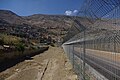
 Majdal Shams border 01.jpg 4,288 × 2,848; 5.47 MB
-
 Majdal Shams border 03.jpg 4,288 × 2,848; 5.34 MB
-
 Majdal Shams border 04.jpg 4,288 × 2,848; 4.97 MB
-
 Majdal Shams border 05.jpg 4,288 × 2,848; 5.35 MB
-
 Majdal Shams border 06.jpg 4,288 × 2,848; 5.67 MB
-
 Majdal Shams border 07.jpg 4,288 × 2,848; 5.65 MB
-
 Majdal Shams border 08.jpg 4,288 × 2,848; 5.43 MB
-
 Majdal Shams border 09.jpg 4,288 × 2,848; 5.4 MB
-
 Majdal Shams border 10.jpg 4,288 × 2,848; 5.19 MB
-
 Majdal Shams border 11.jpg 4,288 × 2,848; 5.05 MB
-
 Majdal Shams border 12.jpg 4,288 × 2,848; 5.31 MB
-
 Majdal Shams border 13.jpg 4,288 × 2,848; 5.36 MB
-
 Majdal Shams.jpg 3,885 × 1,366; 3.85 MB
-
 Majdal.png 974 × 1,231; 2.15 MB
-
 MajdalShams.jpg 2,272 × 1,712; 815 KB
-
 MajdalShamsMay2009.jpg 3,264 × 2,226; 3.79 MB
-
 Monument of Sultan Al-Atrash in Majdal Shams.JPG 4,608 × 3,456; 3.55 MB
-
 Palestine and Levant grids.png 500 × 400; 91 KB
-
 PikiWiki Israel 14696 cheries.JPG 640 × 427; 89 KB
-
 PikiWiki Israel 26457 Sultan el-Atrash statue in Majdal Shams Golan Hei.JPG 2,048 × 1,536; 2.15 MB
-
 PikiWiki Israel 26458 Shouting Hill near Majdal Shams Golan Heights.JPG 2,048 × 1,536; 2.06 MB
-
 PikiWiki Israel 30172 Cities in Israel.JPG 5,184 × 3,456; 2.14 MB
-
 PikiWiki Israel 38785 Sultan Al-Atrash monument in Majdal Shams.JPG 4,608 × 3,456; 3.23 MB
-
 PikiWiki Israel 38786 Sultan Al-Atrash monument in Majdal Shams.JPG 4,608 × 3,456; 4.28 MB
-
 PikiWiki Israel 46388 snow in golan.jpg 1,440 × 1,440; 344 KB
-
 PikiWiki Israel 83494 majdal shams.jpg 3,000 × 2,015; 899 KB
-
 PikiWiki Israel 83556 majdal shams.jpg 3,000 × 2,015; 770 KB
-
 PikiWiki Israel 84347 majdal shams.jpg 3,000 × 2,015; 1.51 MB
-
 PikiWiki Israel 84589 majdal shams in the snow.jpg 2,000 × 990; 441 KB
-
 Shouting Hill by Majdal Shams.JPG 4,608 × 3,456; 4.64 MB
-
 The Golan border from Majdal Shams (1).jpg 3,072 × 1,728; 1.37 MB
-
 The Golan border from Majdal Shams (2).jpg 3,072 × 1,728; 1.66 MB
-
 UNDOF Golan Heights vehicle.JPG 1,484 × 984; 631 KB
-
 Vista North of Majdal Shams - Golan Heights (5707056065).jpg 3,456 × 2,304; 3.98 MB
-
 אוכל וקינוחים.jpg 2,592 × 1,936; 1.52 MB


.jpg)
.jpg)
.jpg)
.jpg)
.jpg)
.jpg)
.jpg)
.jpg)
.jpg)
.jpg)
.jpg)
.jpg)
.jpg)
.jpg)
.jpg)
.jpg)
.jpg)
.jpg)
.jpg)
.jpg)
.jpg)
.jpg)
.jpg)
.jpg)
.jpg)
.jpg)
.jpg)
.jpg)
.jpg)

.jpg)


.jpg)
.jpg)

.jpg)
