Category:Maiden Bradley with Yarnfield
Jump to navigation
Jump to search
English: Maiden Bradley with Yarnfield is a small Wiltshire civil parish near the Somerset border and the home of the Duke of Somerset. The B3092 road that joins Frome to Mere runs through the middle of the village of Maiden Bradley.
civil parish in Wiltshire, England | |||||
| Upload media | |||||
| Instance of | |||||
|---|---|---|---|---|---|
| Location | Wiltshire, South West England, England | ||||
 | |||||
Subcategories
This category has the following 3 subcategories, out of 3 total.
Media in category "Maiden Bradley with Yarnfield"
The following 167 files are in this category, out of 167 total.
-
 12 Church Street - geograph.org.uk - 3779751.jpg 2,580 × 1,932; 5.1 MB
-
 20-21 Church Street - geograph.org.uk - 3817172.jpg 2,580 × 1,932; 3.41 MB
-
 2010 , Byway through Great Bradley Wood - geograph.org.uk - 2065879.jpg 800 × 618; 295 KB
-

-
 2012 , A winterbourne or winterborne - geograph.org.uk - 2868583.jpg 3,744 × 2,753; 4.58 MB
-
 2012 , An oak tree of many winters - geograph.org.uk - 2891448.jpg 3,991 × 2,863; 5.6 MB
-
 2012 , An old oak tree, nicely pruned - geograph.org.uk - 2868570.jpg 3,140 × 2,434; 2.96 MB
-
 2012 , Duke's Lane heading north - geograph.org.uk - 3091910.jpg 4,752 × 3,168; 6.83 MB
-
 2012 , East along the bottom of Brimsdown Hill - geograph.org.uk - 2891406.jpg 4,752 × 3,168; 6.51 MB
-
 2012 , Field from Dead Woman's Corner - geograph.org.uk - 3091943.jpg 4,297 × 2,941; 5.62 MB
-
 2012 , Heading west to Maiden Bradley - geograph.org.uk - 2891596.jpg 4,752 × 3,168; 5.36 MB
-
 2012 , Maize field, four months after harvesting - geograph.org.uk - 2891421.jpg 4,004 × 2,278; 4.3 MB
-
 2012 , North west from the road from Kingston Deverill - geograph.org.uk - 2891585.jpg 4,661 × 2,006; 3.23 MB
-
 2012 , Pasture east of Duke's Lane - geograph.org.uk - 3094575.jpg 4,410 × 2,643; 3.22 MB
-
 2012 , Trimmed hedgerows on the road to Kingston Deverill - geograph.org.uk - 2891590.jpg 3,672 × 2,428; 3.31 MB
-
 25-26 Church Street - geograph.org.uk - 3823809.jpg 2,580 × 1,932; 4.05 MB
-
 27-28 Church Street - geograph.org.uk - 3783934.jpg 1,932 × 2,580; 4.53 MB
-
 All Saints, Maiden Bradley, altar - geograph.org.uk - 5091792.jpg 480 × 640; 57 KB
-

-

-

-

-

-

-

-

-

-

-

-
 All Saints, Maiden Bradley, font - geograph.org.uk - 5091763.jpg 480 × 640; 62 KB
-

-

-

-

-

-

-

-

-

-
 All Saints, Maiden Bradley, organ - geograph.org.uk - 5091790.jpg 480 × 640; 57 KB
-

-

-
 Archer Monument - geograph.org.uk - 3730823.jpg 2,097 × 1,712; 3.67 MB
-

-
 Autumn leaves - geograph.org.uk - 4710937.jpg 1,600 × 1,200; 963 KB
-
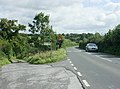
 B3092 Frome Road looking north - geograph.org.uk - 1473996.jpg 640 × 486; 118 KB
-
 B3092 Frome Road looking south - geograph.org.uk - 1474008.jpg 640 × 495; 143 KB
-
 B3092 Frome Road near Maiden Bradley - geograph.org.uk - 1476852.jpg 640 × 477; 129 KB
-
 Bench Mark, Kingston Lane - geograph.org.uk - 2862620.jpg 480 × 640; 108 KB
-
 Bench Mark, The Corner House - geograph.org.uk - 2316466.jpg 480 × 640; 100 KB
-
 Boot Scraper, All Saints' Church - geograph.org.uk - 2866322.jpg 480 × 640; 83 KB
-
 Bowl Barrow - geograph.org.uk - 2486189.jpg 1,288 × 966; 490 KB
-
 Bradley Lane, Maiden Bradley, Warminster - geograph.org.uk - 3528196.jpg 640 × 480; 134 KB
-
 Bridge near Maiden Bradley - geograph.org.uk - 2862604.jpg 640 × 480; 67 KB
-
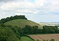
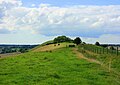
 Brimble Hill Clump (east) - geograph.org.uk - 3098884.jpg 1,288 × 966; 508 KB
-
 Brimble Hill Clump (south) - geograph.org.uk - 3098898.jpg 1,288 × 966; 844 KB
-
 Brimble Hill Clump (view to south east) - geograph.org.uk - 3098919.jpg 1,288 × 966; 524 KB
-
 Brimble Hill Clump (view to south west) - geograph.org.uk - 3098929.jpg 1,288 × 966; 531 KB
-
 Brimble Hill Clump - geograph.org.uk - 2489125.jpg 1,288 × 966; 302 KB
-
 Brimble Hill Clump, Duke's Grave - geograph.org.uk - 3112615.jpg 1,288 × 966; 950 KB
-
 Brimble Hill Clump, Duke's Grave Enclosure - geograph.org.uk - 3112684.jpg 1,288 × 966; 1.07 MB
-
 Brimble Hill Clump, Duke's Grave Entrance - geograph.org.uk - 3112708.jpg 1,288 × 966; 1,011 KB
-
 Brimble Hill Clump, Duke's Grave Gate Latch - geograph.org.uk - 3112749.jpg 1,288 × 966; 661 KB
-
 Brimble Hill Clump, Duke's Grave Main Stone - geograph.org.uk - 3112788.jpg 966 × 1,288; 818 KB
-

-
 Brimble Hill Clump, Duke's Grave Small Stone - geograph.org.uk - 3112894.jpg 768 × 1,024; 434 KB
-

-
 Cleared area in Tyning Wood - geograph.org.uk - 466288.jpg 640 × 480; 139 KB
-
 Clearing at Great Bradley Wood - geograph.org.uk - 4710941.jpg 1,600 × 1,200; 689 KB
-
 Cut timber - geograph.org.uk - 4710862.jpg 1,600 × 1,200; 975 KB
-
 Farmland near Little Knoll - geograph.org.uk - 444561.jpg 640 × 480; 41 KB
-
 Farmland near Little Knoll - geograph.org.uk - 444565.jpg 640 × 480; 53 KB
-

-
 Field Mound - geograph.org.uk - 2487466.jpg 1,288 × 966; 1.04 MB
-

-
 Footpath near Maiden Bradley - geograph.org.uk - 2316423.jpg 640 × 480; 171 KB
-
 Footpath, Maiden Bradley - geograph.org.uk - 2316490.jpg 640 × 481; 84 KB
-
 Ford, Great Bradley Wood - geograph.org.uk - 4710935.jpg 1,600 × 1,200; 1.33 MB
-
 Gare Hill, hillside - geograph.org.uk - 2680196.jpg 1,024 × 768; 377 KB
-
 Gare Hill, track - geograph.org.uk - 2680211.jpg 1,024 × 768; 287 KB
-
 Healle Monument - geograph.org.uk - 3730852.jpg 2,580 × 1,932; 5.24 MB
-
 Hedge laying, Grange Farm - geograph.org.uk - 2316225.jpg 640 × 481; 91 KB
-
 Horse jumps near Grange Farm - geograph.org.uk - 2316242.jpg 640 × 480; 71 KB
-

-

-

-

-

-

-
 Kissing gate, Maiden Bradley - geograph.org.uk - 2316524.jpg 480 × 640; 108 KB
-
 Land near former church at Gare Hill, Somerset - geograph.org.uk - 4710908.jpg 1,600 × 687; 538 KB
-
 Lane to Priory Farm - geograph.org.uk - 1473981.jpg 640 × 483; 135 KB
-
 Little Knoll seen from Long Knoll - geograph.org.uk - 932802.jpg 640 × 447; 54 KB
-
 Long Knoll from Grange Farm - geograph.org.uk - 1625453.jpg 640 × 480; 100 KB
-
 Long Knoll from Highlands cottage - geograph.org.uk - 140063.jpg 640 × 480; 89 KB
-
 Long Knoll from White Sheet Hill - geograph.org.uk - 950589.jpg 640 × 427; 44 KB
-
 Long Knoll summit. - geograph.org.uk - 83598.jpg 640 × 432; 54 KB
-
 Long view of Long Knoll - geograph.org.uk - 946041.jpg 640 × 451; 66 KB
-
 Maiden Bradley High Street - geograph.org.uk - 2679690.jpg 1,024 × 768; 140 KB
-
 Maiden Bradley Village Hall - geograph.org.uk - 2679719.jpg 1,024 × 768; 158 KB
-
 Maiden Bradley, Bradley Lane - geograph.org.uk - 2679855.jpg 1,024 × 768; 183 KB
-
 Maiden Bradley, cattle grazing - geograph.org.uk - 2679879.jpg 1,024 × 768; 155 KB
-
 Maiden Bradley, converted farm - geograph.org.uk - 2679826.jpg 1,024 × 749; 138 KB
-
 Maiden Bradley, Dangells Barn Farm - geograph.org.uk - 2679867.jpg 1,024 × 768; 184 KB
-
 Maiden Bradley, drinking fountain - geograph.org.uk - 2679680.jpg 1,024 × 792; 208 KB
-
 Maiden Bradley, ford - geograph.org.uk - 2680194.jpg 1,024 × 768; 344 KB
-
 Maiden Bradley, former school - geograph.org.uk - 2679731.jpg 1,024 × 768; 165 KB
-
 Maiden Bradley, stubble field - geograph.org.uk - 2679889.jpg 1,024 × 768; 214 KB
-
 Maiden Bradley, T junction - geograph.org.uk - 2679804.jpg 1,024 × 768; 239 KB
-
 Maiden Bradley, track junction - geograph.org.uk - 2680190.jpg 1,024 × 768; 326 KB
-
 Maiden Bradley, track ^ footpath - geograph.org.uk - 2679924.jpg 1,024 × 768; 294 KB
-
 Maiden Bradley, village shop ^ post office - geograph.org.uk - 2679661.jpg 1,024 × 766; 154 KB
-
 Maiden Bradley, woodland - geograph.org.uk - 2680193.jpg 1,024 × 768; 269 KB
-
 Maiden Newton, cottages - geograph.org.uk - 2679759.jpg 1,024 × 755; 185 KB
-
 Manor Farm from Long Knoll - geograph.org.uk - 942676.jpg 640 × 450; 96 KB
-
 Messiter Monument - geograph.org.uk - 3730876.jpg 2,580 × 1,932; 4.78 MB
-
 Milestone - geograph.org.uk - 3752000.jpg 1,932 × 2,580; 5.02 MB
-
 Minor road north of Gare Hill - geograph.org.uk - 1473820.jpg 640 × 520; 216 KB
-
 New planting - geograph.org.uk - 4710913.jpg 1,600 × 1,200; 1.15 MB
-
 North from Bradley Lane - geograph.org.uk - 1473811.jpg 640 × 483; 147 KB
-
 North from Long Knoll to Kelston Round Hill - geograph.org.uk - 947184.jpg 3,594 × 2,581; 3.94 MB
-
 North from White Sheet Downs - geograph.org.uk - 934323.jpg 640 × 427; 65 KB
-

-

-
 Old Dower House - geograph.org.uk - 3766479.jpg 2,580 × 1,932; 4.82 MB
-
 Old Garage - geograph.org.uk - 3736173.jpg 2,580 × 1,932; 4.48 MB
-
 Old Manor House - geograph.org.uk - 3765886.jpg 2,580 × 1,932; 4.64 MB
-
 Old tree near Gare Hill - geograph.org.uk - 2316404.jpg 640 × 480; 71 KB
-
 Old Vicarage - geograph.org.uk - 3750522.jpg 2,580 × 1,932; 5.14 MB
-
 On top of Mere Down looking towards White Sheet Down - geograph.org.uk - 3390924.jpg 1,600 × 1,200; 537 KB
-

-
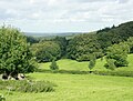
 Pasture near Manor Farm - geograph.org.uk - 1477138.jpg 640 × 521; 127 KB
-
 Perry Farmhouse - geograph.org.uk - 3773772.jpg 2,580 × 1,932; 5.21 MB
-
 Pond in Tyning Wood - geograph.org.uk - 1625478.jpg 640 × 480; 110 KB
-
 Red Phone Box - geograph.org.uk - 3736647.jpg 1,932 × 2,580; 4.13 MB
-
 Ripe barley near Priory Farm - geograph.org.uk - 1474022.jpg 640 × 451; 115 KB
-
 Road closure on the Frome Road - geograph.org.uk - 4710884.jpg 1,600 × 1,200; 1.15 MB
-
 Road junction in Maiden Bradley - geograph.org.uk - 2439406.jpg 800 × 601; 112 KB
-
 Rodmead Farm - geograph.org.uk - 909691.jpg 640 × 480; 149 KB
-
 Rodmead Hill - geograph.org.uk - 909694.jpg 640 × 480; 146 KB
-
 Small valley off Bradley Lane - geograph.org.uk - 1477158.jpg 640 × 472; 166 KB
-
 Somerset Arms - geograph.org.uk - 3745935.jpg 1,024 × 862; 150 KB
-
 Straight on for Gare Hill - geograph.org.uk - 1478770.jpg 640 × 489; 142 KB
-
 Tadbesom Wood to the left - geograph.org.uk - 1478710.jpg 640 × 474; 192 KB
-
 The Corner House, Maiden Bradley - geograph.org.uk - 2316459.jpg 640 × 480; 71 KB
-
 The road through Maiden Bradley - geograph.org.uk - 2439407.jpg 640 × 480; 91 KB
-
 The Somerset Arms, Maiden Bradley - geograph.org.uk - 2430117.jpg 640 × 480; 79 KB
-
 Tumulus - geograph.org.uk - 2487389.jpg 1,288 × 966; 688 KB
-
 United Reform Chapel - geograph.org.uk - 3745924.jpg 2,580 × 1,932; 4.6 MB
-
 View down towards Priory Farm, Maiden Bradley, Wiltshire - geograph.org.uk - 4710844.jpg 1,600 × 1,200; 578 KB
-
 Village Memorial Hall - geograph.org.uk - 3745948.jpg 1,024 × 766; 194 KB
-
 Walking the dog on Honey Pot Lane - geograph.org.uk - 1478722.jpg 640 × 481; 225 KB
-

-
 Woodland ponds - geograph.org.uk - 4710928.jpg 1,600 × 858; 680 KB
-
 Yew tree, All Saints Church - geograph.org.uk - 2866049.jpg 480 × 640; 114 KB
-
 Across the valley to Manor Farm - geograph.org.uk - 1476925.jpg 640 × 530; 157 KB
-
 Bradley Lane looking north - geograph.org.uk - 1476914.jpg 640 × 561; 216 KB
-
 Bradley Lane looking south - geograph.org.uk - 1473805.jpg 640 × 582; 190 KB
-
 Bradley Lane near Manor Farm - geograph.org.uk - 1476938.jpg 640 × 520; 167 KB
-
 Bradley Lane passing Dangell's Barn Farm - geograph.org.uk - 1476858.jpg 640 × 501; 115 KB
-
 Bridleway to Brimsdown Hill - geograph.org.uk - 452656.jpg 640 × 480; 88 KB
-
 Footpath to Witham Friary - geograph.org.uk - 466303.jpg 640 × 480; 140 KB
-
 Holcombe Hole - geograph.org.uk - 539214.jpg 640 × 480; 99 KB
-
 Little Knoll - geograph.org.uk - 444563.jpg 640 × 480; 111 KB
-
 Mapperton Hill - geograph.org.uk - 444546.jpg 640 × 480; 57 KB
-
 Public footpath to Maiden Bradley - geograph.org.uk - 444552.jpg 640 × 480; 63 KB
-
 Rodmead Farm - geograph.org.uk - 533910.jpg 640 × 480; 149 KB


_-_geograph.org.uk_-_5091788.jpg)
_-_geograph.org.uk_-_5091789.jpg)
_-_geograph.org.uk_-_5091744.jpg)
_-_geograph.org.uk_-_5091747.jpg)
_-_geograph.org.uk_-_5091753.jpg)
_-_geograph.org.uk_-_5091757.jpg)
_-_geograph.org.uk_-_5091758.jpg)
_-_geograph.org.uk_-_5091759.jpg)
_-_geograph.org.uk_-_5091760.jpg)
_-_geograph.org.uk_-_5091762.jpg)


_-_geograph.org.uk_-_5091770.jpg)
_-_geograph.org.uk_-_5091773.jpg)
_-_geograph.org.uk_-_5091774.jpg)
_-_geograph.org.uk_-_5091777.jpg)
_-_geograph.org.uk_-_5091780.jpg)
_-_geograph.org.uk_-_5091782.jpg)
_-_geograph.org.uk_-_5091784.jpg)
_-_geograph.org.uk_-_5091786.jpg)


_-_geograph.org.uk_-_3098884.jpg)
_-_geograph.org.uk_-_3098898.jpg)
_-_geograph.org.uk_-_3098919.jpg)
_-_geograph.org.uk_-_3098929.jpg)


_-_geograph.org.uk_-_5091796.jpg)
_-_geograph.org.uk_-_5091797.jpg)
_-_geograph.org.uk_-_5091798.jpg)
_-_geograph.org.uk_-_5091799.jpg)
_-_geograph.org.uk_-_5091802.jpg)
_-_geograph.org.uk_-_5091803.jpg)


