Category:Maghery
Jump to navigation
Jump to search
English: Maghery is a small village in County Armagh, Northern Ireland situated in the townland of Maghery on the southwest shore of Lough Neagh in the parish of Tartaraghan. It lies between the estuaries of the Blackwater and Bann rivers which are only two miles apart giving rise to Maghery's strategic significance as it overlooks both rivers where they enter Lough Neagh and where County Tyrone meets County Armagh.
townland in Armagh, Northern Ireland  | |||||
| Upload media | |||||
| Instance of | |||||
|---|---|---|---|---|---|
| Location | Northern Ireland | ||||
 | |||||
Media in category "Maghery"
The following 19 files are in this category, out of 19 total.
-
 Along the Blackwater at Maghery - geograph.org.uk - 4209041.jpg 640 × 480; 72 KB
-
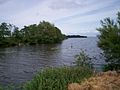
 Derrywarragh Island, Lough Neagh - geograph.org.uk - 279256.jpg 640 × 478; 48 KB
-
 Derrywarragh Island, Lough Neagh - geograph.org.uk - 279260.jpg 640 × 447; 52 KB
-
 Footbridge, Maghery - geograph.org.uk - 3112119.jpg 640 × 482; 64 KB
-
 Maghery Country Park - geograph.org.uk - 51880.jpg 640 × 409; 166 KB
-
 Maghery old RC Church - geograph.org.uk - 279253.jpg 334 × 480; 29 KB
-
 Maghery RC Church - geograph.org.uk - 279250.jpg 640 × 479; 48 KB
-
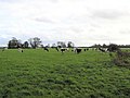
 Maghery Townland - geograph.org.uk - 279581.jpg 640 × 479; 64 KB
-
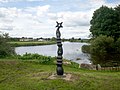 Millennium Milepost, Maghery - geograph.org.uk - 505149.jpg 640 × 480; 76 KB
-
 River Blackwater, Maghery - geograph.org.uk - 3112117.jpg 640 × 482; 58 KB
-
 St Andrew's Parish Church of Ireland - geograph.org.uk - 3112115.jpg 640 × 482; 88 KB
-
 Stone Marker, Maghery Slip - geograph.org.uk - 836758.jpg 640 × 480; 100 KB
-
 Taking it easy - geograph.org.uk - 4539970.jpg 4,000 × 2,664; 5.34 MB
-
 The Blackwater at Maghery - geograph.org.uk - 4209027.jpg 640 × 480; 68 KB
-

-
 The New Bridge at Maghery - geograph.org.uk - 563272.jpg 640 × 480; 69 KB
-

-
 View of Lough Neagh - geograph.org.uk - 836812.jpg 640 × 480; 74 KB
-
 View of Lough Neagh - geograph.org.uk - 836839.jpg 640 × 480; 44 KB


