Category:M1 (road sign, France)
Jump to navigation
Jump to search
Le panonceau M1 peut être utilisé en complément des panneaux de type A, AB, B, C et CE [1].
Media in category "M1 (road sign, France)"
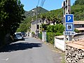
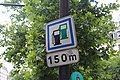
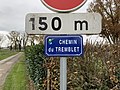
The following 200 files are in this category, out of 241 total.
(previous page) (next page)-
 France road sign M1.svg 334 × 145; 5 KB
-
 Le Bois-d'Oingt - Panneau STOP à 5 m (nov 2018).jpg 3,016 × 4,032; 3.11 MB
-
 Villabe - 2015-04-06 - IMG-8795.jpg 4,474 × 2,983; 2.85 MB
-
 Poids Public - Manziat (FR01) - 2020-09-14 - 4.jpg 4,032 × 3,024; 4.85 MB
-
 Entrée à Bloye (74).JPG 2,048 × 1,536; 493 KB
-
 Sens interdit à 25 mètres près mairie Bellerive-sur-Allier.jpg 1,920 × 1,080; 567 KB
-
 Crue Lac du Bourget 2023 - Chemin du Port de Terre-Nue.JPG 3,160 × 2,344; 5.76 MB
-
 A48 - 20131103 125957.JPG 3,456 × 1,944; 2.12 MB
-
 A48 - 2019-09-17 - IMG 3421.jpg 2,242 × 1,497; 2.07 MB
-
 A48 - 2019-09-17 - IMG 3422.jpg 2,549 × 1,702; 2.35 MB
-
 A71 vers Clermont-Ferrand (depuis le pont de la D 68) - Échangeur A79 2022-11-06.JPG 4,496 × 3,000; 3.21 MB
-
 A79 vers Montluçon (PK 38,5) - Échangeur N7 2022-09-11.JPG 4,496 × 3,000; 2.94 MB
-
 Autoroute A48 - IMG 0013.jpg 1,824 × 1,368; 903 KB
-
 Entrée Les Favards (D 131e, Hauterive) direction Vichy 2022-05-28.JPG 2,992 × 2,000; 3.2 MB
-
 Groix dscn0830 (3908106024).jpg 2,048 × 1,536; 926 KB
-
 Latour-de-Carol - 2015-06-05 - Jorge Franganillo.jpg 2,310 × 1,300; 1.25 MB
-
 P1100125 Paris XX rue des Orteaux poste de police rwk.JPG 2,000 × 1,886; 1.67 MB
-
 Panneau AB25 panonceaux M1 M4d1.jpg 4,000 × 3,000; 4.44 MB
-
 Panneau Carrefour Giratoire Route Favres Biziat 1.jpg 3,024 × 4,032; 5.33 MB
-
 Panneau Carrefour Giratoire Route Favres Biziat 2.jpg 3,024 × 4,032; 4.58 MB
-
 Panneaux A20 C1a panonceau M1.jpg 4,000 × 3,000; 4.93 MB
-
 Panneaux B1 M1 50m.jpg 3,000 × 4,000; 4.82 MB
-
 Panneaux de conditions d'accès-02.jpg 3,024 × 4,032; 2.99 MB
-
 Panneaux E36a Ain B14 30 M1 50m E36b Rhône-Alpes embouteillage Ferney.jpg 4,000 × 3,000; 4.85 MB
-
 Villabé-IMG 2977.jpg 4,042 × 2,695; 7.25 MB
-
 Villeurbanne - Rue Bernard Lecache, depuis la rue du Cimetière.jpg 3,096 × 4,128; 5.85 MB
-
 Civrieux-d'Azergues - Panneau B13 ancien modèle (août 2018).jpg 3,016 × 4,032; 4.06 MB
-
 Panneau Parking Domaine Planons Chemin Seiglières St Cyr Menthon 1.jpg 3,456 × 5,184; 9.51 MB
-
 Panneau Parking Domaine Planons Chemin Seiglières St Cyr Menthon 2.jpg 3,456 × 5,184; 5.92 MB
-
 Arles - Rue Raspail, plaque.jpg 4,128 × 3,096; 3.56 MB
-
 Panneau largeur maximale 1,80 m à 80 m.jpg 4,000 × 3,000; 4.84 MB
-
 A410 Évires panneaux AB3b M1.jpg 4,000 × 2,248; 3.98 MB
-
 A89 depuis le pont près du col de Cervières, vers Bordeaux 2022-04-17.JPG 2,992 × 2,000; 1.9 MB
-
 A89 depuis le pont près du col de Cervières, vers Lyon 2022-04-17.JPG 2,992 × 2,000; 2.25 MB
-
 Chemin Belouzes Perrex 1.jpg 4,032 × 3,024; 6.83 MB
-
 Col de Cervières depuis le pont (sud) 2022-04-17.JPG 2,992 × 2,000; 2.81 MB
-
 Entrée sud d'Aubière 2015-07-21.JPG 2,816 × 2,112; 1.44 MB
-
 Le Perréon - Panneaux cyclistes (avril 2019).jpg 4,032 × 3,016; 4.95 MB
-
 Lieusaint - 2019-04-17 - IMG 1523.jpg 3,883 × 2,589; 5.15 MB
-
 N104 - IMG 0747.jpg 2,585 × 1,939; 764 KB
-
 Panneau A3.jpeg 1,145 × 645; 135 KB
-
 Panneau entrée Chenay Châtel 2.jpg 5,184 × 3,456; 10.21 MB
-
 Panneau entrée Chenay Châtel 4.jpg 5,184 × 3,456; 10.24 MB
-
 Panneaux B5c M1 100m B14 50 kmh.jpg 2,998 × 2,248; 2.27 MB
-
 Plaque chemin Belouzes Perrex 1.jpg 3,024 × 4,032; 4.77 MB
-
 Plaque route Merlières St Cyr Menthon 2.jpg 3,456 × 5,184; 9.94 MB
-
 Plaque route Merlières St Cyr Menthon 3.jpg 3,456 × 5,184; 5.86 MB
-
 Route Bourg - Vésines (FR01) - 2020-09-14 - 6.jpg 4,032 × 3,024; 4.25 MB
-
 Rue Arthur Croquette Charenton Pont 1.jpg 4,032 × 3,024; 5.32 MB
-
 Vétraz-Monthoux panneaux A17 M1.jpg 4,000 × 3,000; 4.95 MB
-
 A41 panneaux B29 M1 D61b zoom.jpg 4,000 × 3,000; 4.59 MB
-
 A41 panneaux B29 M1 D61b.jpg 4,000 × 3,000; 4.56 MB
-
 A48 - 2019-09-19 - IMG 3532.jpg 2,543 × 1,698; 2.28 MB
-
 Auboncourt-Vauzelles (Ardennes) city limit sign.JPG 4,320 × 3,240; 5.98 MB
-
 Avenue Doumer, rappel zone 30 et intersection rue Grangier (Vichy) 2023-03-18.JPG 2,992 × 2,000; 2.46 MB
-
 Cours-le-Bas Panneaux C1a CE6a pré-2008 B14 A13a.jpg 4,000 × 3,000; 4.57 MB
-
 Cours-le-Bas Panneaux C1a CE6a pré-2008.jpg 4,000 × 3,000; 4.6 MB
-
 D311 panneau A1a panonceau M1.jpg 4,000 × 3,000; 4.86 MB
-
 D903 panneaux C28 M1.jpg 4,000 × 2,248; 4.1 MB
-
 Findrol AB3b M1.jpg 1,920 × 2,560; 2.93 MB
-
 Lans-en-Vercors panneaux A13a M1.jpg 3,456 × 2,592; 4.12 MB
-
 Limitation à 50 km-h 032.jpg 640 × 480; 125 KB
-
 Mauvières-FR-36-panneau d'agglomération-2.jpg 3,024 × 4,032; 2.69 MB
-
 N202 panneau C24c au flash.jpg 4,000 × 3,000; 4.59 MB
-
 N202 panneau C24c.jpg 4,000 × 3,000; 4.71 MB
-
 Panneau CE15b rue St Antoine Paris 1.jpg 5,184 × 3,456; 6.64 MB
-
 Panneau CE15b rue St Antoine Paris 2.jpg 5,184 × 3,456; 6.94 MB
-
 Panneau CE15b rue St Antoine Paris 3.jpg 3,456 × 5,184; 6.31 MB
-
 Panneau entrée Bâgé Châtel 3.jpg 5,184 × 3,456; 6.3 MB
-
 Panneau entrée Bâgé Châtel 4.jpg 5,184 × 3,456; 8.23 MB
-
 Panneau entrée Bâgé Châtel 5.jpg 5,184 × 3,456; 8.29 MB
-
 Panneau entrée Luponnas Vonnas 6.jpg 3,456 × 5,184; 8.41 MB
-
 Plaque Chemin Tremblet - Vonnas (FR01) - 2020-12-02 - 1.jpg 4,032 × 3,024; 4.79 MB
-
 RD 1212 arrivant à Ugine (juin 2022).JPG 2,920 × 2,164; 3.28 MB
-
 Rue Grangier depuis l'avenue Doumer (Vichy) 2022-04-30.JPG 2,992 × 2,000; 2.16 MB
-
 Rue Grangier depuis l'avenue Doumer (Vichy) 2022-05-14.JPG 2,992 × 2,000; 2.26 MB
-
 Rue Grangier et hôtel de Biarritz, Vichy.jpg 3,024 × 4,032; 3.6 MB
-
 Rue Marc Juge (Vichy) 2023-08-20 16-22-18.JPG 2,992 × 2,000; 2.44 MB
-
 Rue St Antoine Paris 1.jpg 5,184 × 3,456; 6.32 MB
-
 Signaux A7 et J10 implantés à droite et à gauche.jpg 5,472 × 3,648; 7.39 MB
-
 Signaux A7 et J10 implantés à gauche.jpg 5,472 × 3,648; 7.28 MB
-
 Sortie Les Favards (D 131e, Hauterive) vers le chef-lieu 2022-05-28.JPG 2,992 × 2,000; 1.89 MB
-
 Vichy - Rue Grangier (août 2019).jpg 4,608 × 3,456; 3.86 MB
-
 Dardilly - Panneaux interdiction tourner à droite 3 m hauteur (sept 2018).jpg 2,391 × 3,509; 2.82 MB
-
 A40 - 2014-08-25 - MG 9570.jpg 3,080 × 2,054; 5.11 MB
-
 A43 - 2019-06-18 - IMG 2740.jpg 2,244 × 1,498; 1.75 MB
-
 A6 - 2019-09-16 - IMG 0180.jpg 3,000 × 2,000; 2.54 MB
-
 A6 Bif-A19 IMG 0015.JPG 1,907 × 1,431; 369 KB
-
 A6-A19 - 2019-06-14 - IMG 2548.jpg 1,466 × 979; 884 KB
-
 A6-A19 - 2019-09-16 - IMG 3285.jpg 1,830 × 1,222; 1.18 MB
-
 A71-Bif A10 - 2017-11-19 - IMG 6896.jpg 1,983 × 1,324; 1.07 MB
-
 Ceyrat - Circulation à double sens à 200 m.JPG 1,920 × 1,080; 804 KB
-

-

-
 D 2144 vers Montluçon à 24 km (près de Montaigut-en-Combraille) 2023-03-12.JPG 2,992 × 2,000; 2.14 MB
-
 D1085 (Isère) - 2019-09-17 - IMG 3430.jpg 2,058 × 1,374; 2.39 MB
-
 D2209 03 Fin de créneau de dépassement à 200 m.jpg 1,920 × 1,080; 672 KB
-
 Début D 2009 (Moulins RG) 2015-08-26.JPG 2,816 × 2,112; 1.34 MB
-
 Le Fayet - Saint-Gervais-les-Bains (74).JPG 2,048 × 1,536; 1.2 MB
-
 Limonest - Panneau impasse à droite à 200 m (août 2018).jpg 1,660 × 2,787; 1.2 MB
-
 Lucenay - Panneau descente à 20 % (sept 2018).jpg 3,016 × 4,032; 2.45 MB
-
 N202 panneaux C30 M1.jpg 3,900 × 2,925; 3.44 MB
-
 N87 Panneau CE15d.jpg 3,923 × 2,898; 3.57 MB
-
 Panneau B14 110 panonceau M1 200 m.jpg 4,000 × 2,248; 3.85 MB
-
 Panneau C28 4 à 3 voies 200 m, autoroute A7.jpg 4,000 × 3,000; 4.56 MB
-
 Panneau téléphone SOS 200 m autoroute A9.jpg 2,408 × 1,800; 1.88 MB
-
 Panneaux A7 - A450 Pierre-Bénite.jpg 3,938 × 2,918; 3.54 MB
-
 Panneaux CE2a M1 H13.jpg 3,200 × 2,400; 2.41 MB
-
 Panneaux entrée ouest tunnel d'Alzon.jpg 4,000 × 3,000; 4.65 MB
-
 Plaque allée Manche St Cyr Menthon 2.jpg 5,184 × 3,456; 8.72 MB
-
 Route vers Thuret (Aigueperse) 2016-02-23.JPG 2,816 × 2,112; 1.47 MB
-
 Saint-Vincent-de-Boisset - Route de la Mairie (plaque) - fév 2018.JPG 3,456 × 4,608; 4.1 MB
-
 Panneaux B0 Pneus Chaînes Neige Obligatoire Chemin Bas Garenne Beauregard Ain 1.jpg 3,024 × 4,032; 4.95 MB
-
 A48 - 2019-09-17 - IMG 3414.jpg 2,017 × 1,345; 1.48 MB
-
 A4 - 2019-05-27 - IMG 1504.jpg 1,797 × 1,200; 973 KB
-
 A40 - 2014-08-25 - MG 9586.jpg 3,040 × 2,027; 4.72 MB
-
 A40 D47c C64b C64c2 C64d B5c B14 AK5 M1 M9z.jpg 2,560 × 1,920; 2.89 MB
-
 A40 Sortie 19 Flaine Cluses-centre.jpg 4,000 × 3,000; 4.44 MB
-
 A43 - 2018-08-24 - IMG 7293.jpg 4,104 × 2,736; 3.97 MB
-
 A43 - 2019-09-19 - IMG 3606.jpg 2,663 × 1,778; 2.45 MB
-
 A43 Panneau C28 M1 200m.jpg 2,998 × 2,248; 2.11 MB
-
 A43 Panneau CE2a M1 300m.jpg 2,998 × 2,248; 2.46 MB
-
 A432 - 2019-06-18 - IMG 2825.jpg 2,337 × 1,560; 2.03 MB
-
 A432 - 2019-09-19 - IMG 3648.jpg 2,224 × 1,485; 2.07 MB
-
 A432 autoroute IMG 0049.JPG 2,083 × 1,563; 501 KB
-
 A6 - 2018-08-28 - IMG 9040.jpg 2,316 × 1,544; 1.09 MB
-
 A79 - BPV de Deux-Chaises depuis un chemin proche D 945, vers Mâcon 2022-07-03.JPG 4,496 × 3,000; 2.72 MB
-
 Arrivée par l'est au péage de Viry A40.jpg 5,472 × 3,648; 6.7 MB
-
 Autoroute A406 St André Bâgé 3.jpg 4,032 × 3,024; 5.2 MB
-
 Autoroute A406 St André Bâgé 4.jpg 4,032 × 3,024; 4.48 MB
-
 Autoroute A9 panneaux A3b CE2a C28.jpg 4,000 × 3,000; 4.47 MB
-
 Panneau C28 M1 200m.jpg 3,003 × 2,248; 2.23 MB
-
 Panneaux B10a B9f M1 M9z zoom.jpg 3,000 × 4,000; 4.69 MB
-
 Panneaux B10a B9f M1 M9z.jpg 3,000 × 4,000; 4.54 MB
-
 Panneaux halte péage sauf télépéage, 70 kmh 01.jpg 4,000 × 3,000; 4.96 MB
-
 Quincieux - Panneau annonce rocade A46 (août 2019).jpg 3,016 × 4,032; 5.55 MB
-
 Autoroute A4 vue depuis Pont Nogent - Champigny-sur-Marne (FR94) - 2020-10-14 - 1.jpg 4,032 × 3,024; 3.47 MB
-
 Autoroute A4 vue depuis Pont Nogent - Champigny-sur-Marne (FR94) - 2020-10-14 - 2.jpg 4,032 × 3,024; 4.32 MB
-
 A20 - 2015-08-21 - IMG-0706.jpg 2,962 × 1,975; 785 KB
-
 A40 panneau D52c.jpg 3,760 × 2,820; 3.25 MB
-
 A43 Panneau B3 panonceaux M4f M4x M1.jpg 2,248 × 2,248; 1.62 MB
-
 A6 - 2018-08-28 - IMG 9016.jpg 2,809 × 1,873; 1.83 MB
-
 A6 - 2018-08-28 - IMG 9017.jpg 3,043 × 2,029; 1.85 MB
-
 A6 - 2019-09-19 - IMG 3682.jpg 1,565 × 1,045; 940 KB
-
 A6 - 2019-09-19 - IMG 3683.jpg 1,838 × 1,227; 1.13 MB
-
 Autoroute A4 St Maurice Val Marne 2.jpg 5,184 × 3,456; 7.57 MB
-
 Autoroute A4 St Maurice Val Marne 3.jpg 5,184 × 3,456; 6.09 MB
-
 Autoroute A4 St Maurice Val Marne 4.jpg 5,184 × 3,456; 6.5 MB
-
 Autoroute A4 St Maurice Val Marne 5.jpg 5,184 × 3,456; 6.59 MB
-
 Autoroute A4 St Maurice Val Marne 6.jpg 5,184 × 3,456; 6.72 MB
-
 Autoroute A4 St Maurice Val Marne 7.jpg 5,184 × 3,456; 6.42 MB
-
 Autoroute A4 St Maurice Val Marne 8.jpg 5,184 × 3,456; 5.78 MB
-
 Autoroute A4 St Maurice Val Marne 9.jpg 5,184 × 3,456; 6.14 MB
-
 Guémicourt-FR-80-panneau de voirie-1.jpg 3,024 × 4,032; 2.64 MB
-
 Guémicourt-FR-80-panneau de voirie-3.jpg 4,032 × 3,024; 2.27 MB
-
 Panneau B3a 400 m de 7h à 21h.jpg 2,560 × 1,920; 2.02 MB
-
 Panneaux C64d C62 M1 400m.jpg 2,998 × 2,248; 2.28 MB
-
 Romagnat - Présignalisation de parking.JPG 1,080 × 1,080; 450 KB
-
 Villards-d'Héria - Panneau A16 descente dangereuse (juil 2018).jpg 3,016 × 4,032; 4.58 MB
-
 Panneau B11 1,8 m panonceau M1 450 m 01.jpg 4,000 × 3,000; 4.94 MB
-
 Panneau B11 1,8 m panonceau M1 450 m 02.jpg 4,000 × 3,000; 4.89 MB
-
 A432 - 2012-07-12 - IMG 5127.jpg 4,253 × 2,835; 7.32 MB
-
 Annemasse M10a C207 M1.jpg 4,000 × 3,000; 4.58 MB
-
 Cranves-Sales panneaux M10a C107 M1.jpg 3,000 × 4,000; 3.59 MB
-
 D2209 03 Créneau de dépassement à 500 m.jpg 1,920 × 1,080; 691 KB
-
 D311 panneau C29b panonceau M1.jpg 4,000 × 3,000; 4.64 MB
-
 N201 panneau B12 Tunnel des Monts et sortie 16.jpg 4,000 × 3,000; 4.61 MB
-
 Panneau C13d panonceau M1.jpg 3,904 × 2,925; 3.92 MB
-

-
 Panneau Entrée n°1 Autoroute A406 Route Madeleine Crottet 1.jpg 3,024 × 4,032; 4.7 MB
-
 Panneau Entrée n°1 Autoroute A406 Route Madeleine Crottet 2.jpg 3,024 × 4,032; 3.96 MB
-
 Panneau Voie Sans Issue Route Guillemières St Cyr Menthon 1.jpg 3,456 × 5,184; 5.78 MB
-
 Panneau Voie Sans Issue Route Guillemières St Cyr Menthon 2.jpg 3,456 × 5,184; 5.75 MB
-
 Panneau Voie Sans Issue Route Guillemières St Cyr Menthon 3.jpg 5,184 × 3,456; 5.64 MB
-
 Plaques routes Mâcon Guillemières St Cyr Menthon 4.jpg 5,184 × 3,456; 10.38 MB
-
 A432 - 2019-09-19 - IMG 3617.jpg 2,430 × 1,622; 1.87 MB
-
 A6 - 2019-09-16 - IMG 0233.jpg 2,665 × 1,777; 2.01 MB
-
 Bagnols - Panneau d'interdiction des poids lourds de plus de 12 m (sept 2018).jpg 3,016 × 4,032; 4.41 MB
-
 Entrée dans Laà-Mondrans.jpg 3,835 × 2,488; 4.61 MB
-
 A79 vers Montluçon (PK 36) - Sortie 31 à 1000 m 2022-09-11.JPG 4,496 × 3,000; 3.17 MB
-
 Rue de Blanzat (nord giratoire rue Alexis Duvert) 2015-09-08.JPG 2,816 × 2,112; 2.14 MB
-
 Village de Bruys.JPG 4,272 × 2,848; 4.34 MB
-
 A48 - 2019-09-19 - IMG 3571.jpg 2,665 × 1,779; 3.48 MB
-
 N201 panneau B12 Tunnel des Monts.jpg 3,760 × 2,820; 3.16 MB
-
 Panneau B1 avec panonceaux M4w M4x M1 01.jpg 3,000 × 4,000; 4.88 MB
-
 Panneau B1 avec panonceaux M4w M4x M1 02.jpg 3,000 × 4,000; 4.54 MB
-
 Panneau B1 B9f B10a avec panonceaux M4w M4x M1.jpg 3,000 × 4,000; 4.78 MB
-
 Panneau CE24 station de vidange à 800 m.jpg 820 × 1,040; 242 KB
-
 Panneaux A14 B11 B12 Route Corsant Perrex 1.jpg 4,032 × 3,024; 5.45 MB
-
 Panneaux A14 B11 B12 Route Corsant Perrex 2.jpg 4,032 × 3,024; 6.56 MB
-
 A432 - 2012-07-12 - IMG 5124.jpg 4,513 × 3,009; 7.59 MB
-
 La Barre (Jura) - Entrée village.jpg 4,032 × 3,016; 4.22 MB
-
 1000m before the French-Belgium Border Autoroute 2-5707.jpg 3,137 × 1,765; 3.12 MB
-
 A75 panneaux C26a panonceaux M1 1000 m.jpg 3,877 × 2,840; 3.47 MB
-
 A837 près d'Écurat.JPG 3,264 × 2,448; 1.66 MB
-
 Amange - Rue de la Fontenotte.jpg 4,032 × 3,016; 3.05 MB
-
 Panneau C13a Chemin Soulier - Bâgé Ville - Bâgé Dommartin - 2020-08-20 - 1.jpg 3,024 × 4,032; 4.79 MB
-
 Panneau C13a Chemin Soulier - Bâgé Ville - Bâgé Dommartin - 2020-08-20 - 2.jpg 3,024 × 4,032; 3.51 MB
-
 Panneau C26c panonceau M1 RN 205.jpg 4,000 × 3,000; 4.99 MB
-
 150614-Autoroute-A35-03.jpg 1,920 × 1,080; 787 KB

.jpg)

_-_2020-09-14_-_4.jpg)
.JPG)


_-_%C3%89changeur_A79_2022-11-06.JPG)
_-_%C3%89changeur_N7_2022-09-11.JPG)

_direction_Vichy_2022-05-28.JPG)
.jpg)


.jpg)


_2022-04-17.JPG)

.jpg)


_-_2020-09-14_-_6.jpg)


_city_limit_sign.JPG)
_2023-03-18.JPG)


_-_2020-12-02_-_1.jpg)
.JPG)
_2022-04-30.JPG)
_2022-05-14.JPG)

_2023-08-20_16-22-18.JPG)


_vers_le_chef-lieu_2022-05-28.JPG)
.jpg)
.jpg)


_-_Premi%C3%A8re_pr%C3%A9signalisation_2023-03-12.JPG)
_-_Fin_cr%C3%A9neau_de_d%C3%A9passement_%C3%A0_200_m_2023-03-12.JPG)
_2023-03-12.JPG)
_-_2019-09-17_-_IMG_3430.jpg)

_2015-08-26.JPG)
.JPG)
.jpg)
.jpg)


_2016-02-23.JPG)
_-_f%C3%A9v_2018.JPG)


.jpg)
_-_2020-10-14_-_1.jpg)
_-_2020-10-14_-_2.jpg)


.jpg)


_-_2020-09-18_-_1.jpg)


.jpg)

_-_Sortie_31_%C3%A0_1000_m_2022-09-11.JPG)
_2015-09-08.JPG)


_-_Entr%C3%A9e_village.jpg)


&filefrom=001500%0AA75+panneau+C26a+panonceau+M1+1500+m.jpg#mw-category-media)