Category:M-39 (Michigan highway)
Jump to navigation
Jump to search
 | number: | (thirty-nine) |
|---|---|---|
| State highways in Michigan: | 19 · 20 · 21 · 22 · 24 · 25 · 26 · 27 · 28 · 29 · 30 · 32 · 33 · 34 · 35 · 36 · 37 · 38 · 39 · 40 · 42 · 43 · 44 · 45 · 46 · 47 · 48 · 49 · 50 · 52 · 53 · 54 · 55 · 57 · 59 |
highway in Michigan, United States  | |||||
| Upload media | |||||
| Instance of | |||||
|---|---|---|---|---|---|
| Location | Michigan | ||||
| Transport network | |||||
| Owned by | |||||
| Maintained by | |||||
| Length |
| ||||
| |||||
Media in category "M-39 (Michigan highway)"
The following 6 files are in this category, out of 6 total.
-
 M-39.svg 600 × 600; 4 KB
-
 Michigan 39 map.png 2,205 × 1,239; 161 KB
-
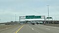 I-96 at Southfield Freeway.jpg 4,032 × 2,268; 3.28 MB
-
 M-39 1926.svg 600 × 600; 7 KB
-
 River Rouge Dearborn.jpg 1,500 × 1,051; 506 KB
-
 Somewhere on the way to Detroit Metropolitan Wayne County Airport - panoramio.jpg 2,592 × 1,639; 1.55 MB


