Category:Mühle Eiklenborg
Jump to navigation
Jump to search
| Object location | | View all coordinates using: OpenStreetMap |
|---|
 | |||||
| Upload media | |||||
| Instance of | |||||
|---|---|---|---|---|---|
| Location | Logabirum, Leer, Lower Saxony, Germany | ||||
| Street address |
| ||||
| Source of energy |
| ||||
 | |||||
Media in category "Mühle Eiklenborg"
The following 21 files are in this category, out of 21 total.
-
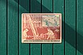
 Leer - 1 Mark 1921a.png 1,084 × 754; 1.75 MB
-
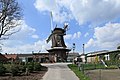 Leer - Logabitumer Straße - 55Mühlenhof + Windmühle 01 ies.jpg 5,616 × 3,744; 17.53 MB
-
 Leer - Logabitumer Straße - 55Mühlenhof - Windmühle 01 ies.jpg 3,744 × 5,616; 18.66 MB
-
 Leer - Logabitumer Straße - 55Mühlenhof - Windmühle 02 ies.jpg 5,616 × 3,743; 19.52 MB
-
 Leer - Logabitumer Straße - 55Mühlenhof - Windmühle 03 ies.jpg 5,616 × 3,744; 21.67 MB
-
 Leer - Logabitumer Straße - 55Mühlenhof - Windmühle 04 ies.jpg 3,745 × 5,616; 21.96 MB
-
 Leer - Logabitumer Straße - 55Mühlenhof - Windmühle 05 ies.jpg 3,744 × 5,616; 15.5 MB
-
 Leer - Logabitumer Straße - 55Mühlenhof - Windmühle 06 ies.jpg 5,616 × 3,744; 16.16 MB
-
 Leer - Logabitumer Straße - 55Mühlenhof - Windmühle 07 ies.jpg 3,744 × 5,616; 19.3 MB
-
 Leer - Logabitumer Straße - 55Mühlenhof - Windmühle 08 ies.jpg 5,616 × 3,745; 17.87 MB
-
 Leer - Logabitumer Straße - 55Mühlenhof - Windmühle 09 ies.jpg 5,616 × 3,745; 18.38 MB
-
 Leer - Logabitumer Straße - 55Mühlenhof - Windmühle 10 ies.jpg 5,616 × 3,744; 16.88 MB
-
 Leer - Logabitumer Straße - 55Mühlenhof - Windmühle 11 ies.jpg 3,744 × 5,616; 19.95 MB
-
 Leer - Logabitumer Straße - 55Mühlenhof - Windmühle 12 ies.jpg 5,616 × 3,744; 21.03 MB
-
 Leer - Logabitumer Straße - 55Mühlenhof - Windmühle 13 ies.jpg 5,616 × 3,744; 21.67 MB
-
 Leer - Logabitumer Straße - 55Mühlenhof - Windmühle 14 ies.jpg 5,616 × 3,744; 15.01 MB
-
 Leer - Logabitumer Straße - 55Mühlenhof - Windmühle 15 ies.jpg 5,616 × 3,744; 16.03 MB
-
 Leer - Logabitumer Straße - 55Mühlenhof - Windmühle 16 ies.jpg 3,744 × 5,616; 16.69 MB
-
 Leer - Logabitumer Straße - 55Mühlenhof - Windmühle 17 ies.jpg 5,616 × 3,744; 21.86 MB
-
 Leer - Logabitumer Straße - 55Mühlenhof - Windmühle 18 ies.jpg 5,616 × 3,744; 16.01 MB
-
 Logabirum windmill.JPG 4,000 × 3,000; 2.41 MB


