Category:Low Moor, Bradford
Jump to navigation
Jump to search
village in the metropolitan borough of the City of Bradford in West Yorkshire, England | |||||
| Upload media | |||||
| Instance of | |||||
|---|---|---|---|---|---|
| Location | Bradford, West Yorkshire, Yorkshire and the Humber, England | ||||
 | |||||

Subcategories
This category has the following 9 subcategories, out of 9 total.
Media in category "Low Moor, Bradford"
The following 54 files are in this category, out of 54 total.
-

-
 Acaster Drive - Union Road - geograph.org.uk - 1354437.jpg 640 × 480; 217 KB
-
-
 Allotments - Low Moor Street - geograph.org.uk - 1355133.jpg 640 × 480; 293 KB
-
 Alnwick cannon (26950045332).jpg 3,648 × 2,736; 3.44 MB
-
 Asquith Buildings - Furnace Road - geograph.org.uk - 1462431.jpg 640 × 480; 239 KB
-
 Bowling Green - Harold Park - geograph.org.uk - 1344554.jpg 640 × 480; 292 KB
-
 Bowling Greens behind the Harold Club - geograph.org.uk - 5653708.jpg 5,152 × 3,864; 3.28 MB
-
 Breaks Road - Cleckheaton Road - geograph.org.uk - 633804.jpg 640 × 480; 37 KB
-
 Caldene Avenue - Sal Royd Road - geograph.org.uk - 1463269.jpg 640 × 480; 215 KB
-
 Caldene Avenue - Sal Royd Road - geograph.org.uk - 1463272.jpg 640 × 480; 253 KB
-
-
 Construction site, Low Moor - geograph.org.uk - 5256582.jpg 640 × 417; 60 KB
-

-

-
 Fairway on South Bradford Golf Course - geograph.org.uk - 5432059.jpg 5,184 × 3,456; 7 MB
-
 Footpath - Cleckheaton Road - geograph.org.uk - 1464367.jpg 480 × 640; 329 KB
-
 Footpath - Common Road - geograph.org.uk - 2571466.jpg 480 × 640; 99 KB
-
 Footpath - Common Road - geograph.org.uk - 2571479.jpg 480 × 640; 83 KB
-
 Footpath - Huddersfield Road - geograph.org.uk - 2571455.jpg 480 × 640; 101 KB
-
 Footpath - Lloyds Drive - geograph.org.uk - 2476771.jpg 480 × 640; 57 KB
-
 Footpath - Trueman Court - geograph.org.uk - 2476752.jpg 480 × 640; 71 KB
-
 Graveyard - Chapel Road - geograph.org.uk - 633793.jpg 640 × 461; 55 KB
-
-
 Horsfall Stadium - Home of Bradford Park Avenue - geograph.org.uk - 5653024.jpg 5,152 × 3,864; 3.4 MB
-
-
 Lake - Harold Park - geograph.org.uk - 1344552.jpg 640 × 480; 238 KB
-
 Lloyds Drive - Park House Road - geograph.org.uk - 1355191.jpg 640 × 411; 176 KB
-
 LMS Fowler 0-8-0 at Low Moor Shed, 1947 - geograph.org.uk - 4319079.jpg 2,318 × 1,251; 1.5 MB
-
 Low Moor Ironworks 1855.jpg 376 × 178; 23 KB
-
 Low Moor Munitions Company memorial - geograph.org.uk - 5685229.jpg 1,024 × 768; 237 KB
-
 Meadows near Raw Nook - geograph.org.uk - 5432067.jpg 5,184 × 3,456; 4.03 MB
-
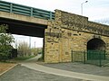
 New Works Road - geograph.org.uk - 633767.jpg 640 × 457; 28 KB
-

-
 Pathway through Wesley Place Graveyard at Low Moor - geograph.org.uk - 5501577.jpg 4,000 × 3,000; 4.19 MB
-
 Playground - Harold Park - geograph.org.uk - 1344545.jpg 640 × 480; 274 KB
-
 Playing Fields - Park Road - geograph.org.uk - 2539922.jpg 640 × 480; 96 KB
-
 Spen Valley Greenway departing Low Moor - geograph.org.uk - 5517195.jpg 4,000 × 3,000; 2.59 MB
-
 Spen Valley Greenway near Low Moor - geograph.org.uk - 5685224.jpg 1,024 × 768; 191 KB
-
 Spen Valley Greenway, looking east at Low Moor - geograph.org.uk - 5344761.jpg 1,024 × 768; 169 KB
-
 Spen Valley Greenway, looking west at Low Moor - geograph.org.uk - 5344763.jpg 1,024 × 768; 221 KB
-
 St Mark, Low Moor - Flywheel.jpg 3,531 × 1,986; 5.73 MB
-
 St Mark, Low Moor - The Harold Club, Low Moor.jpg 2,891 × 1,745; 2.86 MB
-

-
 The end of the line - geograph.org.uk - 2137333.jpg 1,024 × 768; 172 KB
-
 The Guide Post Hotel - Common Road - geograph.org.uk - 1355131.jpg 640 × 437; 193 KB
-
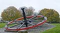
 The Low Moor Wheel - geograph.org.uk - 598794.jpg 640 × 468; 93 KB
-
 Third Street - Main Street - geograph.org.uk - 1463309.jpg 640 × 480; 282 KB
-
 Trackside - Furnace Road - geograph.org.uk - 1462932.jpg 640 × 480; 224 KB
-
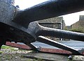
 Victorian cannon 1851 07.JPG 4,000 × 3,000; 4.72 MB
-
 Wesley Drive - Park House Road - geograph.org.uk - 1355189.jpg 640 × 443; 211 KB
-
 Wesley Place - geograph.org.uk - 5432063.jpg 5,184 × 3,456; 5.92 MB
-
 Wickets Close - geograph.org.uk - 634066.jpg 612 × 640; 67 KB
-
 Woodland Path near Raw Nook - geograph.org.uk - 5432071.jpg 5,184 × 3,456; 7.25 MB


.jpg)


