Category:Loosduinen (stadsdeel)
Jump to navigation
Jump to search
village in the Netherlands, since 1923 a neighbourhood in The Hague, The Netherlands   | |||||
| Upload media | |||||
| Instance of | |||||
|---|---|---|---|---|---|
| Location |
| ||||
| Population |
| ||||
 | |||||
Subcategories
This category has the following 17 subcategories, out of 17 total.
B
- Bohemen en Meer en Bos (3 F)
G
K
L
- Lozerlaan 20, Loosduinen (18 F)
M
- Maps of Loosduinen (7 F)
O
S
- Strandslag 1 of The Hague (27 F)
W
Media in category "Loosduinen (stadsdeel)"
The following 36 files are in this category, out of 36 total.
-
 Aan de Loosduinseweg, gesloopt 1897 - Loosduinen - 20142308 - RCE.jpg 1,200 × 881; 272 KB
-
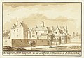
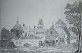
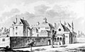 Abdij te Loosduinen, circa 1725 (cropped).jpg 2,118 × 1,302; 1.67 MB
-
 Abdij te Loosduinen, circa 1725.jpg 2,162 × 1,384; 1.95 MB
-
 Atlas Schoemaker-ZUIDHOLLAND-DEEL4-2006-Zuid-Holland, Loosduinen.jpeg 1,023 × 1,664; 336 KB
-
 Braconnier.JPG 1,015 × 1,909; 238 KB
-
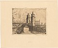 Brug in Loosduinen, RP-P-1937-1028.jpg 4,116 × 3,384; 1.4 MB
-
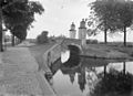
 Brug in Loosduinen, RP-P-1938-1604.jpg 3,678 × 4,088; 1.31 MB
-
 Brug met inrijhek aan de Loosduinseweg - Loosduinen - 20142311 - RCE.jpg 875 × 1,200; 174 KB
-
 Brug met inrijhek aan de Loosduinseweg - Loosduinen - 20142312 - RCE.jpg 875 × 1,200; 161 KB
-
 Brug met inrijhek aan de Loosduinseweg - Loosduinen - 20142313 - RCE.jpg 1,200 × 877; 141 KB
-
 Brug met inrijhek aan de Loosduinseweg - Loosduinen - 20142314 - RCE.jpg 1,200 × 867; 203 KB
-
 Den Haag - 2016 - panoramio (1).jpg 5,472 × 3,648; 4.47 MB
-
 Den Haag - 2016 - panoramio (4).jpg 5,472 × 3,648; 2.51 MB
-
 Dhr Keizer, de kleinste man van Nederland is 65 jaar oud geworden.jpg 1,200 × 1,705; 157 KB
-
 Dorpsgezicht - Loosduinen - 20142303 - RCE.jpg 1,200 × 869; 234 KB
-
 Eindhalte tram 2 in Loosduinen 1992 1.jpg 2,094 × 1,535; 1.58 MB
-
 Eindhalte tram 2 in Loosduinen 1992 2.jpg 2,117 × 1,494; 1.34 MB
-

-
 Gezicht op de abdij en het hof van Henneberg te Loosduinen, RP-T-1888-A-1761.jpg 6,008 × 4,226; 4.54 MB
-
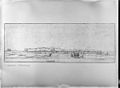
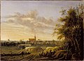 Gezicht op Loosduinen, 1621-1662, toegeschreven aan Anthonie Jansz. van der Croos.jpg 3,151 × 2,320; 1.06 MB
-
 Gustav Czopp.jpg 294 × 398; 10 KB
-
 Kindbett der Margarete von Henneberg.jpg 2,805 × 1,981; 702 KB
-
 Kinderbloemencorso in Loosduinen, Bestanddeelnr 910-5716.jpg 2,621 × 2,608; 1.08 MB
-

-

-
 Kinderbloemencorso in Loosduinen, versierd bokkenwagentje, Bestanddeelnr 910-5718.jpg 2,593 × 2,616; 1.28 MB
-
 Loosduinen Hennebergschloss.jpg 3,381 × 2,189; 1.09 MB
-
 Loosduinen wapen.svg 165 × 185; 55 KB
-
-
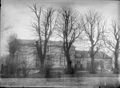
 Overzicht van in 1897 gesloopt landhuis - Loosduinen - 20411372 - RCE.jpg 1,200 × 885; 287 KB
-
 Overzicht van straatbeeld - Loosduinen - 20382381 - RCE.jpg 1,200 × 1,197; 275 KB
-
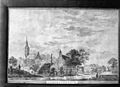
 Pl.m. 1650 naar prent - Loosduinen - 20142309 - RCE.jpg 1,200 × 880; 313 KB
-
 Schapenvierling bij boer Vreugdenhil te Loosduinen, Bestanddeelnr 911-0626.jpg 3,705 × 2,436; 1.96 MB
-
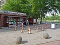
 Tijdelijke halte bij Burgemeester Hovylaan.jpg 3,648 × 2,736; 4.61 MB
-
 Vincent Van Gogh 13.JPG 4,737 × 3,369; 1.91 MB
-
 Vistent tijdens de Coronatijd.jpg 3,648 × 2,736; 6.77 MB

.jpg)


.jpg)
.jpg)


