Category:Longannet Power Station
Jump to navigation
Jump to search
defunct coal-fired power station in Fife, Scotland, UK  | |||||
| Upload media | |||||
| Instance of | |||||
|---|---|---|---|---|---|
| Location | Fife, Scotland | ||||
| Operator |
| ||||
| Service retirement |
| ||||
| Inception |
| ||||
| Dissolved, abolished or demolished date |
| ||||
| Nominal power capacity |
| ||||
 | |||||
Media in category "Longannet Power Station"
The following 47 files are in this category, out of 47 total.
-
 'Leander', Jubilee Class locomotive and train at Longannet, Fife, Scotland.jpg 3,311 × 3,672; 3.04 MB
-
 A Forth View - geograph.org.uk - 340563.jpg 640 × 419; 63 KB
-
 Access Road - geograph.org.uk - 174779.jpg 640 × 480; 164 KB
-
 Coal from Westfield open cast - geograph.org.uk - 945485.jpg 640 × 403; 78 KB
-
 Coals to Longannet - geograph.org.uk - 1212355.jpg 640 × 427; 44 KB
-
 Countryside - geograph.org.uk - 216446.jpg 640 × 480; 103 KB
-
 Cycleway - geograph.org.uk - 471598.jpg 640 × 424; 53 KB
-
 Dock at Bo'ness station - geograph.org.uk - 1416103.jpg 640 × 480; 51 KB
-
 Dock at Bo'ness station - geograph.org.uk - 1416228.jpg 640 × 480; 55 KB
-
 Electricity substation - geograph.org.uk - 469725.jpg 640 × 424; 75 KB
-
 Entrance - geograph.org.uk - 471611.jpg 640 × 424; 57 KB
-
 Falkirk industry area.JPG 3,872 × 2,592; 673 KB
-
-
 Foreshore at Nethermill - geograph.org.uk - 1298330.jpg 640 × 480; 95 KB
-
 Fuel on the move - geograph.org.uk - 2057720.jpg 640 × 400; 83 KB
-
 Kincardine Bridge - geograph.org.uk - 994278.jpg 640 × 426; 41 KB
-

-
 Kitesurfer off Ferny Ness - geograph.org.uk - 2616991.jpg 1,600 × 1,249; 155 KB
-
 Lagoon at Kinneil - geograph.org.uk - 546556.jpg 640 × 480; 60 KB
-

-
 Longannet and haar - geograph.org.uk - 1233407.jpg 640 × 359; 25 KB
-
 Longannet Back-up Power Supply. - geograph.org.uk - 437304.jpg 640 × 503; 81 KB
-
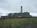
 Longannet Generating Station - geograph.org.uk - 1274019.jpg 640 × 427; 38 KB
-
 Longannet in the mist - geograph.org.uk - 634558.jpg 640 × 462; 32 KB
-
 Longannet Peek-a-Boo - geograph.org.uk - 439206.jpg 640 × 480; 70 KB
-
 Longannet Point - geograph.org.uk - 437247.jpg 640 × 464; 55 KB
-
 Longannet power station - geograph.org.uk - 1546915.jpg 640 × 480; 57 KB
-
 Longannet Power Station - geograph.org.uk - 2365022.jpg 1,024 × 768; 59 KB
-
 Longannet power Station - geograph.org.uk - 5619173.jpg 3,888 × 2,592; 2.14 MB
-
 Longannet Power Station - geograph.org.uk - 573471.jpg 640 × 480; 84 KB
-
 Longannet power station - panoramio.jpg 1,800 × 1,350; 273 KB
-
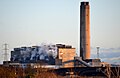
 Longannet Power Station 7 December 2011.jpg 2,000 × 1,333; 1.37 MB
-
 Longannet Power Station from the east - geograph.org.uk - 639151.jpg 1,600 × 1,200; 746 KB
-
 Longannet Power Station, 7 December 2011.jpg 2,000 × 1,193; 1.16 MB
-

-
 Longannet power station.jpg 640 × 480; 39 KB
-
 Longannet towards the River Forth - geograph.org.uk - 437290.jpg 640 × 480; 104 KB
-
 Longannet2012.jpg 500 × 366; 99 KB
-
 Longannet7december2011.jpg 1,000 × 650; 295 KB
-

-
 One lonely Gannet - geograph.org.uk - 768246.jpg 640 × 480; 50 KB
-
 Ploughed field and pylons - geograph.org.uk - 340799.jpg 640 × 424; 56 KB
-

-
 Reclaimed Land - geograph.org.uk - 140105.jpg 640 × 480; 87 KB
-
 The Forth from the Kincardine Bridge - geograph.org.uk - 1495270.jpg 640 × 480; 43 KB
-
 The River Forth - geograph.org.uk - 416573.jpg 640 × 424; 35 KB
-
 Valleyfield Ash Lagoons - geograph.org.uk - 140144.jpg 640 × 480; 106 KB


