Category:Long Plantation, Melton, East Riding of Yorkshire
Jump to navigation
Jump to search
Media in category "Long Plantation, Melton, East Riding of Yorkshire"
The following 21 files are in this category, out of 21 total.
-
 Bluebells near North Ferriby (geograph 7155546).jpg 1,024 × 801; 1.81 MB
-
 Farmland - geograph.org.uk - 130192.jpg 640 × 480; 112 KB
-
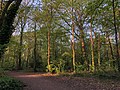 In Long Plantation, North Ferriby (geograph 7155643).jpg 1,024 × 768; 1.78 MB
-
 Lone tree, near Melton (geograph 6438820).jpg 1,024 × 1,024; 1.45 MB
-
 Long Plantation - geograph.org.uk - 1604753.jpg 640 × 480; 65 KB
-
 Long Plantation bluebells near North Ferriby (geograph 7155645).jpg 1,024 × 764; 1.83 MB
-
 Long Plantation, North Ferriby - geograph.org.uk - 280427.jpg 640 × 480; 142 KB
-
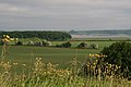
 Looking towards Long Plantation (geograph 3898314).jpg 1,024 × 768; 149 KB
-
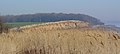
 Melton to Ferriby foreshore - geograph.org.uk - 457703.jpg 640 × 480; 126 KB
-
-
 On top of the Red Cliff (geograph 3898325).jpg 1,024 × 768; 136 KB
-
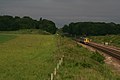
 Rail footbridge, North Ferriby - geograph.org.uk - 584062.jpg 480 × 640; 199 KB
-
 Red Cliff, North Ferriby - geograph.org.uk - 528935.jpg 640 × 426; 157 KB
-
 Red Cliff, North Ferriby - geograph.org.uk - 688475.jpg 640 × 289; 45 KB
-

-

-
 The Trans-Pennine Trail - geograph.org.uk - 688794.jpg 640 × 480; 117 KB
-
 The Yorkshire Wolds Way - geograph.org.uk - 441886.jpg 640 × 480; 169 KB
-
-

-

.jpg)

.jpg)
.jpg)

.jpg)

.jpg)

.jpg)
.jpg)


.jpg)